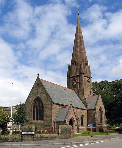
St Catherine`S Church, Baglan stop - Tuesday schedule
| Line | Direction | Time |
|---|---|---|
| 84 | Port Talbot | 07:45 |
| 202 | Port Talbot | 08:50 |
| 84 | Port Talbot | 09:45 |
| 202 | Port Talbot | 10:50 |
| 84 | Port Talbot | 11:45 |
| 202 | Port Talbot | 12:50 |
| 84 | Port Talbot | 13:45 |
| 202 | Port Talbot | 14:50 |
| 84 | Port Talbot | 15:45 |
| 202 | Port Talbot | 16:50 |
| 84 | Port Talbot | 17:45 |
See St Catherine`S Church, Baglan, Wales, on the map
Directions to St Catherine`S Church, Baglan (Wales) with public transport
The following transport lines have routes that pass near St Catherine`S Church, Baglan
 Bus:
Bus: - Train:
How to get to St Catherine`S Church, Baglan by bus?
Click on the bus route to see step by step directions with maps, line arrival times and updated time schedules.
How to get to St Catherine`S Church, Baglan by train?
Click on the train route to see step by step directions with maps, line arrival times and updated time schedules.
Bus stations near St Catherine`S Church, Baglan in Wales
- St Catherine`S Church, Baglan,2 min walk,
- Cedar Gardens, Baglan,5 min walk,
- Baglan,6 min walk,
- Baglan Railway Station, Baglan,6 min walk,
Bus lines to St Catherine`S Church, Baglan in Wales
- 84,Port Talbot,
- 202,Neath,
- 87,Sandfields,
- TRANSPORT FOR WALES,Milford Haven,
- X1,Bridgend,
- 900,Dwr-Y-Felin School,
What are the nearest stations to St Catherine`S Church, Baglan?
The nearest stations to St Catherine`S Church, Baglan are:
- St Catherine`S Church, Baglan is 102 meters away, 2 min walk.
- Cedar Gardens, Baglan is 381 meters away, 5 min walk.
- Baglan is 425 meters away, 6 min walk.
- Baglan Railway Station, Baglan is 432 meters away, 6 min walk.
Which bus line stops near St Catherine`S Church, Baglan?
X1
Which train line stops near St Catherine`S Church, Baglan?
TRANSPORT FOR WALES
What’s the nearest bus stop to St Catherine`S Church, Baglan in Wales?
The nearest bus stop to St Catherine`S Church, Baglan in Wales is St Catherine`S Church, Baglan. It’s a 2 min walk away.
What time is the first train to St Catherine`S Church, Baglan in Wales?
The TRANSPORT FOR WALES is the first train that goes to St Catherine`S Church, Baglan in Wales. It stops nearby at 06:26.
What time is the last train to St Catherine`S Church, Baglan in Wales?
The TRANSPORT FOR WALES is the last train that goes to St Catherine`S Church, Baglan in Wales. It stops nearby at 00:07.
What time is the first bus to St Catherine`S Church, Baglan in Wales?
The 900 is the first bus that goes to St Catherine`S Church, Baglan in Wales. It stops nearby at 08:00.
What time is the last bus to St Catherine`S Church, Baglan in Wales?
The 202 is the last bus that goes to St Catherine`S Church, Baglan in Wales. It stops nearby at 18:44.
See St Catherine`S Church, Baglan, Wales, on the map
Public transport to St Catherine`S Church, Baglan stop (ID: nptagtj) in Wales
Looking for directions to St Catherine`S Church, Baglan in Wales, United Kingdom?
Download the Moovit App to find the current schedule and step-by-step directions for Bus or Train routes that pass through St Catherine`S Church, Baglan.
Looking for the nearest stops closest to St Catherine`S Church, Baglan ? Check out this list of closest stops to your destination: St Catherine`S Church; Cedar Gardens; Baglan; Baglan Railway Station.
Bus:Train:
We make riding on public transit to St Catherine`S Church, Baglan easy, which is why over 1.5 million users, including users in Wales trust Moovit as the best app for public transit.
Use the app to navigate to popular places including to the airport, hospital, stadium, grocery store, mall, coffee shop, school, college, and university.
St Catherine`S Church, Baglan stop’s code is nptagtj
The first line to this stop is 84, at 07:45, and the last line is 84 at 17:45.
Pentwyn Estate, Baglan Community, Wales, United Kingdom
This stop serves First South & West Wales and Forge Travel’s lines
Bus stops near St Catherine`S Church, Baglan
St Catherine`S Church, Baglan,Cedar Gardens, Baglan,Baglan,Baglan Railway Station, BaglanPopular public transport stations in Wales
Ynysangharad Park Gates, Pontypridd,Merthyr Road Shops, Whitchurch,Pont Alyn, Beddgelert,Ega Tube, St Asaph,Atlantic College, St Donats,Swansea Road Alcoa, Waunarlwydd,Aberdovey,Theatr Clwyd, Mold,Marie Curie Hospital, Lower Penarth,Withybush Hospital, Haverfordwest,Prestatyn High School, Meliden,Princess Of Wales Hospital, Bridgend,Cwmgelli Road, Parc Llewellyn,Happy Valley Caravan Park, Wigfach,Dinorwig Terminus, Dinorwic,Morrisons, Bangor,Ysgol David Hughes, Menai Bridge,Coleg Gwent, Crosskeys,Graham Court, Lansbury Park,Edwards Business Park , YnysmaerdyGet around Wales by public transport!
Travelling around Wales has never been so easy. See step by step directions as you travel to any attraction, street or major public transport station. View bus and train timetables, arrival times, service alerts and detailed routes on a map, so you know exactly how to get to anywhere in Wales.
When travelling to any destination around Wales use Moovit's Live Directions with Get Off Notifications to know exactly where and how far to walk, how long to wait for your line , and how many stops are left. Moovit will alert you when it’s time to get off — no need to constantly re-check whether yours is the next stop.
Wondering how to use public transport in Wales or how to pay for public transport in Wales? Moovit public transport app can help you navigate your way with public transport easily, and at minimum cost. It includes public transport fees, ticket prices, and costs. Looking for a map of Wales public transport lines? Moovit public transport app shows all public transport maps in Wales with all bus or train routes and stops on an interactive map.
Wales has 2 transport type(s), including: bus or train, operated by several transport agencies, including National Rail, O.R.Jones, M & H Coaches, Peyton Travel, Gwynfor Coaches, Nefyn, Edwards Coaches, Cardiff Bus, Pembrokeshire County Council, Crickhowell Taxis, Village & Valleys Travel, South Wales Transport, Forge Travel, Sarah Bell and Phil Anslow Travel