See St Lawrence's Church, North Wingfield, North East Derbyshire, on the map
Directions to St Lawrence's Church, North Wingfield (North East Derbyshire) with public transport
The following transport lines have routes that pass near St Lawrence's Church, North Wingfield
 Bus:
Bus:
How to get to St Lawrence's Church, North Wingfield by bus?
Click on the bus route to see step by step directions with maps, line arrival times and updated time schedules.
Bus stations near St Lawrence's Church, North Wingfield in North East Derbyshire
- St Lawrence Road, North Wingfield,4 min walk,
- New Street, Hepthorne Lane,7 min walk,
Bus lines to St Lawrence's Church, North Wingfield in North East Derbyshire
- 48,Brampton - Clay Cross,
- 49,Clowne - Clay Cross,
- 54,Chesterfield - Clay Cross,
- 54A,Chesterfield - Clay Cross,
- 55,Chesterfield Royal Hospital - Alfreton,
- 48A,Hasland,
- 63,Starkholmes,
What are the nearest stations to St Lawrence's Church, North Wingfield?
The nearest stations to St Lawrence's Church, North Wingfield are:
- St Lawrence Road, North Wingfield is 282 meters away, 4 min walk.
- New Street, Hepthorne Lane is 527 meters away, 7 min walk.
Which bus lines stop near St Lawrence's Church, North Wingfield?
These bus lines stop near St Lawrence's Church, North Wingfield: 49, 54, 54A, 55, 63.
What’s the nearest bus stop to St Lawrence's Church, North Wingfield in North East Derbyshire?
The nearest bus stop to St Lawrence's Church, North Wingfield in North East Derbyshire is St Lawrence Road, North Wingfield. It’s a 4 min walk away.
What time is the first bus to St Lawrence's Church, North Wingfield in North East Derbyshire?
The 54 is the first bus that goes to St Lawrence's Church, North Wingfield in North East Derbyshire. It stops nearby at 05:19.
What time is the last bus to St Lawrence's Church, North Wingfield in North East Derbyshire?
The 55 is the last bus that goes to St Lawrence's Church, North Wingfield in North East Derbyshire. It stops nearby at 23:51.
See St Lawrence's Church, North Wingfield, North East Derbyshire, on the map
Public Transit to St Lawrence's Church, North Wingfield in North East Derbyshire
Wondering how to get to St Lawrence's Church, North Wingfield in North East Derbyshire, United Kingdom? Moovit helps you find the best way to get to St Lawrence's Church, North Wingfield with step-by-step directions from the nearest public transit station.
Moovit provides free maps and live directions to help you navigate through your city. View schedules, routes, timetables, and find out how long does it take to get to St Lawrence's Church, North Wingfield in real time.
Looking for the nearest stop or station to St Lawrence's Church, North Wingfield? Check out this list of stops closest to your destination: St Lawrence Road; New Street.
Bus:
Want to see if there’s another route that gets you there at an earlier time? Moovit helps you find alternative routes or times. Get directions from and directions to St Lawrence's Church, North Wingfield easily from the Moovit App or Website.
We make riding to St Lawrence's Church, North Wingfield easy, which is why over 1.5 million users, including users in North East Derbyshire, trust Moovit as the best app for public transit. You don’t need to download an individual bus app or train app, Moovit is your all-in-one transit app that helps you find the best bus time or train time available.
For information on prices of bus and train, costs and ride fares to St Lawrence's Church, North Wingfield, please check the Moovit app.
Use the app to navigate to popular places including to the airport, hospital, stadium, grocery store, mall, coffee shop, school, college, and university.
St Lawrence's Church, North Wingfield Address: St Lawrence Road North Wingfield Chesterfield S42 5 street in North East Derbyshire
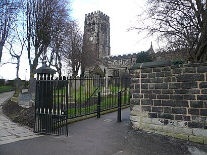
St Lawrence’s Church, North Wingfield is a Grade I listed parish church in the Church of England in North Wingfield, Derbyshire.Wiki
Attractions near St Lawrence's Church, North Wingfield
The Blue Bell Inn,Apex Cleaning,Fatigue Free Futures,B.S. Displays,Arkouda Property,Prockim Trading,The Electric Jerry Can Company,Utility Stats,Avalon 805,Little H Imaging,Kirsty's Salon,New Street / Hepthorne Lane,Bet Promotion Codes,Appliance Spares Centre,Hepthorne Lane Community Centre,Stanwood Engineering,Highlight Crafts,S B Builders,Strateclink,Skinclin LaserHow to get to popular attractions in North East Derbyshire with public transportation
Burton Latimer, Kettering,Ideal World Studios, Peterborough,De Montfort University, Leicester,Sinfin, Derby,Hotel ibis Chesterfield Centre, Chesterfield,RAF Wittering, Peterborough,Market Warsop, Mansfield,Gotham, Rushcliffe,Hucknall Tram Stop, Ashfield,Northampton College, Northampton,Hilton Leicester Hotel, Blaby,The Carlton Centre, Lincoln,Spider Bridge, Derby,Bradlaugh Fields, Northampton,Wyberton, Boston,The Observatory (Wetherspoon), Erewash,Riverside Retail Park, Northampton,Huthwaite, Ashfield,Forest Fields, Nottingham,Bassett Lowke Halls, NorthamptonGet around North East Derbyshire by public transport!
Travelling around North East Derbyshire has never been so easy. See step by step directions as you travel to any attraction, street or major public transport station. View bus and train timetables, arrival times, service alerts and detailed routes on a map, so you know exactly how to get to anywhere in North East Derbyshire.
When travelling to any destination around North East Derbyshire use Moovit's Live Directions with Get Off Notifications to know exactly where and how far to walk, how long to wait for your line , and how many stops are left. Moovit will alert you when it’s time to get off — no need to constantly re-check whether yours is the next stop.
Wondering how to use public transport in North East Derbyshire or how to pay for public transport in North East Derbyshire? Moovit public transport app can help you navigate your way with public transport easily, and at minimum cost. It includes public transport fees, ticket prices, and costs. Looking for a map of North East Derbyshire public transport lines? Moovit public transport app shows all public transport maps in North East Derbyshire with all bus or train routes and stops on an interactive map.
North East Derbyshire has 2 transport type(s), including: bus or train, operated by several transport agencies, including National Rail, Ashbourne Community Transport, Delaine Buses, Arriva Midlands, Centrebus, Our Centre, Hulleys of Baslow, D & G Bus, Stagecoach East Midlands, North Lincolnshire Council, National Rail, Roberts Coaches, Lawson's of Corby, Hawkes Coaches and East Yorkshire