See St. Mary's Church, Great Yarmouth on the map
Directions to St. Mary's Church, Great Yarmouth with public transportation
The following transport lines have routes that pass near St. Mary's Church, Great Yarmouth
 Bus:
Bus: - Train:
How to get to St. Mary's Church, Great Yarmouth by bus?
Click on the bus route to see step by step directions with maps, line arrival times and updated time schedules.
How to get to St. Mary's Church, Great Yarmouth by train?
Click on the train route to see step by step directions with maps, line arrival times and updated time schedules.
Bus stations near St. Mary's Church, Great Yarmouth
- Station Road, Great Yarmouth,2 min walk,
- St Marys Lane, Great Yarmouth,3 min walk,
- Southtown Road, Great Yarmouth,5 min walk,
Bus routes to St. Mary's Church, Great Yarmouth
- 1,Martham - Lowestoft,
- 1A,Martham - Lowestoft,
- X1,Norwich - Lowestoft,
- 6,North Walsham - Stalham - Great Yarmouth,
- X6,North Walsham - Stalham - Great Yarmouth,
- 8,Caister - James Paget Hospital,
- BM11,BM Holton - Gt Yarmouth,
- TS11,Flixton - Gt Yarmouth,
- X11,Norwich - Belton,
- 271,Bradwell - Caister,
- 580,Bungay - Beccles - Great Yarmouth,
- 901,Norwich (Notre Dame School) - James Paget Hospital,
- 931,Burgh Castle - Ormiston Venture Academy,
- 983,Martham - East Norfolk Sixth Form,
- 7,James Paget Hospital,
- 834,Gorleston,
What are the nearest stations to St. Mary's Church, Great Yarmouth?
The nearest stations to St. Mary's Church, Great Yarmouth are:
- Station Road, Great Yarmouth is 97 meters away, 2 min walk.
- St Marys Lane, Great Yarmouth is 207 meters away, 3 min walk.
- Southtown Road, Great Yarmouth is 318 meters away, 5 min walk.
Which bus line stops near St. Mary's Church, Great Yarmouth?
580
Which train line stops near St. Mary's Church, Great Yarmouth?
GREATER ANGLIA
What’s the nearest bus stop to St. Mary's Church, Great Yarmouth?
The nearest bus stop to St. Mary's Church, Great Yarmouth is Station Road, Great Yarmouth. It’s a 2 min walk away.
See St. Mary's Church, Great Yarmouth on the map
Public Transportation to St. Mary's Church, Great Yarmouth
Wondering how to get to St. Mary's Church, Great Yarmouth, United Kingdom? Moovit helps you find the best way to get to St. Mary's Church, Great Yarmouth with step-by-step directions from the nearest public transit station.
Moovit provides free maps and live directions to help you navigate through your city. View schedules, routes, timetables, and find out how long does it take to get to St. Mary's Church, Great Yarmouth in real time.
Looking for the nearest stop or station to St. Mary's Church, Great Yarmouth? Check out this list of stops closest to your destination: Station Road; St Marys Lane; Southtown Road.
Bus:Train:
Want to see if there’s another route that gets you there at an earlier time? Moovit helps you find alternative routes or times. Get directions from and directions to St. Mary's Church, Great Yarmouth easily from the Moovit App or Website.
We make riding to St. Mary's Church, Great Yarmouth easy, which is why over 1.5 million users, including users in Great Yarmouth, trust Moovit as the best app for public transit. You don’t need to download an individual bus app or train app, Moovit is your all-in-one transit app that helps you find the best bus time or train time available.
For information on prices of train and bus, costs and ride fares to St. Mary's Church, Great Yarmouth, please check the Moovit app.
Use the app to navigate to popular places including to the airport, hospital, stadium, grocery store, mall, coffee shop, school, college, and university.
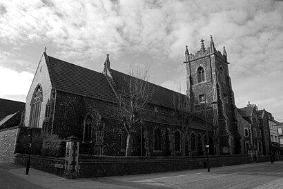
St. Mary's Church, Great Yarmouth Address: 279 Southtown Road Great Yarmouth Great Yarmouth NR31 0 street in Great Yarmouth
Attractions near St. Mary's Church, Great Yarmouth
St. Mary's Church,Seaforths Travel Agency Business Travel Worldwide,A & W Cushion Ltd.,Advanced Travel Partners U K Ltd.,O I S Plc,Fares Direct,Nr31 0jb,Matalan,Bennetts,Earle Security Services,Screens,Nr31 0lp,Paddy Hall Presentations,Nr31 0jg,Nr31 0dt,Waeney Mill,Resolution Business Services,GALAXY PRECISION A G SERVICES LTD,Nr31 0jh,Nr31 0duHow to get to popular attractions in Great Yarmouth with public transportation
Glasswells, St Edmundsbury,Woolpit, Mid Suffolk,Belstead Brook Hotel, Ipswich,GO Outdoors, Norwich,Hellesdon, Norwich,Sawtry community college, Huntingdonshire,Abbey College Cambridge, Cambridge,Netherhall School and Sixth Form College, Cambridge,Caister On Sea, Great Yarmouth,Sir Harry Smith Community College, Fenland,Halesworth, Waveney,ipl whitlesey, Fenland,Lucy Cavendish College, Cambridge,Haslingfield, South Cambridgeshire,Adelaide Street Bus Stop, Norwich,Oliver Cromwell's House, East Cambridgeshire,Downham Market, King'S Lynn And West Norfolk,Holiday Inn Norwich City, Norwich,Taverham Garden Centre, Broadland,Norfolk Lavender, King'S Lynn And West NorfolkGet around Great Yarmouth by public transport!
Travelling around Great Yarmouth has never been so easy. See step by step directions as you travel to any attraction, street or major public transport station. View bus and train timetables, arrival times, service alerts and detailed routes on a map, so you know exactly how to get to anywhere in Great Yarmouth.
When travelling to any destination around Great Yarmouth use Moovit's Live Directions with Get Off Notifications to know exactly where and how far to walk, how long to wait for your line , and how many stops are left. Moovit will alert you when it’s time to get off — no need to constantly re-check whether yours is the next stop.
Wondering how to use public transport in Great Yarmouth or how to pay for public transport in Great Yarmouth? Moovit public transport app can help you navigate your way with public transport easily, and at minimum cost. It includes public transport fees, ticket prices, and costs. Looking for a map of Great Yarmouth public transport lines? Moovit public transport app shows all public transport maps in Great Yarmouth with all train or bus routes and stops on an interactive map.
Great Yarmouth has 2 transport type(s), including: train or bus, operated by several transport agencies, including National Rail, Ambassador Travel, Harwich Harbour Ferry, Stephensons of Essex, Villager Minibus Sharnbrook, The Voluntary Network, Dews Coaches, Felixstowe Ferry Boat Yard, Lord's Travel, Hadleigh Community Transport, Beestons, Fenland Association for Community Transport, First Norfolk & Suffolk, National Rail and Mulleys Motorways