Directions to St Michaels Church, Farnsfield (Newark And Sherwood) with public transport
The following transport lines have routes that pass near St Michaels Church, Farnsfield
How to get to St Michaels Church, Farnsfield by bus?
Click on the bus route to see step by step directions with maps, line arrival times and updated time schedules.
Bus stations near St Michaels Church, Farnsfield in Newark And Sherwood
- The Ridgeway, Farnsfield,7 min walk,
- The Lion, Farnsfield,9 min walk,
- Cockett Lane, Farnsfield,15 min walk,
Bus lines to St Michaels Church, Farnsfield in Newark And Sherwood
- 28,Halam,
- 29,Newark,
- SA,Ollerton,
- 28B,Mansfield,
What are the nearest stations to St Michaels Church, Farnsfield?
The nearest stations to St Michaels Church, Farnsfield are:
- The Ridgeway, Farnsfield is 499 meters away, 7 min walk.
- The Lion, Farnsfield is 619 meters away, 9 min walk.
- Cockett Lane, Farnsfield is 1106 meters away, 15 min walk.
Which bus lines stop near St Michaels Church, Farnsfield?
These bus lines stop near St Michaels Church, Farnsfield: 28, 29, SA.
What’s the nearest bus stop to St Michaels Church, Farnsfield in Newark And Sherwood?
The nearest bus stop to St Michaels Church, Farnsfield in Newark And Sherwood is The Ridgeway, Farnsfield. It’s a 7 min walk away.
What time is the first bus to St Michaels Church, Farnsfield in Newark And Sherwood?
The SA is the first bus that goes to St Michaels Church, Farnsfield in Newark And Sherwood. It stops nearby at 06:35.
What time is the last bus to St Michaels Church, Farnsfield in Newark And Sherwood?
The SA is the last bus that goes to St Michaels Church, Farnsfield in Newark And Sherwood. It stops nearby at 23:49.
See St Michaels Church, Farnsfield, Newark And Sherwood, on the map
Public Transit to St Michaels Church, Farnsfield in Newark And Sherwood
Wondering how to get to St Michaels Church, Farnsfield in Newark And Sherwood, United Kingdom? Moovit helps you find the best way to get to St Michaels Church, Farnsfield with step-by-step directions from the nearest public transit station.
Moovit provides free maps and live directions to help you navigate through your city. View schedules, routes, timetables, and find out how long does it take to get to St Michaels Church, Farnsfield in real time.
Looking for the nearest stop or station to St Michaels Church, Farnsfield? Check out this list of stops closest to your destination: The Ridgeway; The Lion; Cockett Lane.
Bus:2829SA28B
Want to see if there’s another route that gets you there at an earlier time? Moovit helps you find alternative routes or times. Get directions from and directions to St Michaels Church, Farnsfield easily from the Moovit App or Website.
We make riding to St Michaels Church, Farnsfield easy, which is why over 1.5 million users, including users in Newark And Sherwood, trust Moovit as the best app for public transit. You don’t need to download an individual bus app or train app, Moovit is your all-in-one transit app that helps you find the best bus time or train time available.
For information on prices of bus, costs and ride fares to St Michaels Church, Farnsfield, please check the Moovit app.
Use the app to navigate to popular places including to the airport, hospital, stadium, grocery store, mall, coffee shop, school, college, and university.
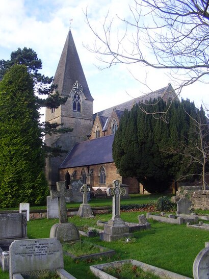
St Michaels Church, Farnsfield Address: Branston Avenue Farnsfield Newark NG22 8JZ street in Newark And Sherwood
St Michael's Church, Farnsfield is a Grade II listed parish church in the Church of England in Farnsfield.Wiki
Attractions near St Michaels Church, Farnsfield
Essay,Garden Rooms Ci,Team Edward,Think Relocation,Meta Site,True Developments Midlands,Southwell Executive Chauffeuring Limited,The Beauty Room,T Buck Seafoods,Lurcher Farm Cottage,Farnsfield Vil,NJP Projects,Farnsfield Jun,Wilkinson Engineering Services,Tom Reddy,Allsorts,Farnsfield,Village & Country Homes,Care & Comfort Community Services,Berwyn HydroHow to get to popular attractions in Newark And Sherwood with public transportation
Orton Gate Shopping, Peterborough,The Castlewood (Brewers Fayre), Bolsover,Icon Centre, Daventry,Wicksteed Park, Kettering,Hotel ibis Chesterfield Centre, Chesterfield,The Lincolnshire Wolds, East Lindsey,Kingsway Hospital, Derby,Morrisons Distribution Centre, Northampton,Mecca Bingo, Broxtowe,RBS Kegworth Data Centre, North West Leicestershire,University Of Nottingham, Nottingham,Billing Aquadrome, Northampton,Sport Park Loughborough University, Charnwood,Western Park, Leicester,Southwell, Newark And Sherwood,Wilko, Nottingham,Lidl, Peterborough,Experian Embankment House, Nottingham,Bassett Lowke Halls, Northampton,Hucknall Tram Stop, AshfieldGet around Newark And Sherwood by public transport!
Travelling around Newark And Sherwood has never been so easy. See step by step directions as you travel to any attraction, street or major public transport station. View bus and train timetables, arrival times, service alerts and detailed routes on a map, so you know exactly how to get to anywhere in Newark And Sherwood.
When travelling to any destination around Newark And Sherwood use Moovit's Live Directions with Get Off Notifications to know exactly where and how far to walk, how long to wait for your line , and how many stops are left. Moovit will alert you when it’s time to get off — no need to constantly re-check whether yours is the next stop.
Wondering how to use public transport in Newark And Sherwood or how to pay for public transport in Newark And Sherwood? Moovit public transport app can help you navigate your way with public transport easily, and at minimum cost. It includes public transport fees, ticket prices, and costs. Looking for a map of Newark And Sherwood public transport lines? Moovit public transport app shows all public transport maps in Newark And Sherwood with all bus routes and stops on an interactive map.
Newark And Sherwood has 1 transport type(s), including: bus, operated by several transport agencies, including National Rail, Ashbourne Community Transport, Delaine Buses, Arriva Midlands, Centrebus, Our Centre, Hulleys of Baslow, D & G Bus, Stagecoach East Midlands, North Lincolnshire Council, National Rail, Roberts Coaches, Lawson's of Corby, Hawkes Coaches and East Yorkshire