Directions to St. Peter Mancroft (Norwich) with public transport
The following transport lines have routes that pass near St. Peter Mancroft
How to get to St. Peter Mancroft by bus?
Click on the bus route to see step by step directions with maps, line arrival times and updated time schedules.
How to get to St. Peter Mancroft by train?
Click on the train route to see step by step directions with maps, line arrival times and updated time schedules.
Bus stations near St. Peter Mancroft in Norwich
- St Stephens Street, Norwich City Centre (Bq),6 min walk,
- Ber Street, Norwich City Centre (Bu),8 min walk,
- Bus Station, Norwich City Centre (L),8 min walk,
- Bus Station, Norwich City Centre (K),8 min walk,
- St Stephens Square, Norwich,10 min walk,
Bus lines to St. Peter Mancroft in Norwich
- 5B,Eaton - Norwich - Dussindale - Wroxham - Stalham,
- 8,Norwich - Dereham - Toftwood,
- 10,Mousehold Heath - Eaton Park,
- 10A,Mousehold Heath - Cringleford,
- 28,Norwich - Thorpe Marriott,
- 29,Norwich - Taverham,
- X29,Norwich - Fakenham,
- TS24,Norwich,
- 84,Hempnall Green,
- 85,Claxton,
- 8A,Norwich,
- 86,Norwich City Centre,
- 1,Norwich - Long Stratton - Burston - Diss,
- 2,Norwich - Long Stratton - A140 - Diss,
- 3,Norwich - N&NU Hospital - Hingham - Watton,
- 3B,Norwich - Barnham Broom - Watton,
- 3C,Norwich - Carbrooke Village - Watton,
- 4,Norwich - Dereham - Swanton Morley,
- 6,Norwich - Wymondham - Hingham - Watton,
- 6A,Norwich - Hethersett - Wymondham - Watton,
What are the nearest stations to St. Peter Mancroft?
The nearest stations to St. Peter Mancroft are:
- St Stephens Street, Norwich City Centre (Bq) is 352 meters away, 6 min walk.
- Ber Street, Norwich City Centre (Bu) is 493 meters away, 8 min walk.
- Bus Station, Norwich City Centre (L) is 535 meters away, 8 min walk.
- Bus Station, Norwich City Centre (K) is 552 meters away, 8 min walk.
- St Stephens Square, Norwich is 614 meters away, 10 min walk.
Which bus line stops near St. Peter Mancroft?
146
Which train lines stop near St. Peter Mancroft?
These train lines stop near St. Peter Mancroft: EAST MIDLANDS TRAINS, GREATER ANGLIA.
What’s the nearest bus stop to St. Peter Mancroft in Norwich?
The nearest bus stop to St. Peter Mancroft in Norwich is St Stephens Street, Norwich City Centre (Bq). It’s a 6 min walk away.
See St. Peter Mancroft, Norwich, on the map
Public Transit to St. Peter Mancroft in Norwich
Wondering how to get to St. Peter Mancroft in Norwich, United Kingdom? Moovit helps you find the best way to get to St. Peter Mancroft with step-by-step directions from the nearest public transit station.
Moovit provides free maps and live directions to help you navigate through your city. View schedules, routes, timetables, and find out how long does it take to get to St. Peter Mancroft in real time.
Looking for the nearest stop or station to St. Peter Mancroft? Check out this list of stops closest to your destination: St Stephens Street; Ber Street; Bus Station; Bus Station; St Stephens Square.
Bus:1465B81010A28TS2484858A861233B3CTrain:EAST MIDLANDS TRAINSGREATER ANGLIA
Want to see if there’s another route that gets you there at an earlier time? Moovit helps you find alternative routes or times. Get directions from and directions to St. Peter Mancroft easily from the Moovit App or Website.
We make riding to St. Peter Mancroft easy, which is why over 1.5 million users, including users in Norwich, trust Moovit as the best app for public transit. You don’t need to download an individual bus app or train app, Moovit is your all-in-one transit app that helps you find the best bus time or train time available.
For information on prices of train and bus, costs and ride fares to St. Peter Mancroft, please check the Moovit app.
Use the app to navigate to popular places including to the airport, hospital, stadium, grocery store, mall, coffee shop, school, college, and university.
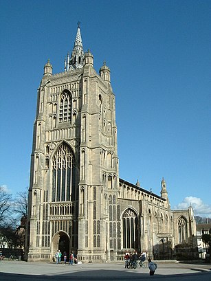
St. Peter Mancroft Address: St Peter's St street in Norwich
Attractions near St. Peter Mancroft
The Forum,Nr2 1tf,St Peter Mancroft Church,Millennium Plain,Nr2 1qq,Nr2 1qx,2nd Air Division Memorial Library,Pizza Express - Norwich Forum,Jacamo,C & A,Shaake,The Television & Movie Store,Tourist Office,BBC Norfolk - Radio & TV Centre,BBC East and BBC Radio Norfolk,Bethel Street,Nr2 1te,Pudding Lane,The Movie Shop,Cotswold Outdoor NorwichHow to get to popular attractions in Norwich with public transportation
Holiday Inn Norwich - North, Norwich,Robert Kett Junior School, South Norfolk,Burwash Manor, South Cambridgeshire,Ransome's Europark, Ipswich,Mid Suffolk Leisure Centre, Mid Suffolk,Breydon Waters Holiday Park, Great Yarmouth,Spire Cambridge Lea Hospital, South Cambridgeshire,Huntingdon Regional College, Huntingdonshire,UEA Congregation Hall, Norwich,Newnham College, Cambridge,Sutton Hoo, Suffolk Coastal,Lammas Land, Cambridge,Caister On Sea, Great Yarmouth,Shrine of Our Lady of Walsingham, North Norfolk,Woolpit, Mid Suffolk,Harfreys Industrial Estate, Great Yarmouth,Sudbury Bus Station, Babergh,St Neots Town FC, Huntingdonshire,Hunstanton Beach, King'S Lynn And West Norfolk,Cringleford, South NorfolkGet around Norwich by public transport!
Travelling around Norwich has never been so easy. See step by step directions as you travel to any attraction, street or major public transport station. View bus and train timetables, arrival times, service alerts and detailed routes on a map, so you know exactly how to get to anywhere in Norwich.
When travelling to any destination around Norwich use Moovit's Live Directions with Get Off Notifications to know exactly where and how far to walk, how long to wait for your line , and how many stops are left. Moovit will alert you when it’s time to get off — no need to constantly re-check whether yours is the next stop.
Wondering how to use public transport in Norwich or how to pay for public transport in Norwich? Moovit public transport app can help you navigate your way with public transport easily, and at minimum cost. It includes public transport fees, ticket prices, and costs. Looking for a map of Norwich public transport lines? Moovit public transport app shows all public transport maps in Norwich with all train or bus routes and stops on an interactive map.
Norwich has 2 transport type(s), including: train or bus, operated by several transport agencies, including National Rail, Ambassador Travel, Harwich Harbour Ferry, Stephensons of Essex, Villager Minibus Sharnbrook, The Voluntary Network, Dews Coaches, Lord's Travel, Felixstowe Ferry Boat Yard, Hadleigh Community Transport, Beestons, Fenland Association for Community Transport, First Norfolk & Suffolk, National Rail and Mulleys Motorways