Directions to St Stephen's Hull with public transportation
The following transport lines have routes that pass near St Stephen's Hull
How to get to St Stephen's Hull by bus?
Click on the bus route to see step by step directions with maps, line arrival times and updated time schedules.
How to get to St Stephen's Hull by train?
Click on the train route to see step by step directions with maps, line arrival times and updated time schedules.
Bus stops near St Stephen's Hull
- Hull Truck Theatre, 3 min walk,
- Prospect Street A, 4 min walk,
- Prospect Street B, 5 min walk,
- Midland Street, 6 min walk,
- Deaf Insitute, 6 min walk,
- Pease Street, 6 min walk,
- Hull Interchange, 7 min walk,
- Albion Street D, 8 min walk,
- Hull Interchange (Bay D), 8 min walk,
Train station near St Stephen's Hull
- Hull, 29 min walk,
Bus routes to St Stephen's Hull
- 1, Hull Hull Truck Theatre,
- 2, Boothferry Estate Sirius Academy,
- 5, Kingswood Asda Kingswood,
- 13, Bilton Grange St Philip`S Church,
- 20, Hull Int Bay 3,
- 20, Hull Interchange,
- 57, Hessle Square,
- 79, Hull Interchange,
- 111, Hull Interchange,
- 173, Hull Interchange,
- 255, Hull Interchange,
- 256, Wren Kitchens,
- 561, Belgravia, Victoria - Hull,
- 3, North Hull Estate Orchard Park Tesco,
- 4, North Hull Estate Orchard Park Tesco,
- 6, Hull Interchange,
- 7, Hull Interchange,
- 23, Beverley Bs,
- 35, Willerby Square,
- 41, Leconfield (Main Street),
What are the nearest stations to St Stephen's Hull?
The nearest stations to St Stephen's Hull are:
- Hull Truck Theatre is 212 meters away, 3 min walk.
- Prospect Street A is 278 meters away, 4 min walk.
- Prospect Street B is 300 meters away, 5 min walk.
- Midland Street is 394 meters away, 6 min walk.
- Deaf Insitute is 445 meters away, 6 min walk.
- Pease Street is 448 meters away, 6 min walk.
- Hull Interchange is 478 meters away, 7 min walk.
- Albion Street D is 539 meters away, 8 min walk.
- Hull Interchange (Bay D) is 554 meters away, 8 min walk.
- Hull is 2247 meters away, 29 min walk.
Which bus lines stop near St Stephen's Hull?
These bus lines stop near St Stephen's Hull: 11, 121, 13, 54, 55, 57, 6, X46.
Which train line stops near St Stephen's Hull?
NORTHERN
What’s the nearest train station to St Stephen's Hull?
The nearest train station to St Stephen's Hull is Hull. It’s a 29 min walk away.
What’s the nearest bus station to St Stephen's Hull?
The nearest bus station to St Stephen's Hull is Hull Truck Theatre. It’s a 3 min walk away.
What time is the first train to St Stephen's Hull?
The TRANSPENNINE EXPRESS is the first train that goes to St Stephen's Hull. It stops nearby at 04:59.
What time is the last train to St Stephen's Hull?
The TRANSPENNINE EXPRESS is the last train that goes to St Stephen's Hull. It stops nearby at 00:24.
What time is the first bus to St Stephen's Hull?
The 1 is the first bus that goes to St Stephen's Hull. It stops nearby at 04:37.
What time is the last bus to St Stephen's Hull?
The 104 is the last bus that goes to St Stephen's Hull. It stops nearby at 00:23.
See St Stephen's Hull on the map
Public Transportation to St Stephen's Hull
Wondering how to get to St Stephen's Hull, United Kingdom? Moovit helps you find the best way to get to St Stephen's Hull with step-by-step directions from the nearest public transit station.
Moovit provides free maps and live directions to help you navigate through your city. View schedules, routes, timetables, and find out how long does it take to get to St Stephen's Hull in real time.
Looking for the nearest stop or station to St Stephen's Hull? Check out this list of stops closest to your destination: Hull Truck Theatre; Prospect Street A; Prospect Street B; Midland Street; Deaf Insitute; Pease Street; Hull Interchange; Albion Street D; Hull Interchange (Bay D); Hull.
Bus: 11, 121, 13, 54, 55, 57, 6, X46, 1, 2, 5, 20, 3, 4, 7, 23, 14, 16, 75, 277, 52, 53, 59, 944.Train: NORTHERN, HULL TRAINS, LONDON NORTH EASTERN RAILWAY, TRANSPENNINE EXPRESS.
Want to see if there’s another route that gets you there at an earlier time? Moovit helps you find alternative routes or times. Get directions from and directions to St Stephen's Hull easily from the Moovit App or Website.
We make riding to St Stephen's Hull easy, which is why over 1.5 million users, including users in Hull, trust Moovit as the best app for public transit. You don’t need to download an individual bus app or train app, Moovit is your all-in-one transit app that helps you find the best bus time or train time available.
For information on prices of bus and train, costs and ride fares to St Stephen's Hull, please check the Moovit app.
Use the app to navigate to popular places including to the airport, hospital, stadium, grocery store, mall, coffee shop, school, college, and university.
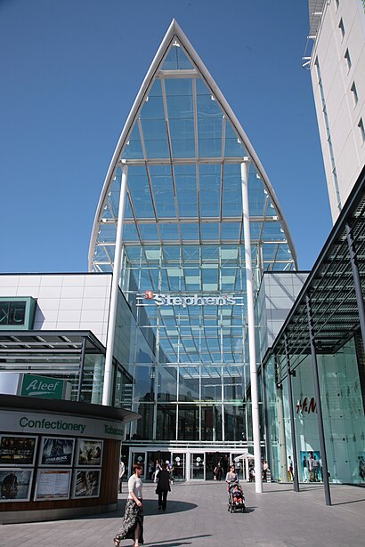
St Stephen's Hull Address: Canning Street Hull Hull HU2 8 street in Hull
Places Near St Stephen's Hull
How to get to popular places in Yorkshire with public transport
Get around Hull by public transport!
Travelling around Hull has never been so easy. See step by step directions as you travel to any attraction, street or major public transport station. View bus and train timetables, arrival times, service alerts and detailed routes on a map, so you know exactly how to get to anywhere in Hull.
When travelling to any destination around Hull use Moovit's Live Directions with Get Off Notifications to know exactly where and how far to walk, how long to wait for your line , and how many stops are left. Moovit will alert you when it’s time to get off — no need to constantly re-check whether yours is the next stop.
Wondering how to use public transport in Hull or how to pay for public transport in Hull? Moovit public transport app can help you navigate your way with public transport easily, and at minimum cost. It includes public transport fees, ticket prices, and costs. Looking for a map of Hull public transport lines? Moovit public transport app shows all public transport maps in Hull with all Bus, Train and Light rail routes and stops on an interactive map.
Yorkshire has 3 transport type(s), including: Bus, Train and Light rail, operated by several transport agencies, including First Leeds, First South Yorkshire, First York, First West Yorkshire Ltd, Arriva Yorkshire, Stagecoach Yorkshire, National Rail, First Bradford, First Halifax, Calder Valley & Huddersfield, East Yorkshire, The Keighley Bus Company, South Yorkshire Future Tram, The Harrogate Bus Company, TM Travel and Coastliner