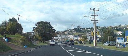
Directions to Stanmore Bay (Stanmore Bay West) with public transport
The following transport lines have routes that pass near Stanmore Bay
How to get to Stanmore Bay by bus?
Click on the bus route to see step by step directions with maps, line arrival times and updated time schedules.
Bus stations near Stanmore Bay in Stanmore Bay West
- Waiora Road, 6 min walk,
Bus lines to Stanmore Bay in Stanmore Bay West
- 982, Gulf Harbour To Hibiscus Coast Station,
What are the nearest stations to Stanmore Bay?
The nearest stations to Stanmore Bay are:
- Waiora Road is 413 meters away, 6 min walk.
Which bus line stops near Stanmore Bay?
982
What’s the nearest bus stop to Stanmore Bay in Stanmore Bay West?
The nearest bus stop to Stanmore Bay in Stanmore Bay West is Waiora Road. It’s a 6 min walk away.
What time is the first bus to Stanmore Bay in Stanmore Bay West?
The 982 is the first bus that goes to Stanmore Bay in Stanmore Bay West. It stops nearby at 07:15.
What time is the last bus to Stanmore Bay in Stanmore Bay West?
The 982 is the last bus that goes to Stanmore Bay in Stanmore Bay West. It stops nearby at 22:17.
How much is the bus fare to Stanmore Bay?
The bus fare to Stanmore Bay costs about $1.06 - $3.59.
See Stanmore Bay, Stanmore Bay West, on the map
Public Transit to Stanmore Bay in Stanmore Bay West
Wondering how to get to Stanmore Bay in Stanmore Bay West, New Zealand? Moovit helps you find the best way to get to Stanmore Bay with step-by-step directions from the nearest public transit station.
Moovit provides free maps and live directions to help you navigate through your city. View schedules, routes, timetables, and find out how long does it take to get to Stanmore Bay in real time.
Looking for the nearest stop or station to Stanmore Bay? Check out this list of stops closest to your destination: Waiora Road.
Bus: 982.
Want to see if there’s another route that gets you there at an earlier time? Moovit helps you find alternative routes or times. Get directions from and directions to Stanmore Bay easily from the Moovit App or Website.
We make riding to Stanmore Bay easy, which is why over 1.5 million users, including users in Stanmore Bay West, trust Moovit as the best app for public transit. You don’t need to download an individual bus app or train app, Moovit is your all-in-one transit app that helps you find the best bus time or train time available.
For information on prices of bus, costs and ride fares to Stanmore Bay, please check the Moovit app.
Use the app to navigate to popular places including to the airport, hospital, stadium, grocery store, mall, coffee shop, school, college, and university.
Stanmore Bay Address: Whangaparaoa, Auckland street in Stanmore Bay West
Attractions near Stanmore Bay
Stanmore Bay Presbyterian Church,Nagellen Best Impressions Property Care Services,A Computer Services,Electrotec Electrical Limited,Debello Investments,Squeeky Clean,SV Painters and Decorators,Brightside Store,10 Brightside Rd,Timbertech Cedar Beautifully Protected,Be Amazing Be You,Hibiscus Coast Scaffolding,Filter Specialists,Alarms R US,Whangaparaoa Lawn Mowing,Nailznz,Soul Fertility,Bayes Brick & Block Construction,National Property Centre Mreinz,WholehealthHow to get to popular attractions in Stanmore Bay West with public transportation
Triniti of Silver Cafe, Springleigh,The Project, Glenavon,Point Chevalier Shops, Point Chevalier East,Mays Road, Te Papapa,wagamama, Mt Wellington South,Wok'n Noodle, Mt Eden North,KFC, Onehunga North West,Sri Mahkota Malaysian Restaurant, Grafton West,Doolan Brothers, Ellerslie North,Claddagh's Irish Pub, Mt Hobson,Eden Park, Kingsland,香面访 Tasty Noodles, Three Kings,Henderson Heights, Henderson West,Mission Bay, Mission Bay,Nespresso Boutique, Newmarket,Fresh & Save 南順發超市, Wiri,Hansan Vietnamese Restaurant | 漢山越南餐館, Mt Hobson,The Warehouse Lincoln Road, Fairdene,Dante's Pizzeria Napoletana, Ponsonby East,Theobroma Chocolate Lounge, Mt Wellington SouthGet around Auckland and Hamilton by public transport!
Travelling around Auckland and Hamilton has never been so easy. See step by step directions as you travel to any attraction, street or major public transport station. View bus and train timetables, arrival times, service alerts and detailed routes on a map, so you know exactly how to get to anywhere in Auckland and Hamilton.
When travelling to any destination around Auckland and Hamilton use Moovit's Live Directions with Get Off Notifications to know exactly where and how far to walk, how long to wait for your line , and how many stops are left. Moovit will alert you when it’s time to get off — no need to constantly re-check whether yours is the next stop.
Wondering how to use public transport in Auckland and Hamilton or how to pay for public transport in Auckland and Hamilton? Moovit public transport app can help you navigate your way with public transport easily, and at minimum cost. It includes public transport fees, ticket prices, and costs. Looking for a map of Auckland and Hamilton public transport lines? Moovit public transport app shows all public transport maps in Auckland and Hamilton with all Bus, Train and Ferry routes and stops on an interactive map.
Auckland and Hamilton has 3 transport type(s), including: Bus, Train and Ferry, operated by several transport agencies, including AT Metro, AT Metro Bus, Fullers360, SeaLink Pine Harbour, Belaire Ferries, Tranzit Group Ltd, New Zealand Bus, Pavlovich Transport Solutions, Bayes Coachlines, Howick and Eastern, Ritchies Transport, Waiheke Bus Company, Mahu City Express, Go Bus, SeaLink