Directions to Summer Hill Pub (Summer Hill (Ashfield)) with public transport
The following transport lines have routes that pass near Summer Hill Pub
How to get to Summer Hill Pub by bus?
Click on the bus route to see step by step directions with maps, line arrival times and updated time schedules.
How to get to Summer Hill Pub by train?
Click on the train route to see step by step directions with maps, line arrival times and updated time schedules.
Bus stations near Summer Hill Pub in Summer Hill (Ashfield)
- Liverpool Rd After Elizabeth St,6 min walk,
Bus lines to Summer Hill Pub in Summer Hill (Ashfield)
- 480,Strathfield,
- 483,Central Pitt St,
What are the nearest stations to Summer Hill Pub?
The nearest stations to Summer Hill Pub are:
- Liverpool Rd After Elizabeth St is 409 meters away, 6 min walk.
Which bus lines stop near Summer Hill Pub?
These bus lines stop near Summer Hill Pub: 438, 461, 483, N80.
Which train line stops near Summer Hill Pub?
T2
What’s the nearest bus stop to Summer Hill Pub in Summer Hill (Ashfield)?
The nearest bus stop to Summer Hill Pub in Summer Hill (Ashfield) is Liverpool Rd After Elizabeth St. It’s a 6 min walk away.
See Summer Hill Pub, Summer Hill (Ashfield), on the map
Public Transit to Summer Hill Pub in Summer Hill (Ashfield)
Wondering how to get to Summer Hill Pub in Summer Hill (Ashfield), Australia? Moovit helps you find the best way to get to Summer Hill Pub with step-by-step directions from the nearest public transit station.
Moovit provides free maps and live directions to help you navigate through your city. View schedules, routes, timetables, and find out how long does it take to get to Summer Hill Pub in real time.
Looking for the nearest stop or station to Summer Hill Pub? Check out this list of stops closest to your destination: Liverpool Rd After Elizabeth St.
Bus:438461483N80480Train:T2
Want to see if there’s another route that gets you there at an earlier time? Moovit helps you find alternative routes or times. Get directions from and directions to Summer Hill Pub easily from the Moovit App or Website.
We make riding to Summer Hill Pub easy, which is why over 1.5 million users, including users in Summer Hill (Ashfield), trust Moovit as the best app for public transit. You don’t need to download an individual bus app or train app, Moovit is your all-in-one transit app that helps you find the best bus time or train time available.
For information on prices of train, bus and light rail, costs and ride fares to Summer Hill Pub, please check the Moovit app.
Use the app to navigate to popular places including to the airport, hospital, stadium, grocery store, mall, coffee shop, school, college, and university.
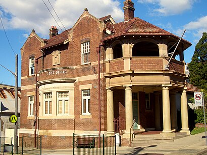
Summer Hill Pub Address: 1 lackey street, summer hill street in Summer Hill (Ashfield)
Attractions near Summer Hill Pub
carlton crescent,Misfitz Productions Studio,Summer Hill Village,Garden Court,Darrell Jackson Playground,anita's place,Next Big Thing Media World Wide Headquarters,Anglicare Shop,Summer Hill Church,John Paton Reserve,Summer Hill Ambulance Station,Absolutely Fanulous,Summer Hill Tennis Courts,Summer Hill Community Centre,Summer Hill Playground,Daryl Jackson Gardens,Summer Hill skatepark,Florida Court,Iga,Ashfield ManorHow to get to popular attractions in Summer Hill (Ashfield) with public transportation
Roselands Shopping Centre, Roselands,Westfield Tuggerah, Tuggerah,Manly Beach, Manly (NSW),Wollongong Station, Wollongong,Kogarah Station, Kogarah,Sydney, Sydney,Stockland Jesmond, Jesmond,Munich Brauhaus, The Rocks (Sydney - NSW),Heritage Belgian Beer Cafe, The Rocks (Sydney - NSW),Ichi-ban Boshi (一番星), Sydney,Westfield Burwood, Burwood (NSW),Broadway Shopping Centre, Glebe (NSW),Newcastle Airport (NTL), Williamtown,Charlestown, Charlestown (NSW),Westfield Liverpool, Liverpool,Fairfield Station, Fairfield (NSW),King Street Brewhouse, Sydney,Padstow Station, Padstow,Sutherland Station, Sutherland (NSW),Campus Centre, RandwickGet around Summer Hill (Ashfield) by public transport!
Travelling around Summer Hill (Ashfield) has never been so easy. See step by step directions as you travel to any attraction, street or major public transport station. View bus and train timetables, arrival times, service alerts and detailed routes on a map, so you know exactly how to get to anywhere in Summer Hill (Ashfield).
When travelling to any destination around Summer Hill (Ashfield) use Moovit's Live Directions with Get Off Notifications to know exactly where and how far to walk, how long to wait for your line , and how many stops are left. Moovit will alert you when it’s time to get off — no need to constantly re-check whether yours is the next stop.
Wondering how to use public transport in Summer Hill (Ashfield) or how to pay for public transport in Summer Hill (Ashfield)? Moovit public transport app can help you navigate your way with public transport easily, and at minimum cost. It includes public transport fees, ticket prices, and costs. Looking for a map of Summer Hill (Ashfield) public transport lines? Moovit public transport app shows all public transport maps in Summer Hill (Ashfield) with all train, bus or light rail routes and stops on an interactive map.
Summer Hill (Ashfield) has 3 transport type(s), including: train, bus or light rail, operated by several transport agencies, including Sydney Metro, Sydney Trains, Sydney Light Rail, Sydney Ferries, Intercity Trains, Intercity Train, NSW TrainLink, CDC NSW R14, U-Go Mobility, Keolis Downer Northern Beaches, Manly Fast Ferry, Transdev John Holland Buses, Busways, Busways North West and Dysons Buslines