See Sunnybank Hills on the map
Directions to Sunnybank Hills with public transportation
The following transport lines have routes that pass near Sunnybank Hills
 Bus:
Bus: - Train:
How to get to Sunnybank Hills by bus?
Click on the bus route to see step by step directions with maps, line arrival times and updated time schedules.
How to get to Sunnybank Hills by train?
Click on the train route to see step by step directions with maps, line arrival times and updated time schedules.
Bus stations near Sunnybank Hills
- Beaudesert Rd at Highlands Drive,5 min walk,
- Calam Rd Near Lear St,6 min walk,
- Compton Rd at Sunnybank Hills Shops, Stop 83,8 min walk,
- Compton Rd Near Chateau St, Stop 25,10 min walk,
- Gowan Rd at Gowan And Compton,13 min walk,
Train stations near Sunnybank Hills
- Altandi Station,11 min walk,
Bus routes to Sunnybank Hills
- P129,Riverside, Creek St,
- 130,Stretton - Gowan Rd,
- 136,Lakewood, Nottingham Rd,
- N130,Stretton - Gowan Rd,
- 115,Calamvale, the Parks,
- P137,Riverside, Creek St,
- 139,UQ Lakes Station,
- 140,Queen Street Station,
- P141,City, Creek St,
- 145,Griffith University A,
- P151,Calamvale, Sunflower,
- 152,Garden City Interchange,
- 138,Riverside, Creek St,
- 150,Browns Plains - City Express Via Runcorn,
- 153,Drewvale - City Rocket,
- N154,City/valley - Browns Plains Nightlink,
- 155,Calamvale - City Express Via Griffith Uni,
- 156,City, Eagle St at Riverside,
- P157,Queen Street Station,
What are the nearest stations to Sunnybank Hills?
The nearest stations to Sunnybank Hills are:
- Beaudesert Rd at Highlands Drive is 339 meters away, 5 min walk.
- Calam Rd Near Lear St is 401 meters away, 6 min walk.
- Compton Rd at Sunnybank Hills Shops, Stop 83 is 601 meters away, 8 min walk.
- Compton Rd Near Chateau St, Stop 25 is 762 meters away, 10 min walk.
- Altandi Station is 825 meters away, 11 min walk.
- Gowan Rd at Gowan And Compton is 944 meters away, 13 min walk.
Which bus lines stop near Sunnybank Hills?
These bus lines stop near Sunnybank Hills: 115, 130, 140, 145, 152.
Which train lines stop near Sunnybank Hills?
These train lines stop near Sunnybank Hills: BEEN, FERN.
What’s the nearest train station to Sunnybank Hills?
The nearest train station to Sunnybank Hills is Altandi Station. It’s a 11 min walk away.
What’s the nearest bus stop to Sunnybank Hills?
The nearest bus stop to Sunnybank Hills is Beaudesert Rd at Highlands Drive. It’s a 5 min walk away.
What time is the first train to Sunnybank Hills?
The BEEN is the first train that goes to Sunnybank Hills. It stops nearby at 04:38.
What time is the last train to Sunnybank Hills?
The FERN is the last train that goes to Sunnybank Hills. It stops nearby at 00:46.
What time is the first bus to Sunnybank Hills?
The 130 is the first bus that goes to Sunnybank Hills. It stops nearby at 04:55.
What time is the last bus to Sunnybank Hills?
The 130 is the last bus that goes to Sunnybank Hills. It stops nearby at 00:11.
How much is the bus fare to Sunnybank Hills?
The bus fare to Sunnybank Hills costs about $2.84 - $4.34.
How much is the train fare to Sunnybank Hills?
The train fare to Sunnybank Hills costs about $3.47 - $54.15.
See Sunnybank Hills on the map
Public Transportation to Sunnybank Hills
Wondering how to get to Sunnybank Hills, Australia? Moovit helps you find the best way to get to Sunnybank Hills with step-by-step directions from the nearest public transit station.
Moovit provides free maps and live directions to help you navigate through your city. View schedules, routes, timetables, and find out how long does it take to get to Sunnybank Hills in real time.
Looking for the nearest stop or station to Sunnybank Hills? Check out this list of stops closest to your destination: Beaudesert Rd at Highlands Drive; Calam Rd Near Lear St; Compton Rd at Sunnybank Hills Shops; Compton Rd Near Chateau St; Altandi Station; Gowan Rd at Gowan And Compton.
Bus:Train:
Want to see if there’s another route that gets you there at an earlier time? Moovit helps you find alternative routes or times. Get directions from and directions to Sunnybank Hills easily from the Moovit App or Website.
We make riding to Sunnybank Hills easy, which is why over 1.5 million users, including users in Brisbane, trust Moovit as the best app for public transit. You don’t need to download an individual bus app or train app, Moovit is your all-in-one transit app that helps you find the best bus time or train time available.
For information on prices of bus and train, costs and ride fares to Sunnybank Hills, please check the Moovit app.
Use the app to navigate to popular places including to the airport, hospital, stadium, grocery store, mall, coffee shop, school, college, and university.
Location: Brisbane
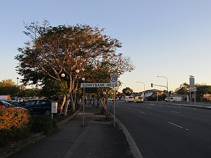
Sunnybank Hills is an outer southern suburb in the City of Brisbane, Queensland, Australia. In the 2021 census, Sunnybank Hills had a population of 18,085 people.Wiki
Popular routes to Sunnybank Hills
Popular routes from Sunnybank Hills
Attractions near Sunnybank Hills
Vac International Media Group,Carter's Critters Pet Shop,Just Soy Café (福泉豆花),Brisbane City Library,Club Lime,Meat Bros,Remox Foreign Exchange & Money Transfer,Sunnybank Hills Aquatic,Suncorp Bank,Game Republic Karaoke GR KTV,Chatterbox Cafe Sunnybank Hills,Sunnybank Hills Parcel Locker,Mo's Retail,Soy Cafe Sunnybank Hills,Calam Rd near Lear St,China Beauty Restaurant,Sunnybank Hills Shoppingtown,The Astute Group,Tony Collivas,Kooralbyn ResortHow to get to popular attractions in Brisbane with public transportation
Garden City, Upper Mount Gravatt,Brisbane Girls Grammar School, Spring Hill,Fortitude Valley, Fortitude Valley,Noosa Heads, Noosa Heads,Gold Coast,RACQ - Fusion Cafe, Eight Mile Plains,Caboolture, Caboolture,Westfield Garden City, Upper Mount Gravatt,Peregian Beach,Forest Lake, Forest Lake,Broadwater Parklands, Southport,Stafford Heights, Stafford Heights,Southport Sharks, Southport,Redland Bay Marina Platform 3,Griffith University Mount Gravatt Campus (Queensland Institute Of Business And Technology), Mount Gravatt,Capalaba Park Shopping Centre, Capalaba,Noosaville, Noosaville,Noosa Heads, Noosa Heads,Griffith University Gold Coast, Southport,Rochedale State High School, RochedaleGet around Brisbane by public transport!
Travelling around Brisbane has never been so easy. See step by step directions as you travel to any attraction, street or major public transport station. View bus and train timetables, arrival times, service alerts and detailed routes on a map, so you know exactly how to get to anywhere in Brisbane.
When travelling to any destination around Brisbane use Moovit's Live Directions with Get Off Notifications to know exactly where and how far to walk, how long to wait for your line , and how many stops are left. Moovit will alert you when it’s time to get off — no need to constantly re-check whether yours is the next stop.
Wondering how to use public transport in Brisbane or how to pay for public transport in Brisbane? Moovit public transport app can help you navigate your way with public transport easily, and at minimum cost. It includes public transport fees, ticket prices, and costs. Looking for a map of Brisbane public transport lines? Moovit public transport app shows all public transport maps in Brisbane with all bus or train routes and stops on an interactive map.
Brisbane has 2 transport type(s), including: bus or train, operated by several transport agencies, including TransLink SEQ, TransLink, TransLink, TransLink, Christensens Bus and Coach, North Stradbroke Island Buses and Griffith Uni Intercampus bus