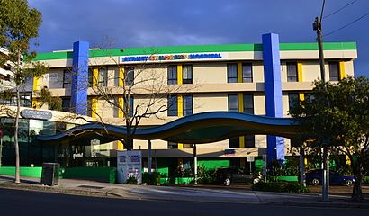
See Sydney Children s Hospital, Randwick, on the map
Directions to Sydney Children s Hospital (Randwick) with public transport
The following transport lines have routes that pass near Sydney Children s Hospital
 Bus:
Bus: - Train:
- Light rail:
How to get to Sydney Children s Hospital by bus?
Click on the bus route to see step by step directions with maps, line arrival times and updated time schedules.
How to get to Sydney Children s Hospital by train?
Click on the train route to see step by step directions with maps, line arrival times and updated time schedules.
Bus stations near Sydney Children s Hospital in Randwick
- Prince of Wales Hospital, Barker St, Gate 1,5 min walk,
- Barker St opp Prince of Wales Hospital,5 min walk,
- Clara St at Blenheim Rd,6 min walk,
- Randwick Girls High School, Avoca St, Stand A,7 min walk,
- Clara St opp Blenheim Rd,7 min walk,
- Botany St at Barker St,7 min walk,
- Belmore Rd at Avoca St,9 min walk,
- Belmore Rd opp Royal Randwick Shopping Centre,9 min walk,
- Sacred Heart Primary School, Avoca St,9 min walk,
- Avoca St opp Sacred Heart Primary School,9 min walk,
- Perouse Rd at Soudan St,10 min walk,
Light Rail stations near Sydney Children s Hospital in Randwick
- Wansey Road Light Rail,16 min walk,
- Juniors Kingsford Light Rail,46 min walk,
Bus lines to Sydney Children s Hospital in Randwick
- 348,Tempe Depot--Fanning St,
- 358,Sydenham Station via Randwick,
- 303,Sans Souci to Prince of Wales Hospital,
- 620E,Randwick Boys HS to Bunnerong Rd near Perry St,
- 621E,Randwick Girls High School to Matraville,
- 630E,Randwick Boys HS to Central Railway Square,
- 631E,Randwick Boys HS to Racecourse Pl near Gardeners Rd,
- 759E,Bellevue Hill Primary School to Eastgardens,
- 370,Glebe Point,
- 390X,Bondi Junction,
- 688E,Eastgardens,
- 640E,Randwick High Schools to Railway Square,
- 641E,Central Station (Kippax St) to Randwick High Schools,
- 642E,Eddy Avenue to Randwick High Schools,
- 644E,Elizabeth & Wellington Sts to Randwick High Schools,
- 715E,Mascot Public School to Rose Bay Secondary College,
- 693E,Eastgardens,
- 636E,Mascot-Gardeners Rd,
- 655E,Randwick-The Spot,
- 694E,Matraville,
What are the nearest stations to Sydney Children s Hospital?
The nearest stations to Sydney Children s Hospital are:
- Prince of Wales Hospital, Barker St, Gate 1 is 295 meters away, 5 min walk.
- Barker St opp Prince of Wales Hospital is 298 meters away, 5 min walk.
- Clara St at Blenheim Rd is 420 meters away, 6 min walk.
- Randwick Girls High School, Avoca St, Stand A is 449 meters away, 7 min walk.
- Clara St opp Blenheim Rd is 458 meters away, 7 min walk.
- Botany St at Barker St is 462 meters away, 7 min walk.
- Belmore Rd at Avoca St is 611 meters away, 9 min walk.
- Belmore Rd opp Royal Randwick Shopping Centre is 614 meters away, 9 min walk.
- Sacred Heart Primary School, Avoca St is 640 meters away, 9 min walk.
- Avoca St opp Sacred Heart Primary School is 650 meters away, 9 min walk.
- Perouse Rd at Soudan St is 664 meters away, 10 min walk.
- Wansey Road Light Rail is 1186 meters away, 16 min walk.
- Juniors Kingsford Light Rail is 3541 meters away, 46 min walk.
Which bus lines stop near Sydney Children s Hospital?
These bus lines stop near Sydney Children s Hospital: 303, 348, 358, 373, 390X, 641E, 642E.
Which train lines stop near Sydney Children s Hospital?
These train lines stop near Sydney Children s Hospital: SCO, T4.
Which light rail line stops near Sydney Children s Hospital?
L2
What’s the nearest light rail station to Sydney Children s Hospital in Randwick?
The nearest light rail station to Sydney Children s Hospital in Randwick is Wansey Road Light Rail. It’s a 16 min walk away.
What’s the nearest bus stop to Sydney Children s Hospital in Randwick?
The nearest bus stops to Sydney Children s Hospital in Randwick are Prince of Wales Hospital, Barker St, Gate 1 and Barker St opp Prince of Wales Hospital. The closest one is a 5 min walk away.
What time is the first light rail to Sydney Children s Hospital in Randwick?
The L2 is the first light rail that goes to Sydney Children s Hospital in Randwick. It stops nearby at 05:04.
What time is the last light rail to Sydney Children s Hospital in Randwick?
The L2 is the last light rail that goes to Sydney Children s Hospital in Randwick. It stops nearby at 01:39.
What time is the first bus to Sydney Children s Hospital in Randwick?
The 373 is the first bus that goes to Sydney Children s Hospital in Randwick. It stops nearby at 03:13.
What time is the last bus to Sydney Children s Hospital in Randwick?
The 373 is the last bus that goes to Sydney Children s Hospital in Randwick. It stops nearby at 03:13.
How much is the light rail fare to Sydney Children s Hospital?
The light rail fare to Sydney Children s Hospital costs about $2.24 - $5.05.
How much is the train fare to Sydney Children s Hospital?
The train fare to Sydney Children s Hospital costs about $2.65 - $7.24.
How much is the bus fare to Sydney Children s Hospital?
The bus fare to Sydney Children s Hospital costs about $2.24 - $3.93.
See Sydney Children s Hospital, Randwick, on the map
Public Transit to Sydney Children s Hospital in Randwick
Wondering how to get to Sydney Children s Hospital in Randwick, Australia? Moovit helps you find the best way to get to Sydney Children s Hospital with step-by-step directions from the nearest public transit station.
Moovit provides free maps and live directions to help you navigate through your city. View schedules, routes, timetables, and find out how long does it take to get to Sydney Children s Hospital in real time.
Looking for the nearest stop or station to Sydney Children s Hospital? Check out this list of stops closest to your destination: Prince of Wales Hospital; Barker St opp Prince of Wales Hospital; Clara St at Blenheim Rd; Randwick Girls High School; Clara St opp Blenheim Rd; Botany St at Barker St; Belmore Rd at Avoca St; Belmore Rd opp Royal Randwick Shopping Centre; Sacred Heart Primary School; Avoca St opp Sacred Heart Primary School; Perouse Rd at Soudan St; Wansey Road Light Rail; Juniors Kingsford Light Rail.
Bus:Train:Light rail:
Want to see if there’s another route that gets you there at an earlier time? Moovit helps you find alternative routes or times. Get directions from and directions to Sydney Children s Hospital easily from the Moovit App or Website.
We make riding to Sydney Children s Hospital easy, which is why over 1.5 million users, including users in Randwick, trust Moovit as the best app for public transit. You don’t need to download an individual bus app or train app, Moovit is your all-in-one transit app that helps you find the best bus time or train time available.
For information on prices of bus, light rail and train, costs and ride fares to Sydney Children s Hospital, please check the Moovit app.
Use the app to navigate to popular places including to the airport, hospital, stadium, grocery store, mall, coffee shop, school, college, and university.
Location: Randwick, Sydney
Attractions near Sydney Children s Hospital
Prince of Wales Hospital NSW Australia,Campus Centre,Barker Street,Prince of Wales Private Hospital,139 Barker Street,Royal Hospital For Women,Adult Emergency Entrance,Sydney Children's Hospital,Volunteers Garden Coffee Shop,Sydney Childrens Hospital School,Prince Of Wales Hospital Emergency,Euroa Centre,High Street Building,Edmund Blackett Building West Wing,Black Dog Institute,Prince of Wales Private Hospital - Randwick Campus,Prince of Wales Hospital High Street Entrance,McNevin Dickson Building,Catherine Hayes Building,Easy StHow to get to popular attractions in Randwick with public transportation
Homebush Station, Homebush (NSW),Holiday Inn, Potts Point,Charlestown Square Shopping Centre, Charlestown (NSW),Coogee, Coogee (NSW),Epping Station (Concourse), Epping (NSW),MarketPlace Leichhardt, Leichhardt (NSW),Katoomba Station, Katoomba,The Kirribilli Hotel, Kirribilli,Marquee, Pyrmont,The Russian Club, Strathfield (NSW),Lidcombe Station (Concourse), Lidcombe,Revesby Station, Revesby,Bondi Beach, Bondi Beach,UNSW, Kensington (NSW),The Dolphin Hotel, Surry Hills,The M5/M7 Pyramid, Prestons,Bar Reggio, Darlinghurst,Dove & Olive Hotel, Surry Hills,Narrabeen, Narrabeen,Turramurra Station, TurramurraGet around Randwick by public transport!
Travelling around Randwick has never been so easy. See step by step directions as you travel to any attraction, street or major public transport station. View bus and train timetables, arrival times, service alerts and detailed routes on a map, so you know exactly how to get to anywhere in Randwick.
When travelling to any destination around Randwick use Moovit's Live Directions with Get Off Notifications to know exactly where and how far to walk, how long to wait for your line , and how many stops are left. Moovit will alert you when it’s time to get off — no need to constantly re-check whether yours is the next stop.
Wondering how to use public transport in Randwick or how to pay for public transport in Randwick? Moovit public transport app can help you navigate your way with public transport easily, and at minimum cost. It includes public transport fees, ticket prices, and costs. Looking for a map of Randwick public transport lines? Moovit public transport app shows all public transport maps in Randwick with all bus, light rail or train routes and stops on an interactive map.
Randwick has 3 transport type(s), including: bus, light rail or train, operated by several transport agencies, including Sydney Metro, Sydney Trains, Sydney Light Rail, Sydney Ferries, Intercity Trains, Intercity Train, NSW TrainLink, CDC NSW R14, U-Go Mobility, Keolis Downer Northern Beaches, Manly Fast Ferry, Transdev John Holland Buses, Busways, Busways North West and Dysons Buslines