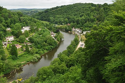
Directions to Symonds Yat East (Herefordshire, County Of) with public transport
The following transport lines have routes that pass near Symonds Yat East
How to get to Symonds Yat East by bus?
Click on the bus route to see step by step directions with maps, line arrival times and updated time schedules.
Bus stations near Symonds Yat East in Herefordshire, County Of
- Car Park Entrance, Symonds Yat Rock,19 min walk,
Bus lines to Symonds Yat East in Herefordshire, County Of
- 708,Coleford,
What are the nearest stations to Symonds Yat East?
The nearest stations to Symonds Yat East are:
- Car Park Entrance, Symonds Yat Rock is 1435 meters away, 19 min walk.
Which bus line stops near Symonds Yat East?
35
See Symonds Yat East, Herefordshire, County Of, on the map
Public Transit to Symonds Yat East in Herefordshire, County Of
Wondering how to get to Symonds Yat East in Herefordshire, County Of, United Kingdom? Moovit helps you find the best way to get to Symonds Yat East with step-by-step directions from the nearest public transit station.
Moovit provides free maps and live directions to help you navigate through your city. View schedules, routes, timetables, and find out how long does it take to get to Symonds Yat East in real time.
Looking for the nearest stop or station to Symonds Yat East? Check out this list of stops closest to your destination: Car Park Entrance.
Bus:35708
Want to see if there’s another route that gets you there at an earlier time? Moovit helps you find alternative routes or times. Get directions from and directions to Symonds Yat East easily from the Moovit App or Website.
We make riding to Symonds Yat East easy, which is why over 1.5 million users, including users in Herefordshire, County Of, trust Moovit as the best app for public transit. You don’t need to download an individual bus app or train app, Moovit is your all-in-one transit app that helps you find the best bus time or train time available.
For information on prices of bus, costs and ride fares to Symonds Yat East, please check the Moovit app.
Use the app to navigate to popular places including to the airport, hospital, stadium, grocery store, mall, coffee shop, school, college, and university.
Symonds Yat East Address: Symonds Yat Ross-on-Wye street in Herefordshire, County Of
Attractions near Symonds Yat East
The Royal Lodge (The Royal Hotel Symonds Yat),Hr9 6jl,Symonds Yat,Gl16 7nz,English Bicknor Tuesday Club,Octeapus,John Cole Farm Services,Richard Jackson Plumbing and Heating,Saltbox Escapes,The New Inn,Eastbach Court,Braceland,Julie & Mark Taylor Forever Living Products,Bracelands Campsite,Forest Holidays,Gl16 7nn,the dog and muffler inn,Welsh Bicknor,Bracelands Adventure Centre,Cabin 111How to get to popular attractions in Herefordshire, County Of with public transportation
Southampton Common, Southampton,Bath Bus Station, Bath And North East Somerset,St Brendan's Sixth Form College, Bristol, City Of,Sony Europe, Basingstoke And Deane,Trowbridge Railway Station (TRO), Wiltshire,Sandbanks Beach, Poole,Bristol Parkway Railway Station (BPW), South Gloucestershire,Kingsway Village, Gloucester,Odeon, Bath And North East Somerset,Gloucester Docks, Gloucester,The Kings Head Inn (Wetherspoon), Wiltshire,GE Aviation Systems, Tewkesbury,Tiverton Parkway Railway Station (TVP), Mid Devon,Bristol Temple Meads Railway Station (BRI) (TPB), Bristol, City Of,Wightlink Ferry Terminal (Car Ferry), Portsmouth,Swindon Bus Station, Swindon,Tesco, Poole,Weston-super-Mare Seafront, North Somerset,Lloyds Bank, Bristol, City Of,Truro Railway Station (TRU), CornwallGet around Herefordshire, County Of by public transport!
Travelling around Herefordshire, County Of has never been so easy. See step by step directions as you travel to any attraction, street or major public transport station. View bus and train timetables, arrival times, service alerts and detailed routes on a map, so you know exactly how to get to anywhere in Herefordshire, County Of.
When travelling to any destination around Herefordshire, County Of use Moovit's Live Directions with Get Off Notifications to know exactly where and how far to walk, how long to wait for your line , and how many stops are left. Moovit will alert you when it’s time to get off — no need to constantly re-check whether yours is the next stop.
Wondering how to use public transport in Herefordshire, County Of or how to pay for public transport in Herefordshire, County Of? Moovit public transport app can help you navigate your way with public transport easily, and at minimum cost. It includes public transport fees, ticket prices, and costs. Looking for a map of Herefordshire, County Of public transport lines? Moovit public transport app shows all public transport maps in Herefordshire, County Of with all bus routes and stops on an interactive map.
Herefordshire, County Of has 1 transport type(s), including: bus, operated by several transport agencies, including National Rail, Stagecoach South, Padstow Harbour Commissioners, Royal Buses, Tavistock Community Transport, River Link, Beaminster Town Council, Yeos Contracts, MD Coaches, Newport Bus, First Bristol, Bath & the West, First Kernow, St Mawes Ferry, First Wessex, Dorset & South Somerset and Isles of Scilly Steamship Co