See Tarban Creek Bridge, Hunters Hill, on the map
Directions to Tarban Creek Bridge (Hunters Hill) with public transport
The following transport lines have routes that pass near Tarban Creek Bridge
 Bus:
Bus: - Ferry:
How to get to Tarban Creek Bridge by bus?
Click on the bus route to see step by step directions with maps, line arrival times and updated time schedules.
Bus stations near Tarban Creek Bridge in Hunters Hill
- Burns Bay Rd at Church St,2 min walk,
- Burns Bay Rd at Gladesville Rd,3 min walk,
- Gladesville Rd before Joubert St North,3 min walk,
- Gladesville Rd at Howard Pl,3 min walk,
- C A Fairland Hall, Church St,4 min walk,
- Church St opp C A Fairland Hall,5 min walk,
- Hunters Hill High School, The Avenue,6 min walk,
Ferry stations near Tarban Creek Bridge in Hunters Hill
- Drummoyne Wharf,14 min walk,
- Hunters Hill Wharf,51 min walk,
Bus lines to Tarban Creek Bridge in Hunters Hill
- 252,Gladesville,
- 530,Parramatta Rd Nr Rosebank College,
- 536,Riverside Girls HS,
- 681W,Ryde,
- 692W,St. Ignatius Senior,
- 693W,Hunters Hill,
- 598S,Hunters Hill High,
- 506,Macquarie University to City Domain via East Ryde,
- 538,Gladesville to Woolwich,
- 564S,Ryde Depot to Newington College,
- 576W,West Ryde Station to Marist Sisters, Woolwich,
- 577W,Meadowbank Station to Marist Sisters, Woolwich,
- 582W,Lane Cove Rd & Lorna Ave to Marist Sisters, Woolwich,
- 584W,Wicks & Twin Rds to Marist Sisters, Woolwich,
- 585W,Quarry & Lane Cove Rds to Marist Sisters, Woolwich,
- 586W,Eastwood Station to Marist Sisters, Woolwich,
- 588W,Balaclava & Blaxland Rd,Eastwood to Marist Sisters, Woolwich,
- 704W,Ryde Depot to Marist Sisters, Woolwich,
- 723W,Villa Maria Primary to Woolwich Wharf,
- 795W,Church St & Morrison Rd, Putney to Hunters Hill Shops,
What are the nearest stations to Tarban Creek Bridge?
The nearest stations to Tarban Creek Bridge are:
- Burns Bay Rd at Church St is 105 meters away, 2 min walk.
- Burns Bay Rd at Gladesville Rd is 173 meters away, 3 min walk.
- Gladesville Rd before Joubert St North is 177 meters away, 3 min walk.
- Gladesville Rd at Howard Pl is 204 meters away, 3 min walk.
- C A Fairland Hall, Church St is 242 meters away, 4 min walk.
- Church St opp C A Fairland Hall is 277 meters away, 5 min walk.
- Hunters Hill High School, The Avenue is 408 meters away, 6 min walk.
- Drummoyne Wharf is 1033 meters away, 14 min walk.
- Hunters Hill Wharf is 3947 meters away, 51 min walk.
Which bus lines stop near Tarban Creek Bridge?
These bus lines stop near Tarban Creek Bridge: 252, 506, 530.
What’s the nearest bus stop to Tarban Creek Bridge in Hunters Hill?
The nearest bus stop to Tarban Creek Bridge in Hunters Hill is Burns Bay Rd at Church St. It’s a 2 min walk away.
What’s the nearest ferry station to Tarban Creek Bridge in Hunters Hill?
The nearest ferry station to Tarban Creek Bridge in Hunters Hill is Drummoyne Wharf. It’s a 14 min walk away.
What time is the first bus to Tarban Creek Bridge in Hunters Hill?
The 252 is the first bus that goes to Tarban Creek Bridge in Hunters Hill. It stops nearby at 06:53.
What time is the last bus to Tarban Creek Bridge in Hunters Hill?
The 252 is the last bus that goes to Tarban Creek Bridge in Hunters Hill. It stops nearby at 00:16.
What time is the first ferry to Tarban Creek Bridge in Hunters Hill?
The F3 is the first ferry that goes to Tarban Creek Bridge in Hunters Hill. It stops nearby at 07:32.
What time is the last ferry to Tarban Creek Bridge in Hunters Hill?
The F3 is the last ferry that goes to Tarban Creek Bridge in Hunters Hill. It stops nearby at 22:10.
How much is the train fare to Tarban Creek Bridge?
The train fare to Tarban Creek Bridge costs about $2.80 - $7.65.
How much is the bus fare to Tarban Creek Bridge?
The bus fare to Tarban Creek Bridge costs about $2.24 - $5.33.
See Tarban Creek Bridge, Hunters Hill, on the map
Public Transit to Tarban Creek Bridge in Hunters Hill
Wondering how to get to Tarban Creek Bridge in Hunters Hill, Australia? Moovit helps you find the best way to get to Tarban Creek Bridge with step-by-step directions from the nearest public transit station.
Moovit provides free maps and live directions to help you navigate through your city. View schedules, routes, timetables, and find out how long does it take to get to Tarban Creek Bridge in real time.
Looking for the nearest stop or station to Tarban Creek Bridge? Check out this list of stops closest to your destination: Burns Bay Rd at Church St; Burns Bay Rd at Gladesville Rd; Gladesville Rd before Joubert St North; Gladesville Rd at Howard Pl; C A Fairland Hall; Church St opp C A Fairland Hall; Hunters Hill High School; Drummoyne Wharf; Hunters Hill Wharf.
Bus:Ferry:
Want to see if there’s another route that gets you there at an earlier time? Moovit helps you find alternative routes or times. Get directions from and directions to Tarban Creek Bridge easily from the Moovit App or Website.
We make riding to Tarban Creek Bridge easy, which is why over 1.5 million users, including users in Hunters Hill, trust Moovit as the best app for public transit. You don’t need to download an individual bus app or train app, Moovit is your all-in-one transit app that helps you find the best bus time or train time available.
For information on prices of bus and train, costs and ride fares to Tarban Creek Bridge, please check the Moovit app.
Use the app to navigate to popular places including to the airport, hospital, stadium, grocery store, mall, coffee shop, school, college, and university.
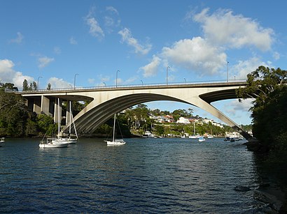
Tarban Creek Bridge Address: Burns Bay Rd street in Hunters Hill
Attractions near Tarban Creek Bridge
Burns Bay Rd Off Ramp East Side,Hunters Hill,Hunters Hill Overpass,Hunters Hill Hotel,Hunters Hill Hotel,Hunters Hill Dermatology-Specialist Skin Cancer &,Maison Residences Hunters Hill,Hunter's Hill Village,Movies4u,BENTLEY Estate Agency,Fox Badger Ferret,Basil's,Figtree Newsagency,Concord Dry Cleaners,Fig Tree Bridge,John Ward Prestige Realty,Hunters Hill High School,Grand View Chinese Restaurant,Fig Tree House,St Mary Mackillop Care(NSW)How to get to popular attractions in Hunters Hill with public transportation
Westfield Mt Druitt, Mount Druitt,Wynyard, Sydney,Bronte Beach, Bronte,Homebush Station, Homebush (NSW),Broadway Shopping Centre, Glebe (NSW),Munich Brauhaus, The Rocks (Sydney - NSW),Forestway, Frenchs Forest,Chatswood Station (Main Concourse), Chatswood,The Grounds of Alexandria, Alexandria,Ms. G's, Potts Point,Toongabbie Station, Toongabbie (NSW),St Marys Station, St Marys (NSW),North Ryde Station, North Ryde,Parramatta, Parramatta,Coogee, Coogee (NSW),Pontoon Bar, Sydney,Turramurra Station, Turramurra,The Orient Hotel, The Rocks (Sydney - NSW),Westfield Warringah Mall, Brookvale,Holiday Inn, Potts PointGet around Hunters Hill by public transport!
Travelling around Hunters Hill has never been so easy. See step by step directions as you travel to any attraction, street or major public transport station. View bus and train timetables, arrival times, service alerts and detailed routes on a map, so you know exactly how to get to anywhere in Hunters Hill.
When travelling to any destination around Hunters Hill use Moovit's Live Directions with Get Off Notifications to know exactly where and how far to walk, how long to wait for your line , and how many stops are left. Moovit will alert you when it’s time to get off — no need to constantly re-check whether yours is the next stop.
Wondering how to use public transport in Hunters Hill or how to pay for public transport in Hunters Hill? Moovit public transport app can help you navigate your way with public transport easily, and at minimum cost. It includes public transport fees, ticket prices, and costs. Looking for a map of Hunters Hill public transport lines? Moovit public transport app shows all public transport maps in Hunters Hill with all bus or train routes and stops on an interactive map.
Hunters Hill has 2 transport type(s), including: bus or train, operated by several transport agencies, including Sydney Metro, Sydney Trains, Sydney Light Rail, Sydney Ferries, Intercity Trains, Intercity Train, NSW TrainLink, CDC NSW R14, U-Go Mobility, Keolis Downer Northern Beaches, Manly Fast Ferry, Transdev John Holland Buses, Busways, Busways North West and Dysons Buslines