See The King's School, Grantham, South Kesteven, on the map
Directions to The King's School, Grantham (South Kesteven) with public transport
The following transport lines have routes that pass near The King's School, Grantham
 Bus:
Bus: - Train:
How to get to The King's School, Grantham by bus?
Click on the bus route to see step by step directions with maps, line arrival times and updated time schedules.
Bus stations near The King's School, Grantham in South Kesteven
- The King's School, Grantham,2 min walk,
- Finkin Street, Grantham,4 min walk,
- Boots, Grantham,4 min walk,
- Wyndham Park School, Grantham,8 min walk,
Train stations near The King's School, Grantham in South Kesteven
- Grantham,10 min walk,
Bus lines to The King's School, Grantham in South Kesteven
- G,Grantham - Great Gonerby,
- 1,Lincoln - Grantham,
- 1A|GRANTHAM INTO TOWN,Grantham - Alma Park - Sunningdale,
- 1B|GRANTHAM INTO TOWN,Grantham - Alma Park,
- M4,Grantham - Moy Park,
- 22,Grantham - Coddington,
- 22A,Balderton - Grantham,
- 22B,Winthorpe - Grantham,
- X22,Sutton On Trent - Grantham,
- 23,Farndon - Grantham,
- 27,Sleaford - Grantham,
- 55,Melton Mowbray - Grantham,
- S156S,Sleaford - Grantham,
- 8,Melton Mowbray,
- 28,Colsterworth,
- 24,Great Gonerby,
- GS1,Hickling - Grantham,
- GS2,Colston Bassett - Grantham,
- GS3,Radcliffe On Trent - Grantham,
- GS4,East Bridgford - Grantham,
What are the nearest stations to The King's School, Grantham?
The nearest stations to The King's School, Grantham are:
- The King's School, Grantham is 73 meters away, 2 min walk.
- Finkin Street, Grantham is 241 meters away, 4 min walk.
- Boots, Grantham is 266 meters away, 4 min walk.
- Wyndham Park School, Grantham is 592 meters away, 8 min walk.
- Grantham is 703 meters away, 10 min walk.
Which bus lines stop near The King's School, Grantham?
These bus lines stop near The King's School, Grantham: 1G, 1K, 27.
What’s the nearest train station to The King's School, Grantham in South Kesteven?
The nearest train station to The King's School, Grantham in South Kesteven is Grantham. It’s a 10 min walk away.
What’s the nearest bus stop to The King's School, Grantham in South Kesteven?
The nearest bus stop to The King's School, Grantham in South Kesteven is The King's School, Grantham. It’s a 2 min walk away.
See The King's School, Grantham, South Kesteven, on the map
Public Transit to The King's School, Grantham in South Kesteven
Wondering how to get to The King's School, Grantham in South Kesteven, United Kingdom? Moovit helps you find the best way to get to The King's School, Grantham with step-by-step directions from the nearest public transit station.
Moovit provides free maps and live directions to help you navigate through your city. View schedules, routes, timetables, and find out how long does it take to get to The King's School, Grantham in real time.
Looking for the nearest stop or station to The King's School, Grantham? Check out this list of stops closest to your destination: The King's School; Finkin Street; Boots; Wyndham Park School; Grantham.
Bus:Train:
Want to see if there’s another route that gets you there at an earlier time? Moovit helps you find alternative routes or times. Get directions from and directions to The King's School, Grantham easily from the Moovit App or Website.
We make riding to The King's School, Grantham easy, which is why over 1.5 million users, including users in South Kesteven, trust Moovit as the best app for public transit. You don’t need to download an individual bus app or train app, Moovit is your all-in-one transit app that helps you find the best bus time or train time available.
For information on prices of bus, costs and ride fares to The King's School, Grantham, please check the Moovit app.
Use the app to navigate to popular places including to the airport, hospital, stadium, grocery store, mall, coffee shop, school, college, and university.
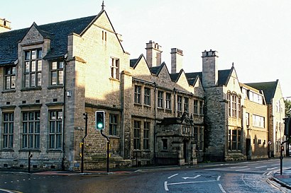
The King's School, Grantham Address: Brook Street street in South Kesteven
Attractions near The King's School, Grantham
The Kings School,The Kings School, Grantham,St Wulframs Church Coffee Shop,Grantham The King s School,NVSZ Limited,Sylvia Beauty S House,MR Ian Fraser,Johnson, MR Christopher,Walden Building Services,Brown & Co,Unior International,Huffey Group,Van with Man,J Adore Group,The Range Store,Quick Bite-Grantham,Ampm Exterior Property Services,G H Linnell Limited,Escene It,LjaleisureHow to get to popular attractions in South Kesteven with public transportation
Holiday Inn Express Peterborough, Peterborough,Fosse Shopping Park, Blaby,YBS Group - Lynch Wood, Peterborough,British Gas Museum, Leicester,The Samuel Hall (Wetherspoon), Nottingham,Matalan, Corby,University Of Derby, Derby,Kingsway Hospital, Derby,Wyberton, Boston,The Castlewood (Brewers Fayre), Bolsover,Peterborough Marriott Hotel, Peterborough,Lakeside Arts Centre, Nottingham,Ikea, Broxtowe,Nuffield Health Nottingham Fitness & Wellbeing Gym, Gedling,Sutton-In-Ashfield, Ashfield,Morrisons Distribution Centre, Northampton,Tottle Bakery, Nottingham,Nettleham, West Lindsey,Burton Latimer, Kettering,Ideal World Studios, PeterboroughGet around South Kesteven by public transport!
Travelling around South Kesteven has never been so easy. See step by step directions as you travel to any attraction, street or major public transport station. View bus and train timetables, arrival times, service alerts and detailed routes on a map, so you know exactly how to get to anywhere in South Kesteven.
When travelling to any destination around South Kesteven use Moovit's Live Directions with Get Off Notifications to know exactly where and how far to walk, how long to wait for your line , and how many stops are left. Moovit will alert you when it’s time to get off — no need to constantly re-check whether yours is the next stop.
Wondering how to use public transport in South Kesteven or how to pay for public transport in South Kesteven? Moovit public transport app can help you navigate your way with public transport easily, and at minimum cost. It includes public transport fees, ticket prices, and costs. Looking for a map of South Kesteven public transport lines? Moovit public transport app shows all public transport maps in South Kesteven with all bus routes and stops on an interactive map.
South Kesteven has 1 transport type(s), including: bus, operated by several transport agencies, including National Rail, Ashbourne Community Transport, Delaine Buses, Arriva Midlands, Centrebus, Our Centre, Hulleys of Baslow, D & G Bus, Stagecoach East Midlands, North Lincolnshire Council, National Rail, Roberts Coaches, Lawson's of Corby, Hawkes Coaches and East Yorkshire