See The Marsden Grotto, South Tyneside, on the map
Directions to The Marsden Grotto (South Tyneside) with public transport
The following transport lines have routes that pass near The Marsden Grotto
 Bus:
Bus: - Underground:
How to get to The Marsden Grotto by bus?
Click on the bus route to see step by step directions with maps, line arrival times and updated time schedules.
Bus stations near The Marsden Grotto in South Tyneside
- Coast Road - Marsden Grotto, Marsden,2 min walk,
- Lizard Lane-Grotto Road, Marsden,6 min walk,
- Lizard Lane-Lake Avenue, Marsden,7 min walk,
- Coast Road-Redwell Lane, Marsden,7 min walk,
- Prince Edward Road East - Lizard Lane, Marsden,10 min walk,
- Marsden Lane - Prince Edward Road East, Marsden,10 min walk,
Underground stations near The Marsden Grotto in South Tyneside
- Chichester,53 min walk,
Bus lines to The Marsden Grotto in South Tyneside
- E1,South Shields,
- 826,Marsden,
- E2,South Shields,
- E6,South Shields,
- E6,Sunderland,
- 516,South Shields,
- 50,Marsden,
- 7,Marsden,
- 8,South Shields,
- 10,Low Simonside,
- X34,Harton Nook,
- 575,Bede,
- 960,Barmston,
What are the nearest stations to The Marsden Grotto?
The nearest stations to The Marsden Grotto are:
- Coast Road - Marsden Grotto, Marsden is 121 meters away, 2 min walk.
- Lizard Lane-Grotto Road, Marsden is 397 meters away, 6 min walk.
- Lizard Lane-Lake Avenue, Marsden is 500 meters away, 7 min walk.
- Coast Road-Redwell Lane, Marsden is 521 meters away, 7 min walk.
- Prince Edward Road East - Lizard Lane, Marsden is 712 meters away, 10 min walk.
- Marsden Lane - Prince Edward Road East, Marsden is 713 meters away, 10 min walk.
- Chichester is 4128 meters away, 53 min walk.
Which bus lines stop near The Marsden Grotto?
These bus lines stop near The Marsden Grotto: 11, 516, E1, E2, E6.
What’s the nearest bus stop to The Marsden Grotto in South Tyneside?
The nearest bus stop to The Marsden Grotto in South Tyneside is Coast Road - Marsden Grotto, Marsden. It’s a 2 min walk away.
What time is the first underground to The Marsden Grotto in South Tyneside?
The YEL is the first underground that goes to The Marsden Grotto in South Tyneside. It stops nearby at 05:33.
What time is the last underground to The Marsden Grotto in South Tyneside?
The YEL is the last underground that goes to The Marsden Grotto in South Tyneside. It stops nearby at 00:00.
What time is the first bus to The Marsden Grotto in South Tyneside?
The 8 is the first bus that goes to The Marsden Grotto in South Tyneside. It stops nearby at 05:46.
What time is the last bus to The Marsden Grotto in South Tyneside?
The 826 is the last bus that goes to The Marsden Grotto in South Tyneside. It stops nearby at 15:32.
See The Marsden Grotto, South Tyneside, on the map
Public Transit to The Marsden Grotto in South Tyneside
Wondering how to get to The Marsden Grotto in South Tyneside, United Kingdom? Moovit helps you find the best way to get to The Marsden Grotto with step-by-step directions from the nearest public transit station.
Moovit provides free maps and live directions to help you navigate through your city. View schedules, routes, timetables, and find out how long does it take to get to The Marsden Grotto in real time.
Looking for the nearest stop or station to The Marsden Grotto? Check out this list of stops closest to your destination: Coast Road - Marsden Grotto; Lizard Lane-Grotto Road; Lizard Lane-Lake Avenue; Coast Road-Redwell Lane; Prince Edward Road East - Lizard Lane; Marsden Lane - Prince Edward Road East; Chichester.
Bus:Underground:
Want to see if there’s another route that gets you there at an earlier time? Moovit helps you find alternative routes or times. Get directions from and directions to The Marsden Grotto easily from the Moovit App or Website.
We make riding to The Marsden Grotto easy, which is why over 1.5 million users, including users in South Tyneside, trust Moovit as the best app for public transit. You don’t need to download an individual bus app or train app, Moovit is your all-in-one transit app that helps you find the best bus time or train time available.
For information on prices of bus, underground and ferry, costs and ride fares to The Marsden Grotto, please check the Moovit app.
Use the app to navigate to popular places including to the airport, hospital, stadium, grocery store, mall, coffee shop, school, college, and university.
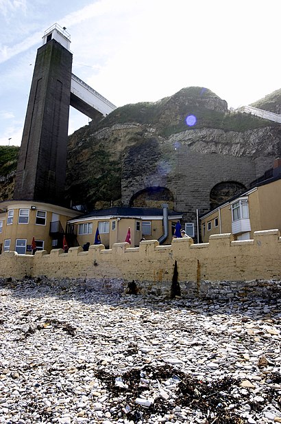
The Marsden Grotto Address: Coast Road street in South Tyneside
Attractions near The Marsden Grotto
Marsden Grotto,Marsden Rock,Lizard Lane Caravan Park,Lizard Lane,Marsden Beach,Quarry Lane,Ne34 7aw,Minchella & Co,Marsden Chinese,Marsden Inn,Marsden Old Quarry Local Nature Reserve,The White Horse,Whitburn Golf Club,Velvet Beds Island (Camel Island),KLR Plumbing Heating and Gas Services,Cleadon Social Club,The Cleadon Club,Fulwell Avenue (marsden fulwell avenue),Hillhead tearooms & farm shop,Renovations North EastHow to get to popular attractions in South Tyneside with public transportation
Tesco, North Tyneside,Birtley High Street, Gateshead,Fulwell, Sunderland,Arthurs Hill, Newcastle Upon Tyne,Durham Cathedral, County Durham,Amble, Northumberland,Ryhope, Sunderland,Whitley Bay, North Tyneside,Teesside University Centuria Building, Middlesbrough,Pamir Halal Meat, Newcastle Upon Tyne,Penshaw, Sunderland,Castlegate Shopping Centre, Stockton-On-Tees,Ashington, Northumberland,Newcastle upon Tyne, Newcastle Upon Tyne,Blackfriars Restaurant, Newcastle Upon Tyne,Tantobie, County Durham,Easington Colliery, County Durham,Alnwick Castle, Northumberland,Al Qasimi Building, County Durham,Faverdale Industrial Estate, DarlingtonGet around South Tyneside by public transport!
Travelling around South Tyneside has never been so easy. See step by step directions as you travel to any attraction, street or major public transport station. View bus and train timetables, arrival times, service alerts and detailed routes on a map, so you know exactly how to get to anywhere in South Tyneside.
When travelling to any destination around South Tyneside use Moovit's Live Directions with Get Off Notifications to know exactly where and how far to walk, how long to wait for your line , and how many stops are left. Moovit will alert you when it’s time to get off — no need to constantly re-check whether yours is the next stop.
Wondering how to use public transport in South Tyneside or how to pay for public transport in South Tyneside? Moovit public transport app can help you navigate your way with public transport easily, and at minimum cost. It includes public transport fees, ticket prices, and costs. Looking for a map of South Tyneside public transport lines? Moovit public transport app shows all public transport maps in South Tyneside with all bus, underground or ferry routes and stops on an interactive map.
South Tyneside has 3 transport type(s), including: bus, underground or ferry, operated by several transport agencies, including Go North East, Stagecoach North East, Stagecoach Cumbria and North Lancashire, Arriva North East, Gateshead Central Taxis, JH Coaches, Weardale Motor Services, Stanley Travel, Cumbria Classic Coaches, Peter Hogg of Jedburgh, Generation Travel, Hodgsons, Tyne and Wear Metro, Ferryhill Village Travel and A-line Coaches