See The State Hospital, Lampits Road Lanark Lanark ML11 8, South Lanarkshire, on the map
Directions to The State Hospital, Lampits Road Lanark Lanark ML11 8 (South Lanarkshire) with public transport
The following transport lines have routes that pass near The State Hospital, Lampits Road Lanark Lanark ML11 8
 Bus:
Bus: - Train:
How to get to The State Hospital, Lampits Road Lanark Lanark ML11 8 by bus?
Click on the bus route to see step by step directions with maps, line arrival times and updated time schedules.
How to get to The State Hospital, Lampits Road Lanark Lanark ML11 8 by train?
Click on the train route to see step by step directions with maps, line arrival times and updated time schedules.
Train stations near The State Hospital, Lampits Road Lanark Lanark ML11 8 in South Lanarkshire
- Carstairs,29 min walk,
Bus stations near The State Hospital, Lampits Road Lanark Lanark ML11 8 in South Lanarkshire
- Biggar Road, Carnwath,31 min walk,
Bus lines to The State Hospital, Lampits Road Lanark Lanark ML11 8 in South Lanarkshire
- 37,Lanark,
- 137,Stobwood,
What are the nearest stations to The State Hospital, Lampits Road Lanark Lanark ML11 8?
The nearest stations to The State Hospital, Lampits Road Lanark Lanark ML11 8 are:
- Carstairs is 2193 meters away, 29 min walk.
- Biggar Road, Carnwath is 2350 meters away, 31 min walk.
Which bus line stops near The State Hospital, Lampits Road Lanark Lanark ML11 8?
37
Which train line stops near The State Hospital, Lampits Road Lanark Lanark ML11 8?
SCOTRAIL
What’s the nearest train station to The State Hospital, Lampits Road Lanark Lanark ML11 8 in South Lanarkshire?
The nearest train station to The State Hospital, Lampits Road Lanark Lanark ML11 8 in South Lanarkshire is Carstairs. It’s a 29 min walk away.
See The State Hospital, Lampits Road Lanark Lanark ML11 8, South Lanarkshire, on the map
Public Transit to The State Hospital, Lampits Road Lanark Lanark ML11 8 in South Lanarkshire
Wondering how to get to The State Hospital, Lampits Road Lanark Lanark ML11 8 in South Lanarkshire, United Kingdom? Moovit helps you find the best way to get to The State Hospital, Lampits Road Lanark Lanark ML11 8 with step-by-step directions from the nearest public transit station.
Moovit provides free maps and live directions to help you navigate through your city. View schedules, routes, timetables, and find out how long does it take to get to The State Hospital, Lampits Road Lanark Lanark ML11 8 in real time.
Looking for the nearest stop or station to The State Hospital, Lampits Road Lanark Lanark ML11 8? Check out this list of stops closest to your destination: Carstairs; Biggar Road.
Bus:Train:
Want to see if there’s another route that gets you there at an earlier time? Moovit helps you find alternative routes or times. Get directions from and directions to The State Hospital, Lampits Road Lanark Lanark ML11 8 easily from the Moovit App or Website.
We make riding to The State Hospital, Lampits Road Lanark Lanark ML11 8 easy, which is why over 1.5 million users, including users in South Lanarkshire, trust Moovit as the best app for public transit. You don’t need to download an individual bus app or train app, Moovit is your all-in-one transit app that helps you find the best bus time or train time available.
For information on prices of bus and train, costs and ride fares to The State Hospital, Lampits Road Lanark Lanark ML11 8, please check the Moovit app.
Use the app to navigate to popular places including to the airport, hospital, stadium, grocery store, mall, coffee shop, school, college, and university.
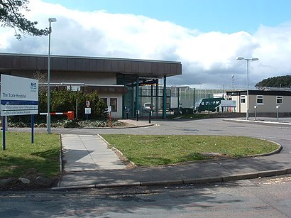
The State Hospital, Lampits Road Lanark Lanark ML11 8 Address: Lampits Road Lanark Lanark ML11 8 street in South Lanarkshire
Attractions near The State Hospital, Lampits Road Lanark Lanark ML11 8
Scotland State Hospital,State Hospital, Carstairs Junction,CARSTAIRS STATE HOSPITAL,State Hospital Carstairs The,Ml11 8rp,Carstairs State Hospital,Balmoral Crescent, Carstairs,Westend Mini Market,Ml11 8rr,Ml11 8fb,Tinto Drive, Carstairs Junction,Ml11 8rw,West End Carnwath,Ml11 8ry,Westend Satellite & Aerial Services,Ml11 8rs,5 Tinto Drive,Jappacakes,Ml11 8rx,Ml11 8rtHow to get to popular attractions in South Lanarkshire with public transportation
Glasgow Central Railway Station (GLC), Glasgow,Partick Railway Station (PTK), Glasgow,St Andrews University Library, St Andrews,The Queens Arms, Edinburgh,River Clyde, Glasgow City,Hyndland Railway Station (HYN), Glasgow,North Berwick, North Berwick,Kilmarnock Bus Station, Kilmarnock,Tesco Extra, Edinburgh,Fir Park Stadium, Motherwell,Thornliebank, Thornliebank,New Gorbals, Glasgow,The Counting House (Wetherspoon), Dundee,Virgin Active, Glasgow,Aberdeen International Airport (ABZ), Dyce,Forth Bridge,Drumgelloch Railway Station (DRU), Airdrie,The Alexander Graham Bell (Wetherspoon), Edinburgh,IKEA, Loanhead,Saughton House, EdinburghGet around South Lanarkshire by public transport!
Travelling around South Lanarkshire has never been so easy. See step by step directions as you travel to any attraction, street or major public transport station. View bus and train timetables, arrival times, service alerts and detailed routes on a map, so you know exactly how to get to anywhere in South Lanarkshire.
When travelling to any destination around South Lanarkshire use Moovit's Live Directions with Get Off Notifications to know exactly where and how far to walk, how long to wait for your line , and how many stops are left. Moovit will alert you when it’s time to get off — no need to constantly re-check whether yours is the next stop.
Wondering how to use public transport in South Lanarkshire or how to pay for public transport in South Lanarkshire? Moovit public transport app can help you navigate your way with public transport easily, and at minimum cost. It includes public transport fees, ticket prices, and costs. Looking for a map of South Lanarkshire public transport lines? Moovit public transport app shows all public transport maps in South Lanarkshire with all bus or train routes and stops on an interactive map.
South Lanarkshire has 2 transport type(s), including: bus or train, operated by several transport agencies, including First Greater Glasgow, First Aberdeen, Lothian Buses, McGill's Bus Service, Stagecoach East Scotland, Stagecoach Bluebird, Xplore Dundee, Community Transport Glasgow, Prentice Westwood, McCall's Coaches, J P Minibus, National Rail, R Robertson & Son, Burnbrae Garage and Ember