See The Tower House, Knightsbridge, on the map
Directions to The Tower House (Knightsbridge) with public transport
The following transport lines have routes that pass near The Tower House
 Bus:
Bus: - Train:
- Tube:
- River Bus:
How to get to The Tower House by bus?
Click on the bus route to see step by step directions with maps, line arrival times and updated time schedules.
How to get to The Tower House by train?
Click on the train route to see step by step directions with maps, line arrival times and updated time schedules.
How to get to The Tower House by Tube?
Click on the Tube route to see step by step directions with maps, line arrival times and updated time schedules.
Bus stations near The Tower House in Knightsbridge
- Brompton Square (KW),3 min walk,
- Walpole Street (KA),9 min walk,
- Onslow Square (HV),9 min walk,
Tube stations near The Tower House in Knightsbridge
- Knightsbridge,6 min walk,
- South Kensington,8 min walk,
River Bus stations near The Tower House in Knightsbridge
- Cadogan Pier,10 min walk,
Bus lines to The Tower House in Knightsbridge
- C1,White City,
- 14,Russell Square,
- 74,Putney, High Street,
- N74,Baker Street Station,
- N97,Trafalgar Square,
- 414,Marble Arch,
- 11,Fulham Broadway,
- N11,Ealing Broadway,
- 22,Putney Common,
- N22,Fulwell,
- 211,Battersea Power Station,
- 319,Sloane Square,
- 345,Peckham,
What are the nearest stations to The Tower House?
The nearest stations to The Tower House are:
- Brompton Square (KW) is 178 meters away, 3 min walk.
- Knightsbridge is 418 meters away, 6 min walk.
- South Kensington is 599 meters away, 8 min walk.
- Walpole Street (KA) is 612 meters away, 9 min walk.
- Onslow Square (HV) is 631 meters away, 9 min walk.
- Cadogan Pier is 736 meters away, 10 min walk.
Which bus lines stop near The Tower House?
These bus lines stop near The Tower House: 14, 19, 360, 49, 74, C1.
Which train lines stop near The Tower House?
These train lines stop near The Tower House: CHILTERN RAILWAYS, ELIZABETH, OVERGROUND, SOUTHERN.
Which Tube lines stop near The Tower House?
These Tube lines stop near The Tower House: CIRCLE, DISTRICT, PICCADILLY.
What’s the nearest Tube station to The Tower House in Knightsbridge?
The nearest Tube station to The Tower House in Knightsbridge is Knightsbridge. It’s a 6 min walk away.
What’s the nearest bus stop to The Tower House in Knightsbridge?
The nearest bus stop to The Tower House in Knightsbridge is Brompton Square (KW). It’s a 3 min walk away.
What’s the nearest River Bus station to The Tower House in Knightsbridge?
The nearest River Bus station to The Tower House in Knightsbridge is Cadogan Pier. It’s a 10 min walk away.
What time is the first Tube to The Tower House in Knightsbridge?
The DISTRICT is the first Tube that goes to The Tower House in Knightsbridge. It stops nearby at 05:16.
What time is the last Tube to The Tower House in Knightsbridge?
The DISTRICT is the last Tube that goes to The Tower House in Knightsbridge. It stops nearby at 00:47.
What time is the first bus to The Tower House in Knightsbridge?
The 14 is the first bus that goes to The Tower House in Knightsbridge. It stops nearby at 03:00.
What time is the last bus to The Tower House in Knightsbridge?
The N11 is the last bus that goes to The Tower House in Knightsbridge. It stops nearby at 03:24.
What time is the first River Bus to The Tower House in Knightsbridge?
The RB6 is the first River Bus that goes to The Tower House in Knightsbridge. It stops nearby at 06:55.
What time is the last River Bus to The Tower House in Knightsbridge?
The RB6 is the last River Bus that goes to The Tower House in Knightsbridge. It stops nearby at 21:49.
See The Tower House, Knightsbridge, on the map
Public Transit to The Tower House in Knightsbridge
Wondering how to get to The Tower House in Knightsbridge, United Kingdom? Moovit helps you find the best way to get to The Tower House with step-by-step directions from the nearest public transit station.
Moovit provides free maps and live directions to help you navigate through your city. View schedules, routes, timetables, and find out how long does it take to get to The Tower House in real time.
Looking for the nearest stop or station to The Tower House? Check out this list of stops closest to your destination: Brompton Square (KW); Knightsbridge; South Kensington; Walpole Street (KA); Onslow Square (HV); Cadogan Pier.
Bus:Train:Tube:River Bus:
Want to see if there’s another route that gets you there at an earlier time? Moovit helps you find alternative routes or times. Get directions from and directions to The Tower House easily from the Moovit App or Website.
We make riding to The Tower House easy, which is why over 1.5 million users, including users in Knightsbridge, trust Moovit as the best app for public transit. You don’t need to download an individual bus app or train app, Moovit is your all-in-one transit app that helps you find the best bus time or train time available.
For information on prices of bus, Tube and train, costs and ride fares to The Tower House, please check the Moovit app.
Use the app to navigate to popular places including to the airport, hospital, stadium, grocery store, mall, coffee shop, school, college, and university.
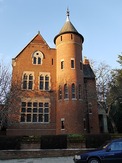
The Tower House Address: Richard's Place street in Knightsbridge
Attractions near The Tower House
Baker & Spice,Marlborough,Papillon,Katherine Pooley,Walton Street,Zefi Bar,Hari S Notting Hill,Eliot Zed,Kx Gym Health Club,Sarah Chapman Skinesis Clinic,Oriental Massage London,HTB Courtfield Gardens,SW3 3AP,London Asian Relaxing Sensual Massage,The Signature Clinic,Daphne's (Daphne's Restaurant),Daphne's,Marlborough Primary School,Golden Goose,Isabel MarantHow to get to popular attractions in Knightsbridge with public transportation
Hayes Railway Station, Hayes (Kent),Barbican Centre, City Of London,Crouch End, Crouch End,Windsor Castle, Windsor,Asda, Park Royal,University Of Brighton - Falmer Campus, Brighton And Hove,Brentwood, Brentwood,St. Michael's Mead, Bishop'S Stortford,Southall Police Station, Southall,Redbridge Roundabout, Clayhall,ESCP Europe London Campus, West Hampstead,Cricklewood, Cricklewood,Virgin Active, Wimbledon,Ferney Road, East Barnet,Westfield Stratford City, Stratford,Greenham Common, West Berkshire,The Whittington Hospital, Upper Holloway,Cassiobury Park, Watford,Putney, Putney,Romford, RomfordGet around Knightsbridge by public transport!
Travelling around Knightsbridge has never been so easy. See step by step directions as you travel to any attraction, street or major public transport station. View bus and train timetables, arrival times, service alerts and detailed routes on a map, so you know exactly how to get to anywhere in Knightsbridge.
When travelling to any destination around Knightsbridge use Moovit's Live Directions with Get Off Notifications to know exactly where and how far to walk, how long to wait for your line , and how many stops are left. Moovit will alert you when it’s time to get off — no need to constantly re-check whether yours is the next stop.
Wondering how to use public transport in Knightsbridge or how to pay for public transport in Knightsbridge? Moovit public transport app can help you navigate your way with public transport easily, and at minimum cost. It includes public transport fees, ticket prices, and costs. Looking for a map of Knightsbridge public transport lines? Moovit public transport app shows all public transport maps in Knightsbridge with all bus, Tube or train routes and stops on an interactive map.
Knightsbridge has 3 transport type(s), including: bus, Tube or train, operated by several transport agencies, including London Underground, London Buses, Transport for London, London Tramlink, Transport for London, National Rail, Bluestar, Berry's Coaches, Oxford Bus Company, Stagecoach West, Community First Wessex, Cresta Coaches, D & P Boat Hire, First Portsmouth, Fareham & Gosport and FYTbus