Directions to The Trolleybus Museum at Sandtoft (Belton) with public transport
The following transport lines have routes that pass near The Trolleybus Museum at Sandtoft
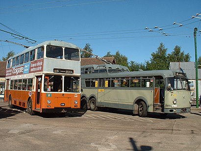
How to get to The Trolleybus Museum at Sandtoft by bus?
Click on the bus route to see step by step directions with maps, line arrival times and updated time schedules.
Bus stations near The Trolleybus Museum at Sandtoft in Belton
- Reindeer Inn,11 min walk,
Bus lines to The Trolleybus Museum at Sandtoft in Belton
- 97,Sandtoft,
What are the nearest stations to The Trolleybus Museum at Sandtoft?
The nearest stations to The Trolleybus Museum at Sandtoft are:
- Reindeer Inn is 769 meters away, 11 min walk.
Which bus line stops near The Trolleybus Museum at Sandtoft?
97
What’s the nearest bus stop to The Trolleybus Museum at Sandtoft in Belton?
The nearest bus stop to The Trolleybus Museum at Sandtoft in Belton is Reindeer Inn. It’s a 11 min walk away.
See The Trolleybus Museum at Sandtoft, Belton, on the map
Public Transit to The Trolleybus Museum at Sandtoft in Belton
Wondering how to get to The Trolleybus Museum at Sandtoft in Belton, United Kingdom? Moovit helps you find the best way to get to The Trolleybus Museum at Sandtoft with step-by-step directions from the nearest public transit station.
Moovit provides free maps and live directions to help you navigate through your city. View schedules, routes, timetables, and find out how long does it take to get to The Trolleybus Museum at Sandtoft in real time.
Looking for the nearest stop or station to The Trolleybus Museum at Sandtoft? Check out this list of stops closest to your destination: Reindeer Inn.
Bus:97
Want to see if there’s another route that gets you there at an earlier time? Moovit helps you find alternative routes or times. Get directions from and directions to The Trolleybus Museum at Sandtoft easily from the Moovit App or Website.
We make riding to The Trolleybus Museum at Sandtoft easy, which is why over 1.5 million users, including users in Belton, trust Moovit as the best app for public transit. You don’t need to download an individual bus app or train app, Moovit is your all-in-one transit app that helps you find the best bus time or train time available.
For information on prices of bus and train, costs and ride fares to The Trolleybus Museum at Sandtoft, please check the Moovit app.
Use the app to navigate to popular places including to the airport, hospital, stadium, grocery store, mall, coffee shop, school, college, and university.
Location: Belton, Yorkshire
Attractions near The Trolleybus Museum at Sandtoft
OPEL Doncaster,Sandtoft,RAF Sandtoft,Dirtness Pumping Station (Environment Agency),Smaque Farm,Belton Surgery,Life Line Screening, Belton Park Pavilion, Off High Street Belton, Doncaster,Belton North Lincolnshire England,The Old Rectory,Amazon Counter-Post Office Belton,Graham Cook CA,Gavin B,Keith Clough Estate Agents,Lay By A18,7 Lakes Country Park,Curlews Farm,DHH Fencing,HG Consulting Education Management,Classic PEUGEOT Spares,Ealand PlaygroundHow to get to popular attractions in Belton with public transportation
Pen-Y-Ghent, Halton Gill,Flamborough Head, Flamborough,Crematorium, York, Bishopthorpe,Cosmo, Sheffield,Owlerton Stadium, Sheffield,Betty's Café Tea Rooms, York,Amazon LBA1 Doncaster,Dn11 0bf, Loversall,ASDA, Sheffield,Wath upon Dearne, Rotherham,St Andrew's Quay Retail Park, Hull,Wigfield Farm, Barnsley,Shambles Market, York,Barnsley Hospital, Barnsley, Barnsley,Carleton High School, Pontefract,Kirkstall Bridge Shopping Park, Leeds,Northallerton Town Centre, Northallerton,Lion Inn, Blakey Ridge,Robin Hood's Bay, Fylingdales,Skipton Crematorium, CarletonGet around Belton by public transport!
Travelling around Belton has never been so easy. See step by step directions as you travel to any attraction, street or major public transport station. View bus and train timetables, arrival times, service alerts and detailed routes on a map, so you know exactly how to get to anywhere in Belton.
When travelling to any destination around Belton use Moovit's Live Directions with Get Off Notifications to know exactly where and how far to walk, how long to wait for your line , and how many stops are left. Moovit will alert you when it’s time to get off — no need to constantly re-check whether yours is the next stop.
Wondering how to use public transport in Belton or how to pay for public transport in Belton? Moovit public transport app can help you navigate your way with public transport easily, and at minimum cost. It includes public transport fees, ticket prices, and costs. Looking for a map of Belton public transport lines? Moovit public transport app shows all public transport maps in Belton with all bus or train routes and stops on an interactive map.
Belton has 2 transport type(s), including: bus or train, operated by several transport agencies, including First Leeds, First South Yorkshire, First York, Arriva Yorkshire, Stagecoach Yorkshire, National Rail, First Bradford, First Halifax, Calder Valley & Huddersfield, East Yorkshire, The Keighley Bus Company, South Yorkshire Future Tram, The Harrogate Bus Company, National Rail, TM Travel and Coastliner