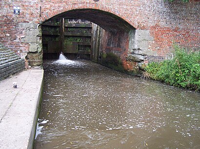
See Twyford and Stenson, South Derbyshire, on the map
Directions to Twyford and Stenson (South Derbyshire) with public transport
The following transport lines have routes that pass near Twyford and Stenson
Bus:
How to get to Twyford and Stenson by Bus?
Click on the Bus route to see step by step directions with maps, line arrival times and updated time schedules.
Bus stations near Twyford and Stenson in South Derbyshire
- Village Green, Twyford,24 min walk,
Train stations near Twyford and Stenson in South Derbyshire
- Willington,55 min walk,
Bus lines to Twyford and Stenson in South Derbyshire
- 70A,Willington,
- 219,Etwall,
- 70,Derby,
What are the nearest stations to Twyford and Stenson?
The nearest stations to Twyford and Stenson are:
- Village Green, Twyford is 1794 meters away, 24 min walk.
- Willington is 4258 meters away, 55 min walk.
Which Bus lines stop near Twyford and Stenson?
These Bus lines stop near Twyford and Stenson: 70
See Twyford and Stenson, South Derbyshire, on the map

Public Transit to Twyford and Stenson in South Derbyshire
Wondering how to get to Twyford and Stenson in South Derbyshire, United Kingdom? Moovit helps you find the best way to get to Twyford and Stenson with step-by-step directions from the nearest public transit station.
Moovit provides free maps and live directions to help you navigate through your city. View schedules, routes, timetables, and find out how long does it take to get to Twyford and Stenson in real time.
Looking for the nearest stop or station to Twyford and Stenson? Check out this list of stops closest to your destination: Village Green; Willington.
Bus:
Want to see if there’s another route that gets you there at an earlier time? Moovit helps you find alternative routes or times. Get directions from and directions to Twyford and Stenson easily from the Moovit App or Website.
We make riding to Twyford and Stenson easy, which is why over 1.5 million users, including users in South Derbyshire, trust Moovit as the best app for public transit. You don’t need to download an individual bus app or train app, Moovit is your all-in-one transit app that helps you find the best bus time or train time available.
For information on prices of Bus, costs and ride fares to Twyford and Stenson, please check the Moovit app.
Use the app to navigate to popular places including to the airport, hospital, stadium, grocery store, mall, coffee shop, school, college, and university.
Location: South Derbyshire, East Midlands

Attractions near Twyford and Stenson
- Sarah Bates School of Swimming
- The Travelling Taverna (The Traveling Taverna)
- Bubble Inn Gastro Pub
- Stenson Lock
- Stenson Lock Coffee Shop
- The Bubble Inn
- The Courtyard Hotel at the Stenson Bubble Derby
- Findern Lane
- Dan T Doherty
- Boughton Loam & Turf Management
- Wragley Way / Stenson Road
- Winchester Baking
- Rig Engineering Limited
- Midland Roadways
- Resin Driveway Installers
- Midland Hydro Therapy
- All for You
- Beaufort Bookkeeping Services
- Tickham Avenue
- Tunni Limited
How to get to popular attractions in South Derbyshire with public transportation
- Nottingham Station, Nottingham
- Western Park, Leicester
- Wyberton, Boston
- Asda, Rushcliffe
- Tottle Bakery, Nottingham
- Northampton College, Northampton
- Morrisons Distribution Centre, Northampton
- Hotel ibis Chesterfield Centre, Chesterfield
- James France Building, Charnwood
- David Lloyd Nottingham, Nottingham
- Hucknall Tram Stop, Ashfield
- Chesterfield College, Chesterfield
- Bassett Lowke Halls, Northampton
- The Mallard (Beefeater), Derby
- Experian Embankment House, Nottingham
- Silverstone Village, South Northamptonshire
- Soar Valley Way, Leicester
- The Observatory (Wetherspoon), Erewash
- Sutton-In-Ashfield, Ashfield
- University Of Nottingham, Nottingham