Directions to Uraidla with public transportation
The following transport lines have routes that pass near Uraidla
How to get to Uraidla by bus?
Click on the bus route to see step by step directions with maps, line arrival times and updated time schedules.
Bus stations near Uraidla
- Stop 23 Greenhill Rd - North East side, 2 min walk,
- Stop 23 Greenhill Rd - South West side, 2 min walk,
Bus routes to Uraidla
- 821, Carey Gully (Greenhill Rd),
- 822, City,
- 871, Glenunga International High School (School Bus),
- 872, Carey Gully (School Bus),
- 875T, Summertown (School Bus),
What are the nearest stations to Uraidla?
The nearest stations to Uraidla are:
- Stop 23 Greenhill Rd - North East side is 85 meters away, 2 min walk.
- Stop 23 Greenhill Rd - South West side is 106 meters away, 2 min walk.
Which bus lines stop near Uraidla?
These bus lines stop near Uraidla: 822, 871.
What’s the nearest bus stop to Uraidla?
The nearest bus stops to Uraidla are Stop 23 Greenhill Rd - North East side and Stop 23 Greenhill Rd - South West side. The closest one is a 2 min walk away.
How much is the bus fare to Uraidla?
The bus fare to Uraidla costs about $1.50 - $4.25.
See Uraidla on the map
Public Transportation to Uraidla
Wondering how to get to Uraidla, Australia? Moovit helps you find the best way to get to Uraidla with step-by-step directions from the nearest public transit station.
Moovit provides free maps and live directions to help you navigate through your city. View schedules, routes, timetables, and find out how long does it take to get to Uraidla in real time.
Looking for the nearest stop or station to Uraidla? Check out this list of stops closest to your destination: Stop 23 Greenhill Rd - North East side; Stop 23 Greenhill Rd - South West side.
Bus: 822, 871, 821, 872, 875T.
Want to see if there’s another route that gets you there at an earlier time? Moovit helps you find alternative routes or times. Get directions from and directions to Uraidla easily from the Moovit App or Website.
We make riding to Uraidla easy, which is why over 1.5 million users, including users in Uraidla, trust Moovit as the best app for public transit. You don’t need to download an individual bus app or train app, Moovit is your all-in-one transit app that helps you find the best bus time or train time available.
For information on prices of bus, costs and ride fares to Uraidla, please check the Moovit app.
Use the app to navigate to popular places including to the airport, hospital, stadium, grocery store, mall, coffee shop, school, college, and university.
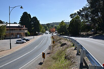
Uraidla Address: Greenhill Road street in Uraidla
Attractions near Uraidla
7-Eleven,Uraidla Show & Sustainability Fair,Wotton's Greenhill Cherries,Lavianto Wedding & Event Hire,Summertown Homestead Bed & Breakfast,Summertown SA Australia,Hoad Water Cartage,Snooty Tooty,Dragonfly Springwater,Unnamed (No.HA22) Heritage Agreement,20 Greenhill Rd - North East Side,All Soap Is Lost Stall,Lee Simon Sound,A. Ability Removals,The One Wedding Makeup,Helbig and Ries,Tfa Solar,Uraidla Hotel,Main Carpark -Woodhouse Activity Centre,Woodhouse Activity CentreHow to get to popular attractions in Uraidla with public transportation
Adelaide Aquatic Centre, North Adelaide,Pulteney Grammar School, Adelaide,St Andrews Hospital, Adelaide,Rydges Adelaide, Adelaide,Hamilton Secondary School, Mitchell Park,Watermark Hotel, Glenelg North,Hahndorf, Hahndorf,Unley High School, Netherby,Nazareth Catholic Community Secondary College, Flinders Park,Cleland Wildlife Park, Piccadilly,SkyCity Adelaide, Adelaide,Adelaide Convention Centre, Adelaide,Art Gallery of South Australia, Adelaide,Hollywood Plaza, Salisbury Downs,Earl of Leicester Hotel, Parkside,Burnside Village Shopping Centre, Glenside,St Aloysius College, Adelaide,Sacred Heart College, Somerton Park,Centro St. Agnes, St Agnes,Coromandel Valley, Coromandel ValleyGet around Adelaide by public transport!
Travelling around Adelaide has never been so easy. See step by step directions as you travel to any attraction, street or major public transport station. View bus and train timetables, arrival times, service alerts and detailed routes on a map, so you know exactly how to get to anywhere in Adelaide.
When travelling to any destination around Adelaide use Moovit's Live Directions with Get Off Notifications to know exactly where and how far to walk, how long to wait for your line , and how many stops are left. Moovit will alert you when it’s time to get off — no need to constantly re-check whether yours is the next stop.
Wondering how to use public transport in Adelaide or how to pay for public transport in Adelaide? Moovit public transport app can help you navigate your way with public transport easily, and at minimum cost. It includes public transport fees, ticket prices, and costs. Looking for a map of Adelaide public transport lines? Moovit public transport app shows all public transport maps in Adelaide with all Bus, Train and Light rail routes and stops on an interactive map.
Adelaide has 3 transport type(s), including: Bus, Train and Light rail, operated by several transport agencies, including Adelaide Metro (Busways), SouthLink, Torrens Transit, Adelaide Metro Train, Adelaide Metro (Torrens Connect), Adelaide Metro (Industrial Service - Torrens Transit), Adelaide Metro (School Service - SouthLink), Adelaide Metro (School Service - Torrens Transit), Adelaide Metro (School Service - Busways)