See Wakerley, East Northamptonshire, on the map
Directions to Wakerley (East Northamptonshire) with public transport
The following transport lines have routes that pass near Wakerley
 Bus:
Bus:
How to get to Wakerley by bus?
Click on the bus route to see step by step directions with maps, line arrival times and updated time schedules.
Bus stations near Wakerley in East Northamptonshire
- Church Lane, Barrowden,16 min walk,
Bus lines to Wakerley in East Northamptonshire
- 4R,Stamford & Rutland Callconnect,
- R5,Stamford - Uppingham,
- 47,Uppingham - Peterborough,
What are the nearest stations to Wakerley?
The nearest stations to Wakerley are:
- Church Lane, Barrowden is 1236 meters away, 16 min walk.
Which bus lines stop near Wakerley?
These bus lines stop near Wakerley: 12, 4S.
See Wakerley, East Northamptonshire, on the map
Public Transit to Wakerley in East Northamptonshire
Wondering how to get to Wakerley in East Northamptonshire, United Kingdom? Moovit helps you find the best way to get to Wakerley with step-by-step directions from the nearest public transit station.
Moovit provides free maps and live directions to help you navigate through your city. View schedules, routes, timetables, and find out how long does it take to get to Wakerley in real time.
Looking for the nearest stop or station to Wakerley? Check out this list of stops closest to your destination: Church Lane.
Bus:
Want to see if there’s another route that gets you there at an earlier time? Moovit helps you find alternative routes or times. Get directions from and directions to Wakerley easily from the Moovit App or Website.
We make riding to Wakerley easy, which is why over 1.5 million users, including users in East Northamptonshire, trust Moovit as the best app for public transit. You don’t need to download an individual bus app or train app, Moovit is your all-in-one transit app that helps you find the best bus time or train time available.
For information on prices of bus, costs and ride fares to Wakerley, please check the Moovit app.
Use the app to navigate to popular places including to the airport, hospital, stadium, grocery store, mall, coffee shop, school, college, and university.
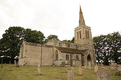
Wakerley Address: Main Street street in East Northamptonshire
Attractions near Wakerley
Le15 8pa,Main Street,Wakerley Road,Le15 8pd,Grapevine Communications,Wakerley Church,Keith Sutcliffe Building,A C Roberts,Le15 8nz,Le15 8eh,Le15 8ea,D E Clayton,W H & M Weed,Barrowden & Wakerley Community Shop and Café,Le15 8aq,Barrowden Surgery,Le15 8ef,Le15 8er,Chapel Lane Associates Ltd.,Le15 8eqHow to get to popular attractions in East Northamptonshire with public transportation
The Carlton Centre, Lincoln,Hotel ibis Chesterfield Centre, Chesterfield,Francis Crick House, Northampton,Bilborough College, Nottingham,Leicester Royal Infirmary, Leicester,The Samuel Hall (Wetherspoon), Nottingham,Bradlaugh Fields, Northampton,Currys PC World, Nottingham,Linney Group Ltd., Mansfield,Wingerworth, North East Derbyshire,Soar Valley Way, Leicester,Nando's, Kettering,RBS Kegworth Data Centre, North West Leicestershire,Bracebridge Heath, North Kesteven,Queens Medical Centre, Nottingham,David Lloyd Nottingham, Nottingham,Experian Embankment House, Nottingham,Sinfin, Derby,Steep Hill, Lincoln,Memsaab Restaurant, NottinghamGet around East Northamptonshire by public transport!
Travelling around East Northamptonshire has never been so easy. See step by step directions as you travel to any attraction, street or major public transport station. View bus and train timetables, arrival times, service alerts and detailed routes on a map, so you know exactly how to get to anywhere in East Northamptonshire.
When travelling to any destination around East Northamptonshire use Moovit's Live Directions with Get Off Notifications to know exactly where and how far to walk, how long to wait for your line , and how many stops are left. Moovit will alert you when it’s time to get off — no need to constantly re-check whether yours is the next stop.
Wondering how to use public transport in East Northamptonshire or how to pay for public transport in East Northamptonshire? Moovit public transport app can help you navigate your way with public transport easily, and at minimum cost. It includes public transport fees, ticket prices, and costs. Looking for a map of East Northamptonshire public transport lines? Moovit public transport app shows all public transport maps in East Northamptonshire with all bus routes and stops on an interactive map.
East Northamptonshire has 1 transport type(s), including: bus, operated by several transport agencies, including National Rail, Ashbourne Community Transport, Delaine Buses, Arriva Midlands, Centrebus, Our Centre, Hulleys of Baslow, D & G Bus, Stagecoach East Midlands, North Lincolnshire Council, National Rail, Roberts Coaches, Lawson's of Corby, Hawkes Coaches and East Yorkshire