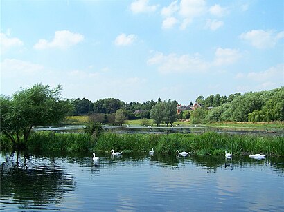
See Watermead Country Park, Leicester, on the map
Directions to Watermead Country Park (Leicester) with public transport
The following transport lines have routes that pass near Watermead Country Park
Bus:
How to get to Watermead Country Park by Bus?
Click on the Bus route to see step by step directions with maps, line arrival times and updated time schedules.
Bus stations near Watermead Country Park in Leicester
- Sainsbury'S, Leicester,2 min walk,
- Braemer Drive, Leicester,9 min walk,
Bus lines to Watermead Country Park in Leicester
- 5,Leicester - Syston - East Goscote,
- 5A,Leicester - Syston - Rearsby - Asfordby - Melton Mowbray,
- X5,Leicester - Melton Mowbray,
- 6,Leicester - Thurmaston - Leicester,
- 6A,Leicester - Thurmaston - Leicester,
- 4,Leicester,
- 40|CIRCLELINE,Eyres Monsell,
- 832,Thurmaston,
What are the nearest stations to Watermead Country Park?
The nearest stations to Watermead Country Park are:
- Sainsbury'S, Leicester is 129 meters away, 2 min walk.
- Braemer Drive, Leicester is 639 meters away, 9 min walk.
Which Bus lines stop near Watermead Country Park?
These Bus lines stop near Watermead Country Park: 5
What’s the nearest bus stop to Watermead Country Park in Leicester?
The nearest bus stop to Watermead Country Park in Leicester is Sainsbury'S, Leicester. It’s a 2 min walk away.
What time is the first Bus to Watermead Country Park in Leicester?
The 4 is the first Bus that goes to Watermead Country Park in Leicester. It stops nearby at 09:30.
What time is the last Bus to Watermead Country Park in Leicester?
The 5 is the last Bus that goes to Watermead Country Park in Leicester. It stops nearby at 22:35.
See Watermead Country Park, Leicester, on the map

Public Transit to Watermead Country Park in Leicester
Wondering how to get to Watermead Country Park in Leicester, United Kingdom? Moovit helps you find the best way to get to Watermead Country Park with step-by-step directions from the nearest public transit station.
Moovit provides free maps and live directions to help you navigate through your city. View schedules, routes, timetables, and find out how long does it take to get to Watermead Country Park in real time.
Looking for the nearest stop or station to Watermead Country Park? Check out this list of stops closest to your destination: Sainsbury'S; Braemer Drive.
Bus:
Want to see if there’s another route that gets you there at an earlier time? Moovit helps you find alternative routes or times. Get directions from and directions to Watermead Country Park easily from the Moovit App or Website.
We make riding to Watermead Country Park easy, which is why over 1.5 million users, including users in Leicester, trust Moovit as the best app for public transit. You don’t need to download an individual bus app or train app, Moovit is your all-in-one transit app that helps you find the best bus time or train time available.
For information on prices of Bus, costs and ride fares to Watermead Country Park, please check the Moovit app.
Use the app to navigate to popular places including to the airport, hospital, stadium, grocery store, mall, coffee shop, school, college, and university.
Watermead Country Park Address: Alderton Close Leicester Leicester LE4 7 street in Leicester

Attractions near Watermead Country Park
- Watermead Way
- Sainsbury's Leicester North
- Nan-Si Beauty
- Shell
- Western Union
- Melton Road
- Carbon Point
- Onlinebargainworld
- PM Brands
- Robert Wojcik
- Manor Medical Centre (Manor Park Medical Practice)
- Axxra Transport
- Shree Kashtabhanjan Dev Foods
- 3 Style Entertainment
- Anglair
- Alumasc Groundworks
- Daksha Jobanputra
- Reform Medical Aesthetics
- Jesse Jackson Park
- Feast India
How to get to popular attractions in Leicester with public transportation
- Market Warsop, Mansfield
- Peterborough Marriott Hotel, Peterborough
- Hucknall Tram Stop, Ashfield
- Southwell, Newark And Sherwood
- Royal Derby Hospital, Derby
- Nettleham, West Lindsey
- Lidl, Peterborough
- University Of Nottingham, Nottingham
- British Gas Museum, Leicester
- Premier Inn Nottingham West, Broxtowe
- Ibis Hotel, Northampton
- The Lincolnshire Wolds, East Lindsey
- Nottingham Council House, Nottingham
- The Observatory (Wetherspoon), Erewash
- Experian Embankment House, Nottingham
- Soar Valley Way, Leicester
- Nottingham Station, Nottingham
- Nando's, Kettering
- RAF Wittering, Peterborough
- Outwood Academy Newbold, Chesterfield