Directions to Westfield Sydney with public transportation
The following transport lines have routes that pass near Westfield Sydney
How to get to Westfield Sydney by bus?
Click on the bus route to see step by step directions with maps, line arrival times and updated time schedules.
How to get to Westfield Sydney by train?
Click on the train route to see step by step directions with maps, line arrival times and updated time schedules.
Bus stations near Westfield Sydney
- St James Station, Castlereagh St, Stand D, 2 min walk,
- St James Station, Elizabeth St, Stand B, 3 min walk,
- St James Station, Elizabeth St, Stand C, 4 min walk,
- Town Hall Station, Park St, Stand H, 4 min walk,
- QVB, York St, Stand D, 4 min walk,
- Martin Place Station, Elizabeth St, Stand E, 5 min walk,
- Town Hall Station, Park St, Stand G, 5 min walk,
- QVB, York St, Stand C, 5 min walk,
- QVB, York St, Stand B, 6 min walk,
- QVB, York St, Stand E, 10 min walk,
Light Rail stations near Westfield Sydney
- Town Hall Light Rail, 4 min walk,
Train stations near Westfield Sydney
- Town Hall Station, 5 min walk,
- Martin Place Station, 22 min walk,
Bus routes to Westfield Sydney
- 339X, Clovelly to City Museum (Express Service),
- 373X, Coogee to City Museum (Express Service),
- 374X, Coogee to City Museum via Bream St (Express Service),
- 377X, Maroubra Beach to City Museum via South Coogee (Express Service),
- 396X, Maroubra Beach to City Museum (Express Service),
- 397X, South Maroubra to City Museum (Express Service),
- 423, Kingsgrove to City Martin Place,
- 423X, Kingsgrove to City Martin Place (Express Service),
- 426, Dulwich Hill to City Martin Place,
- 428, Canterbury to City Martin Place,
- 428X, Canterbury to City Martin Place (Express Service),
- 430, Sydenham to City Martin Place,
- 304, City Circular Quay to Green Square (Loop Service),
- 333, North Bondi to City Circular Quay via Bondi Junction,
- 343, Kingsford to City Circular Quay,
- 392N, Matraville to City Circular Quay (Night Service),
- 396, Maroubra Beach to City Circular Quay,
- 412, Campsie to City Martin Place via Earlwood & Dulwich Hill,
- 431, Glebe Point to City Martin Place,
- 438N, Abbotsford to City Martin Place (Night Service),
What are the nearest stations to Westfield Sydney?
The nearest stations to Westfield Sydney are:
- St James Station, Castlereagh St, Stand D is 100 meters away, 2 min walk.
- St James Station, Elizabeth St, Stand B is 166 meters away, 3 min walk.
- St James Station, Elizabeth St, Stand C is 234 meters away, 4 min walk.
- Town Hall Light Rail is 253 meters away, 4 min walk.
- Town Hall Station, Park St, Stand H is 268 meters away, 4 min walk.
- QVB, York St, Stand D is 277 meters away, 4 min walk.
- Martin Place Station, Elizabeth St, Stand E is 282 meters away, 5 min walk.
- Town Hall Station, Park St, Stand G is 304 meters away, 5 min walk.
- Town Hall Station is 311 meters away, 5 min walk.
- QVB, York St, Stand C is 352 meters away, 5 min walk.
- QVB, York St, Stand B is 386 meters away, 6 min walk.
- QVB, York St, Stand E is 677 meters away, 10 min walk.
- Martin Place Station is 1684 meters away, 22 min walk.
Which bus lines stop near Westfield Sydney?
These bus lines stop near Westfield Sydney: 170X, 297, 320, 325, 333, 392X, 423, 431.
Which train lines stop near Westfield Sydney?
These train lines stop near Westfield Sydney: T1, T2, T3, T4, T8, T9.
What’s the nearest light rail station to Westfield Sydney?
The nearest light rail station to Westfield Sydney is Town Hall Light Rail. It’s a 4 min walk away.
What’s the nearest train station to Westfield Sydney?
The nearest train station to Westfield Sydney is Town Hall Station. It’s a 5 min walk away.
What’s the nearest bus stop to Westfield Sydney?
The nearest bus stop to Westfield Sydney is St James Station, Castlereagh St, Stand D. It’s a 2 min walk away.
What time is the first light rail to Westfield Sydney?
The L2 is the first light rail that goes to Westfield Sydney. It stops nearby at 04:47.
What time is the last light rail to Westfield Sydney?
The L2 is the last light rail that goes to Westfield Sydney. It stops nearby at 21:32.
What time is the first train to Westfield Sydney?
The T8 is the first train that goes to Westfield Sydney. It stops nearby at 04:20.
What time is the last train to Westfield Sydney?
The SCO is the last train that goes to Westfield Sydney. It stops nearby at 05:06.
What time is the first bus to Westfield Sydney?
The N20 is the first bus that goes to Westfield Sydney. It stops nearby at 03:00.
What time is the last bus to Westfield Sydney?
The N90 is the last bus that goes to Westfield Sydney. It stops nearby at 03:24.
How much is the bus fare to Westfield Sydney?
The bus fare to Westfield Sydney costs about $2.24 - $3.79.
How much is the ferry fare to Westfield Sydney?
The ferry fare to Westfield Sydney costs about $9.90.
How much is the train fare to Westfield Sydney?
The train fare to Westfield Sydney costs about $2.56 - $6.99.
How much is the metro fare to Westfield Sydney?
The metro fare to Westfield Sydney costs about $2.56 - $6.99.
See Westfield Sydney on the map
Public Transportation to Westfield Sydney
Wondering how to get to Westfield Sydney, Australia? Moovit helps you find the best way to get to Westfield Sydney with step-by-step directions from the nearest public transit station.
Moovit provides free maps and live directions to help you navigate through your city. View schedules, routes, timetables, and find out how long does it take to get to Westfield Sydney in real time.
Looking for the nearest stop or station to Westfield Sydney? Check out this list of stops closest to your destination: St James Station; St James Station; St James Station; Town Hall Light Rail; Town Hall Station; QVB; Martin Place Station; Town Hall Station; Town Hall Station; QVB; QVB; QVB; Martin Place Station.
Bus: 170X, 297, 320, 325, 333, 392X, 423, 431, 339X, 373X, 374X, 377X, 396X, 423X, 426, 428, 428X, 304, 343, 392N, 396, N10, N11, N20, N30, N40.Train: T1, T2, T3, T4, T8, T9, CCN, SCO, M1.
Want to see if there’s another route that gets you there at an earlier time? Moovit helps you find alternative routes or times. Get directions from and directions to Westfield Sydney easily from the Moovit App or Website.
We make riding to Westfield Sydney easy, which is why over 1.5 million users, including users in Sydney, trust Moovit as the best app for public transit. You don’t need to download an individual bus app or train app, Moovit is your all-in-one transit app that helps you find the best bus time or train time available.
For information on prices of train, bus, ferry and metro, costs and ride fares to Westfield Sydney, please check the Moovit app.
Use the app to navigate to popular places including to the airport, hospital, stadium, grocery store, mall, coffee shop, school, college, and university.
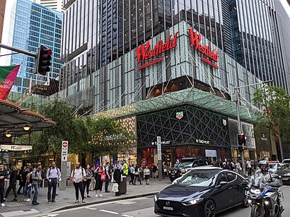
Westfield Sydney Address: Market Street street in Sydney
Attractions near Westfield Sydney
Westfield Sydney,Sydney Tower,Zimmermann,kikki.K,100 Market Street,Swarovski,Sydney Tower Eye,CHANEL Boutique,Tod's,Gucci,David Jones,PRADA,Platypus Shoes,TAG Heuer,Iku Wholefoods,Zara,Babylon Rooftop,Rip Curl,Pumpkin Patch,Nespresso BoutiqueHow to get to popular attractions in Sydney with public transportation
Westpoint Shopping Centre, Blacktown,Castle Towers, Castle Hill (NSW),Kingsford Smith Airport - International Terminal, Mascot,Starbucks, Sydney,St Vincents Hospital, Darlinghurst,Sydney Airport (SYD), Mascot,Heritage Belgian Beer Cafe, The Rocks (Sydney - NSW),Manly Wharf Bar,Wollongong Station, Wollongong,Kogarah Station, Kogarah,Penrith Station, Penrith,Shady Pines Saloon, Darlinghurst,Central, Haymarket,Padstow Station, Padstow,Charlestown Square Shopping Centre, Charlestown (NSW),Adriano Zumbo Pâtissier, Pyrmont,Westfield Tuggerah, Tuggerah,Ivy, Sydney,Westfield Hurstville, Hurstville,The Sheaf, Double BayGet around Sydney by public transport!
Travelling around Sydney has never been so easy. See step by step directions as you travel to any attraction, street or major public transport station. View bus and train timetables, arrival times, service alerts and detailed routes on a map, so you know exactly how to get to anywhere in Sydney.
When travelling to any destination around Sydney use Moovit's Live Directions with Get Off Notifications to know exactly where and how far to walk, how long to wait for your line , and how many stops are left. Moovit will alert you when it’s time to get off — no need to constantly re-check whether yours is the next stop.
Wondering how to use public transport in Sydney or how to pay for public transport in Sydney? Moovit public transport app can help you navigate your way with public transport easily, and at minimum cost. It includes public transport fees, ticket prices, and costs. Looking for a map of Sydney public transport lines? Moovit public transport app shows all public transport maps in Sydney with all Bus, Train, Metro, Light rail and Ferry routes and stops on an interactive map.
Sydney has 5 transport type(s), including: Bus, Train, Metro, Light rail and Ferry, operated by several transport agencies, including Sydney Metro, Sydney Trains, Sydney Light Rail, Sydney Ferries, Intercity Trains, Intercity Train, NSW TrainLink, CDC NSW R14, U-Go Mobility, Keolis Downer Northern Beaches, Manly Fast Ferry, Transdev John Holland Buses, Busways, Busways North West, Dysons Buslines