See Westminster Pier, Charing Cross, on the map
Directions to Westminster Pier (Charing Cross) with public transport
The following transport lines have routes that pass near Westminster Pier
 Bus:
Bus: - Train:
- Tube:
- River Bus:
How to get to Westminster Pier by bus?
Click on the bus route to see step by step directions with maps, line arrival times and updated time schedules.
How to get to Westminster Pier by train?
Click on the train route to see step by step directions with maps, line arrival times and updated time schedules.
How to get to Westminster Pier by Tube?
Click on the Tube route to see step by step directions with maps, line arrival times and updated time schedules.
Bus stations near Westminster Pier in Charing Cross
- London Eye, Waterloo,1 min walk,
- Westminster Bridge / County Hall (D),2 min walk,
- Whitehall / Horseguards Avenue (P),5 min walk,
- Horse Guards Parade (S),5 min walk,
- Banqueting House, Westminster,6 min walk,
- Whitehall / Trafalgar Square (N),7 min walk,
- Northumberland Avenue / Trafalgar Square (W),8 min walk,
Tube stations near Westminster Pier in Charing Cross
- Westminster,4 min walk,
- Embankment,6 min walk,
River Bus stations near Westminster Pier in Charing Cross
- London Eye Waterloo Pier,5 min walk,
- Westminster Pier,5 min walk,
Bus lines to Westminster Pier in Charing Cross
- 734,Waterloo,
- 11,Fulham Broadway,
- 12,Dulwich Library,
- N53,Plumstead Station,
- N109,Croydon Town Centre,
- 148,White City,
- N155,Aldwych,
- 159,Oxford Circus,
- N381,Whitehall, Horse Guards,
- 453,Deptford Bridge,
- N3,Oxford Circus,
- N11,Whitehall, Horse Guards - Ealing Broadway,
- 24,Hampstead Heath - Pimlico,
- 26,Victoria - Hackney Wick,
- N26,Chingford Station - Victoria,
- N44,Sutton Station - Aldwych,
- 87,Aldwych - Wandsworth,
- N87,Aldwych - Kingston,
- 88,Clapham Common - Parliament Hill Fields,
- N136,Chislehurst, War Memorial - Oxford Circus,
What are the nearest stations to Westminster Pier?
The nearest stations to Westminster Pier are:
- London Eye, Waterloo is 36 meters away, 1 min walk.
- Westminster Bridge / County Hall (D) is 89 meters away, 2 min walk.
- Westminster is 283 meters away, 4 min walk.
- London Eye Waterloo Pier is 312 meters away, 5 min walk.
- Westminster Pier is 321 meters away, 5 min walk.
- Whitehall / Horseguards Avenue (P) is 375 meters away, 5 min walk.
- Horse Guards Parade (S) is 379 meters away, 5 min walk.
- Embankment is 419 meters away, 6 min walk.
- Banqueting House, Westminster is 435 meters away, 6 min walk.
- Whitehall / Trafalgar Square (N) is 489 meters away, 7 min walk.
- Northumberland Avenue / Trafalgar Square (W) is 606 meters away, 8 min walk.
Which bus lines stop near Westminster Pier?
These bus lines stop near Westminster Pier: 139, 148, 24, 453.
Which train lines stop near Westminster Pier?
These train lines stop near Westminster Pier: ELIZABETH, SOUTH WESTERN RAILWAY, SOUTHEASTERN.
Which Tube lines stop near Westminster Pier?
These Tube lines stop near Westminster Pier: BAKERLOO, DISTRICT, JUBILEE.
What’s the nearest Tube station to Westminster Pier in Charing Cross?
The nearest Tube station to Westminster Pier in Charing Cross is Westminster. It’s a 4 min walk away.
What’s the nearest bus stop to Westminster Pier in Charing Cross?
The nearest bus stop to Westminster Pier in Charing Cross is London Eye, Waterloo. It’s a 1 min walk away.
What’s the nearest River Bus station to Westminster Pier in Charing Cross?
The nearest River Bus stations to Westminster Pier in Charing Cross are London Eye Waterloo Pier and Westminster Pier. The closest one is a 5 min walk away.
What time is the first Tube to Westminster Pier in Charing Cross?
The DISTRICT is the first Tube that goes to Westminster Pier in Charing Cross. It stops nearby at 05:25.
What time is the last Tube to Westminster Pier in Charing Cross?
The JUBILEE is the last Tube that goes to Westminster Pier in Charing Cross. It stops nearby at 00:47.
What time is the first bus to Westminster Pier in Charing Cross?
The 88 is the first bus that goes to Westminster Pier in Charing Cross. It stops nearby at 03:00.
What time is the last bus to Westminster Pier in Charing Cross?
The N18 is the last bus that goes to Westminster Pier in Charing Cross. It stops nearby at 04:01.
What time is the first River Bus to Westminster Pier in Charing Cross?
The RB6 is the first River Bus that goes to Westminster Pier in Charing Cross. It stops nearby at 06:16.
What time is the last River Bus to Westminster Pier in Charing Cross?
The RB1 is the last River Bus that goes to Westminster Pier in Charing Cross. It stops nearby at 22:34.
See Westminster Pier, Charing Cross, on the map
Public Transit to Westminster Pier in Charing Cross
Wondering how to get to Westminster Pier in Charing Cross, United Kingdom? Moovit helps you find the best way to get to Westminster Pier with step-by-step directions from the nearest public transit station.
Moovit provides free maps and live directions to help you navigate through your city. View schedules, routes, timetables, and find out how long does it take to get to Westminster Pier in real time.
Looking for the nearest stop or station to Westminster Pier? Check out this list of stops closest to your destination: London Eye; Westminster Bridge / County Hall (D); Westminster; London Eye Waterloo Pier; Westminster Pier; Whitehall / Horseguards Avenue (P); Horse Guards Parade (S); Embankment; Banqueting House; Whitehall / Trafalgar Square (N); Northumberland Avenue / Trafalgar Square (W).
Bus:Train:Tube:River Bus:
Want to see if there’s another route that gets you there at an earlier time? Moovit helps you find alternative routes or times. Get directions from and directions to Westminster Pier easily from the Moovit App or Website.
We make riding to Westminster Pier easy, which is why over 1.5 million users, including users in Charing Cross, trust Moovit as the best app for public transit. You don’t need to download an individual bus app or train app, Moovit is your all-in-one transit app that helps you find the best bus time or train time available.
For information on prices of bus, Tube and train, costs and ride fares to Westminster Pier, please check the Moovit app.
Use the app to navigate to popular places including to the airport, hospital, stadium, grocery store, mall, coffee shop, school, college, and university.
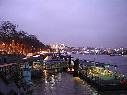
Westminster Pier Address: Victoria Embankment Westminster London SW1A 2 street in Charing Cross
Attractions near Westminster Pier
victoria embankment coach bays,Ministry of Defense Mod,New Scotland Yard,New Scotland Yard,Metropolitan Police,Privy Garden of the Palace of Whitehall,Victoria Embankment,Ministry Of Defence,Ministry of Defence Main Building,Former Whitehall Palace Steps,Sw1a 2jl,The Tattershall Castle,Richmond Terrace,Attlee Suite,Banqueting House Whitehall,Banqueting House (The Banqueting House),Parliament Street Whitehall,Westminster Pier (Stop K),Downing Street (downing whitehall),Thames River BoatsHow to get to popular attractions in Charing Cross with public transportation
Stratford Station, Stratford,Ferney Road, East Barnet,Brookwood Railway Station (BKO), Woking,Cassiobury Park, Watford,High Street, Hounslow,Lichfield Court, Richmond,Cricklewood, Cricklewood,Southgate, Southgate,Renaissance London Heathrow Hotel, Heathrow,Dover Beach, Dover,Covent Garden Station, Covent Garden,VQ, Chelsea,Waitrose, Beckenham,Terminal 4, Heathrow,Brent, Colindale,Charing Cross Hospital, Hammersmith,University Of Brighton - Falmer Campus, Brighton And Hove,Golders Green, Golders Green,John Radcliffe Main Hospital, Oxford,Parkside Gardens, East BarnetGet around Charing Cross by public transport!
Travelling around Charing Cross has never been so easy. See step by step directions as you travel to any attraction, street or major public transport station. View bus and train timetables, arrival times, service alerts and detailed routes on a map, so you know exactly how to get to anywhere in Charing Cross.
When travelling to any destination around Charing Cross use Moovit's Live Directions with Get Off Notifications to know exactly where and how far to walk, how long to wait for your line , and how many stops are left. Moovit will alert you when it’s time to get off — no need to constantly re-check whether yours is the next stop.
Wondering how to use public transport in Charing Cross or how to pay for public transport in Charing Cross? Moovit public transport app can help you navigate your way with public transport easily, and at minimum cost. It includes public transport fees, ticket prices, and costs. Looking for a map of Charing Cross public transport lines? Moovit public transport app shows all public transport maps in Charing Cross with all bus, Tube or train routes and stops on an interactive map.
Charing Cross has 3 transport type(s), including: bus, Tube or train, operated by several transport agencies, including London Underground, London Buses, Transport for London, London Tramlink, Transport for London, National Rail, Bluestar, Berry's Coaches, Oxford Bus Company, Stagecoach West, Community First Wessex, Cresta Coaches, D & P Boat Hire, First Portsmouth, Fareham & Gosport and FYTbus