Directions to Whitby Hospital with public transportation
The following transport lines have routes that pass near Whitby Hospital
How to get to Whitby Hospital by bus?
Click on the bus route to see step by step directions with maps, line arrival times and updated time schedules.
How to get to Whitby Hospital by train?
Click on the train route to see step by step directions with maps, line arrival times and updated time schedules.
Bus stations near Whitby Hospital
- Pannett Park,3 min walk,
- Chubb Hill Road,3 min walk,
- St Hildas Terrace,3 min walk,
- Whitby,6 min walk,
Bus routes to Whitby Hospital
- X4,Redcar And Cleveland - Whitby,
- X4A,Whitby - Redcar And Cleveland,
- X93,Whitby - Scarborough,
- X94,Scarborough - Whitby,
- 95,Eskdaleside Cum Ugglebarnby - Whitby,
- 96,Glaisdale - Whitby,
- 840,Thornton-Le-Dale - Leeds,
- G,Co-Op (Adj),
- Y,West Cliff,
- P1,Whitby,
- P2,Whitby,
- NORTHERN,Middlesbrough,
What are the nearest stations to Whitby Hospital?
The nearest stations to Whitby Hospital are:
- Pannett Park is 190 meters away, 3 min walk.
- Chubb Hill Road is 191 meters away, 3 min walk.
- St Hildas Terrace is 192 meters away, 3 min walk.
- Whitby is 408 meters away, 6 min walk.
Which bus lines stop near Whitby Hospital?
These bus lines stop near Whitby Hospital: 840, X93, X94.
Which train line stops near Whitby Hospital?
TRANSPENNINE EXPRESS
What’s the nearest bus stop to Whitby Hospital?
The nearest bus stops to Whitby Hospital are Pannett Park, Chubb Hill Road and St Hildas Terrace. The closest one is a 3 min walk away.
What time is the first train to Whitby Hospital?
The NORTHERN is the first train that goes to Whitby Hospital. It stops nearby at 10:12.
What time is the last train to Whitby Hospital?
The NORTHERN is the last train that goes to Whitby Hospital. It stops nearby at 18:34.
What time is the first bus to Whitby Hospital?
The X93 is the first bus that goes to Whitby Hospital. It stops nearby at 07:58.
What time is the last bus to Whitby Hospital?
The P1 is the last bus that goes to Whitby Hospital. It stops nearby at 20:44.
See Whitby Hospital on the map
Public Transportation to Whitby Hospital
Wondering how to get to Whitby Hospital, United Kingdom? Moovit helps you find the best way to get to Whitby Hospital with step-by-step directions from the nearest public transit station.
Moovit provides free maps and live directions to help you navigate through your city. View schedules, routes, timetables, and find out how long does it take to get to Whitby Hospital in real time.
Looking for the nearest stop or station to Whitby Hospital? Check out this list of stops closest to your destination: Pannett Park; Chubb Hill Road; St Hildas Terrace; Whitby.
Bus:840X93X94P1P2GYX4X4A95NORTHERNTrain:TRANSPENNINE EXPRESS
Want to see if there’s another route that gets you there at an earlier time? Moovit helps you find alternative routes or times. Get directions from and directions to Whitby Hospital easily from the Moovit App or Website.
We make riding to Whitby Hospital easy, which is why over 1.5 million users, including users in Whitby, trust Moovit as the best app for public transit. You don’t need to download an individual bus app or train app, Moovit is your all-in-one transit app that helps you find the best bus time or train time available.
For information on prices of bus and train, costs and ride fares to Whitby Hospital, please check the Moovit app.
Use the app to navigate to popular places including to the airport, hospital, stadium, grocery store, mall, coffee shop, school, college, and university.
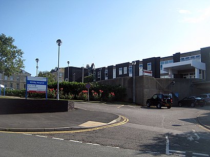
Whitby Hospital Address: Spring Hill street in Whitby
The Whitby Hospital is a community hospital in Springhill, Whitby, North Yorkshire, England. It is managed by Humber NHS Foundation Trust.Wiki
Attractions near Whitby Hospital
D Mead Glazing,Mulgrave Community Sports Association,Easington Mechanical Services,Whitby Hospital Car Park (Rear),Whitby Open Top Bus Tour,Endeavour Cottage,Keel House,George House,Snuze Whitby, Centrally Located On Falcon Terrace,Whitby Dental Care,Ije Plant Training Services,Number Twelve,Whitby Police Station Car Park,Newbiggin Hall Cottages,Marisco Whitb,Endeavour House Management Limited,Whitby Youth Centre,The Hyding Place On Bagdale Whitby,Blair WM Hankin,Coastlets HolidaysHow to get to popular attractions in Whitby with public transportation
Oec, Sheffield,University of York, Heslington,York Barbican Centre, York,Vulcan House, Sheffield,Leeds General Infirmary Visitors Car Park, Leeds,Cross Green Industrial Estate, Leeds,Crowne Plaza Royal Victoria, Sheffield,Druids Temple,Childrens Hospital, Sheffield, Sheffield,No 222 Bus Barnsley to Mexborough, Rotherham,Lidl Doncaster Regional Distribution Centre, Loversall,East Ardsley, Leeds,Sheffield Crown Court, Sheffield,Pudsey Civic Hall, Leeds,Chapeltown Road, Leeds,Royal Armouries, Leeds, Leeds,Leeds United Football Club, Leeds,Xscape-Castleford, Pontefract,Graves Park Farm, Sheffield,Peak District National Park, SheffieldGet around Whitby by public transport!
Travelling around Whitby has never been so easy. See step by step directions as you travel to any attraction, street or major public transport station. View bus and train timetables, arrival times, service alerts and detailed routes on a map, so you know exactly how to get to anywhere in Whitby.
When travelling to any destination around Whitby use Moovit's Live Directions with Get Off Notifications to know exactly where and how far to walk, how long to wait for your line , and how many stops are left. Moovit will alert you when it’s time to get off — no need to constantly re-check whether yours is the next stop.
Wondering how to use public transport in Whitby or how to pay for public transport in Whitby? Moovit public transport app can help you navigate your way with public transport easily, and at minimum cost. It includes public transport fees, ticket prices, and costs. Looking for a map of Whitby public transport lines? Moovit public transport app shows all public transport maps in Whitby with all bus or train routes and stops on an interactive map.
Whitby has 2 transport type(s), including: bus or train, operated by several transport agencies, including First Leeds, First South Yorkshire, First York, Arriva Yorkshire, Stagecoach Yorkshire, National Rail, First Bradford, First Halifax, Calder Valley & Huddersfield, East Yorkshire, The Keighley Bus Company, South Yorkshire Future Tram, The Harrogate Bus Company, National Rail, TM Travel and Coastliner