Directions to Willesden Green with public transportation
The following transport lines have routes that pass near Willesden Green
 Bus:
Bus: - Train:
- Tube:
How to get to Willesden Green by bus?
Click on the bus route to see step by step directions with maps, line arrival times and updated time schedules.
How to get to Willesden Green by train?
Click on the train route to see step by step directions with maps, line arrival times and updated time schedules.
How to get to Willesden Green by Tube?
Click on the Tube route to see step by step directions with maps, line arrival times and updated time schedules.
Bus stations near Willesden Green
- Peter Avenue (G),3 min walk,
- Willesden Sports Centre (A),4 min walk,
- Hanover Road (F),6 min walk,
- Robson Avenue (HG),8 min walk,
Tube stations near Willesden Green
- Willesden Green,18 min walk,
- Willesden Junction,31 min walk,
Train stations near Willesden Green
- Brondesbury Park,25 min walk,
Bus routes to Willesden Green
- 206,Kilburn Park,
- 6,Victoria,
- 52,Victoria,
- 302,Mill Hill Broadway,
- 226,Golders Green,
What are the nearest stations to Willesden Green?
The nearest stations to Willesden Green are:
- Peter Avenue (G) is 145 meters away, 3 min walk.
- Willesden Sports Centre (A) is 259 meters away, 4 min walk.
- Hanover Road (F) is 413 meters away, 6 min walk.
- Robson Avenue (HG) is 550 meters away, 8 min walk.
- Willesden Green is 1315 meters away, 18 min walk.
- Brondesbury Park is 1873 meters away, 25 min walk.
- Willesden Junction is 2364 meters away, 31 min walk.
Which bus lines stop near Willesden Green?
These bus lines stop near Willesden Green: 206, 302, 6.
Which train line stops near Willesden Green?
OVERGROUND
Which Tube line stops near Willesden Green?
JUBILEE
What’s the nearest Tube station to Willesden Green?
The nearest Tube station to Willesden Green is Willesden Green. It’s a 18 min walk away.
What’s the nearest train station to Willesden Green?
The nearest train station to Willesden Green is Brondesbury Park. It’s a 25 min walk away.
What’s the nearest bus stop to Willesden Green?
The nearest bus stop to Willesden Green is Peter Avenue (G). It’s a 3 min walk away.
What time is the first Tube to Willesden Green?
The BAKERLOO is the first Tube that goes to Willesden Green. It stops nearby at 05:31.
What time is the last Tube to Willesden Green?
The JUBILEE is the last Tube that goes to Willesden Green. It stops nearby at 00:53.
What time is the first train to Willesden Green?
The OVERGROUND is the first train that goes to Willesden Green. It stops nearby at 05:49.
What time is the last train to Willesden Green?
The OVERGROUND is the last train that goes to Willesden Green. It stops nearby at 00:50.
What time is the first bus to Willesden Green?
The 52 is the first bus that goes to Willesden Green. It stops nearby at 03:12.
What time is the last bus to Willesden Green?
The 52 is the last bus that goes to Willesden Green. It stops nearby at 03:43.
See Willesden Green on the map
Public Transportation to Willesden Green
Wondering how to get to Willesden Green, United Kingdom? Moovit helps you find the best way to get to Willesden Green with step-by-step directions from the nearest public transit station.
Moovit provides free maps and live directions to help you navigate through your city. View schedules, routes, timetables, and find out how long does it take to get to Willesden Green in real time.
Looking for the nearest stop or station to Willesden Green? Check out this list of stops closest to your destination: Peter Avenue (G); Willesden Sports Centre (A); Hanover Road (F); Robson Avenue (HG); Willesden Green; Brondesbury Park; Willesden Junction.
Bus:Train:Tube:
Want to see if there’s another route that gets you there at an earlier time? Moovit helps you find alternative routes or times. Get directions from and directions to Willesden Green easily from the Moovit App or Website.
We make riding to Willesden Green easy, which is why over 1.5 million users, including users in Willesden, trust Moovit as the best app for public transit. You don’t need to download an individual bus app or train app, Moovit is your all-in-one transit app that helps you find the best bus time or train time available.
For information on prices of bus, train and Tube, costs and ride fares to Willesden Green, please check the Moovit app.
Use the app to navigate to popular places including to the airport, hospital, stadium, grocery store, mall, coffee shop, school, college, and university.
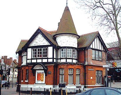
Willesden Green Address: Alexander Avenue street in Willesden
Attractions near Willesden Green
Willesden Sports Centre Pool,Willesden Green,The Best Broasted Limited,Willesden Sports Centre,Thames Water Covered Reservoir,Rewear Beyond Vintage,NW10 3QX,Donnington Primary School,Eponymous Public Relations Limited,St Mary Magdalen Roman Catholic Church,Barber Shop,Burnley Medical Practice,St Mary Magdalen Rc Church,Clarendon Court,Newman Catholic College,Desire Coffee & Bistro,Willesden Centre For Health And Care,The Islamic College,Nw10 3ry,All in the Home LimitedHow to get to popular attractions in Willesden with public transportation
Camden Market Hall, Camden Town,Romford, Romford,Reading College, Reading,Golders Green, Golders Green,Highgate Hill, Upper Holloway,Whitgift School, South Croydon,Trafalgar Square, Charing Cross,Romford Market, Romford,Brent Cross Shopping Centre, Brent Cross,Issigonis House, Acton,King's Cross St Pancras Underground Station, Pentonville,Kingston University Penrhyn Road Campus, Kingston,ESCP Europe London Campus, West Hampstead,Warner Bros. Studio Tour London - the Making Of Harry Potter, Three Rivers,Charing Cross Hospital, Hammersmith,Willesden Bus Garage, Willesden,Sands, High Wycombe,Royal Observatory Greenwich, Greenwich,Amazon.co.uk HQ, Slough,Oxford Brookes University, Wheatley Campus, South OxfordshireGet around Willesden by public transport!
Travelling around Willesden has never been so easy. See step by step directions as you travel to any attraction, street or major public transport station. View bus and train timetables, arrival times, service alerts and detailed routes on a map, so you know exactly how to get to anywhere in Willesden.
When travelling to any destination around Willesden use Moovit's Live Directions with Get Off Notifications to know exactly where and how far to walk, how long to wait for your line , and how many stops are left. Moovit will alert you when it’s time to get off — no need to constantly re-check whether yours is the next stop.
Wondering how to use public transport in Willesden or how to pay for public transport in Willesden? Moovit public transport app can help you navigate your way with public transport easily, and at minimum cost. It includes public transport fees, ticket prices, and costs. Looking for a map of Willesden public transport lines? Moovit public transport app shows all public transport maps in Willesden with all bus, train or Tube routes and stops on an interactive map.
Willesden has 3 transport type(s), including: bus, train or Tube, operated by several transport agencies, including London Underground, London Buses, Transport for London, London Tramlink, Transport for London, National Rail, Bluestar, Berry's Coaches, Oxford Bus Company, Stagecoach West, Community First Wessex, Cresta Coaches, D & P Boat Hire, First Portsmouth, Fareham & Gosport and FYTbus