See Wolli Creek on the map
Directions to Wolli Creek with public transportation
The following transport lines have routes that pass near Wolli Creek
 Bus:
Bus: - Train:
How to get to Wolli Creek by bus?
Click on the bus route to see step by step directions with maps, line arrival times and updated time schedules.
How to get to Wolli Creek by train?
Click on the train route to see step by step directions with maps, line arrival times and updated time schedules.
Bus stations near Wolli Creek
- West Botany St at Flora St,4 min walk,
- Princes Hwy opp Cahill Park,6 min walk,
- Wolli Creek Station, Discovery Point Pl,11 min walk,
- Wollongong Rd opp Done St,13 min walk,
- Princes Hwy opp Fanning St,14 min walk,
Train stations near Wolli Creek
- Wolli Creek Station,10 min walk,
Bus routes to Wolli Creek
- 422,Pitt St and Barlow St,
- N10,Sutherland Station,
- N11,Town Hall Station,
- 348,Prince of Wales Hospital, Barker St,
- 473,Arncliffe Station,
- 720S,Beamish St and South Pde (Anzac Mal,
- 425,Dulwich Hill Shops,
What are the nearest stations to Wolli Creek?
The nearest stations to Wolli Creek are:
- West Botany St at Flora St is 206 meters away, 4 min walk.
- Princes Hwy opp Cahill Park is 404 meters away, 6 min walk.
- Wolli Creek Station is 745 meters away, 10 min walk.
- Wolli Creek Station, Discovery Point Pl is 772 meters away, 11 min walk.
- Wollongong Rd opp Done St is 938 meters away, 13 min walk.
- Princes Hwy opp Fanning St is 1068 meters away, 14 min walk.
Which bus lines stop near Wolli Creek?
These bus lines stop near Wolli Creek: 348, 420, 422.
Which train lines stop near Wolli Creek?
These train lines stop near Wolli Creek: SCO, T4.
What’s the nearest train station to Wolli Creek?
The nearest train station to Wolli Creek is Wolli Creek Station. It’s a 10 min walk away.
What’s the nearest bus stop to Wolli Creek?
The nearest bus stop to Wolli Creek is West Botany St at Flora St. It’s a 4 min walk away.
What time is the first train to Wolli Creek?
The T4 is the first train that goes to Wolli Creek. It stops nearby at 04:32.
What time is the last train to Wolli Creek?
The SCO is the last train that goes to Wolli Creek. It stops nearby at 04:50.
What time is the first bus to Wolli Creek?
The N10 is the first bus that goes to Wolli Creek. It stops nearby at 03:03.
What time is the last bus to Wolli Creek?
The N11 is the last bus that goes to Wolli Creek. It stops nearby at 03:23.
How much is the train fare to Wolli Creek?
The train fare to Wolli Creek costs about $2.80 - $7.65.
How much is the ferry fare to Wolli Creek?
The ferry fare to Wolli Creek costs about $6.79.
How much is the bus fare to Wolli Creek?
The bus fare to Wolli Creek costs about $2.24 - $4.15.
See Wolli Creek on the map
Public Transportation to Wolli Creek
Wondering how to get to Wolli Creek, Australia? Moovit helps you find the best way to get to Wolli Creek with step-by-step directions from the nearest public transit station.
Moovit provides free maps and live directions to help you navigate through your city. View schedules, routes, timetables, and find out how long does it take to get to Wolli Creek in real time.
Looking for the nearest stop or station to Wolli Creek? Check out this list of stops closest to your destination: West Botany St at Flora St; Princes Hwy opp Cahill Park; Wolli Creek Station; Wolli Creek Station; Wollongong Rd opp Done St; Princes Hwy opp Fanning St.
Bus:Train:
Want to see if there’s another route that gets you there at an earlier time? Moovit helps you find alternative routes or times. Get directions from and directions to Wolli Creek easily from the Moovit App or Website.
We make riding to Wolli Creek easy, which is why over 1.5 million users, including users in Wolli Creek, trust Moovit as the best app for public transit. You don’t need to download an individual bus app or train app, Moovit is your all-in-one transit app that helps you find the best bus time or train time available.
For information on prices of train, bus and ferry, costs and ride fares to Wolli Creek, please check the Moovit app.
Use the app to navigate to popular places including to the airport, hospital, stadium, grocery store, mall, coffee shop, school, college, and university.
Wolli Creek Address: Discovery Point Place street in Wolli Creek
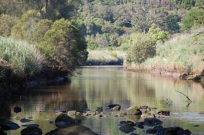
Wolli Creek () is an urban watercourse of the Cooks River catchment located in the southern suburbs of Sydney, in New South Wales, Australia.Wiki
Popular routes to Wolli Creek
Attractions near Wolli Creek
Wolli Creek Station (Concourse),Tempe Bridge,Milk Flower - Wolli Creek,Orange Supermarket (Asian),Dan Murphy's 1467,The Lokal Cafe (Top Impression Bakery Cafe),WBC Wolli Burger Cafe,Australia Post Parcel Locker,Fresh and Hot - Ma la Tang,Kei Hair Professional,Le Laque Boutique,Matar Health Holistic Nutrition and Wellness Clini,Tempe House,Mount Olympus Heritage Gardens,Wolli Creek,Aroma Street,Woolworths,ALDI,Wolli Creek,Tempe VelodromeHow to get to popular attractions in Wolli Creek with public transportation
UNSW, Kensington (NSW),Rouse Hill Town Centre, Rouse Hill,Crowne Plaza, Coogee (NSW),Ms. G's, Potts Point,Mortdale Station, Mortdale,Kogarah Station, Kogarah,Munich Brauhaus, The Rocks (Sydney - NSW),Epping Station (Concourse), Epping (NSW),Cruise Bar, The Rocks (Sydney - NSW),Chat Thai, Haymarket,Petersham Station, Petersham,Narrabeen, Narrabeen,Lewisham Station, Lewisham (NSW),Shady Pines Saloon, Darlinghurst,Katoomba Station, Katoomba,Nepean Hospital, Kingswood (Penrith - NSW),Central, Haymarket,The Sheaf, Double Bay,Bexley North Station, Kingsgrove,Westfield Miranda, Miranda (NSW)Get around Wolli Creek by public transport!
Travelling around Wolli Creek has never been so easy. See step by step directions as you travel to any attraction, street or major public transport station. View bus and train timetables, arrival times, service alerts and detailed routes on a map, so you know exactly how to get to anywhere in Wolli Creek.
When travelling to any destination around Wolli Creek use Moovit's Live Directions with Get Off Notifications to know exactly where and how far to walk, how long to wait for your line , and how many stops are left. Moovit will alert you when it’s time to get off — no need to constantly re-check whether yours is the next stop.
Wondering how to use public transport in Wolli Creek or how to pay for public transport in Wolli Creek? Moovit public transport app can help you navigate your way with public transport easily, and at minimum cost. It includes public transport fees, ticket prices, and costs. Looking for a map of Wolli Creek public transport lines? Moovit public transport app shows all public transport maps in Wolli Creek with all train, bus or ferry routes and stops on an interactive map.
Wolli Creek has 3 transport type(s), including: train, bus or ferry, operated by several transport agencies, including Sydney Metro, Sydney Trains, Sydney Light Rail, Sydney Ferries, Intercity Trains, Intercity Train, NSW TrainLink, CDC NSW R14, U-Go Mobility, Keolis Downer Northern Beaches, Manly Fast Ferry, Transdev John Holland Buses, Busways, Busways North West and Dysons Buslines