See Wormhill, High Peak, on the map
Directions to Wormhill (High Peak) with public transport
The following transport lines have routes that pass near Wormhill
 Bus:
Bus:
How to get to Wormhill by bus?
Click on the bus route to see step by step directions with maps, line arrival times and updated time schedules.
Which bus line stops near Wormhill?
65
See Wormhill, High Peak, on the map
Public Transit to Wormhill in High Peak
Wondering how to get to Wormhill in High Peak, United Kingdom? Moovit helps you find the best way to get to Wormhill with step-by-step directions from the nearest public transit station.
Moovit provides free maps and live directions to help you navigate through your city. View schedules, routes, timetables, and find out how long does it take to get to Wormhill in real time.
Bus:
Want to see if there’s another route that gets you there at an earlier time? Moovit helps you find alternative routes or times. Get directions from and directions to Wormhill easily from the Moovit App or Website.
We make riding to Wormhill easy, which is why over 1.5 million users, including users in High Peak, trust Moovit as the best app for public transit. You don’t need to download an individual bus app or train app, Moovit is your all-in-one transit app that helps you find the best bus time or train time available.
For information on prices of bus, costs and ride fares to Wormhill, please check the Moovit app.
Use the app to navigate to popular places including to the airport, hospital, stadium, grocery store, mall, coffee shop, school, college, and university.
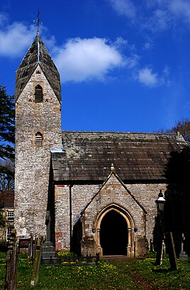
Wormhill Address: Buxton street in High Peak
Attractions near Wormhill
R J Edwards Plumbing & Heating,Litton Mill, Miller's Dale,Wardlow Mires, Wardlow,Dbsdwmjp,White Lodge Car Park, Monsal Dale,Monsal Trail,Headstone Tunnel Viaduct The Middle,Headstone Tunnel,Bulls Head Inn,The Buttery,Dbsgmjpw,Dbsdpgtp,Dbsdampd,Sheldon's Retreat B&B,Far Hill,Winnat's Pass,Dbsapapj,Dbsapapg,Mam Tor Car Park,Blue John CavernHow to get to popular attractions in High Peak with public transportation
Cleckheaton, Heckmondwike,Bradford Royal Infirmary, Bradford,Supertram - Yellow Route: Meadowhall via City Centre to Middlewood, Sheffield,Halton Moor, Leeds,Barnsley Hospital, Barnsley,Ripponden, Ripponden,Oxley Residences, Leeds,Thirsk Railway Station (THI), Thirsk,Notre Dame High School, Sheffield,Merchant Gate, Wakefield,Chapel Allerton Hospital, Leeds,Doncaster Sheffield International Airport, Finningley,New College Pontefract, Pontefract,Skipton, Skipton,Cardigan Fields Leisure Park, Leeds,Ecclesfield School, Ecclesfield,Parkgate, Rotherham,PwC Leeds, Leeds,Yorkshire Ambulance Service HQ, Wakefield,Huddersfield Royal Infirmary, HuddersfieldGet around High Peak by public transport!
Travelling around High Peak has never been so easy. See step by step directions as you travel to any attraction, street or major public transport station. View bus and train timetables, arrival times, service alerts and detailed routes on a map, so you know exactly how to get to anywhere in High Peak.
When travelling to any destination around High Peak use Moovit's Live Directions with Get Off Notifications to know exactly where and how far to walk, how long to wait for your line , and how many stops are left. Moovit will alert you when it’s time to get off — no need to constantly re-check whether yours is the next stop.
Wondering how to use public transport in High Peak or how to pay for public transport in High Peak? Moovit public transport app can help you navigate your way with public transport easily, and at minimum cost. It includes public transport fees, ticket prices, and costs. Looking for a map of High Peak public transport lines? Moovit public transport app shows all public transport maps in High Peak with all bus routes and stops on an interactive map.
High Peak has 1 transport type(s), including: bus, operated by several transport agencies, including First Leeds, First South Yorkshire, First York, First West Yorkshire Ltd, Arriva Yorkshire, Stagecoach Yorkshire, National Rail, First Bradford, First Halifax, Calder Valley & Huddersfield, East Yorkshire, The Keighley Bus Company, South Yorkshire Future Tram, The Harrogate Bus Company, National Rail and TM Travel