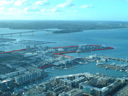
See Wynyard Point, Auckland Harbourside, on the map
Directions to Wynyard Point (Auckland Harbourside) with public transport
The following transport lines have routes that pass near Wynyard Point
 Bus:
Bus: - Train:
- Ferry:
How to get to Wynyard Point by bus?
Click on the bus route to see step by step directions with maps, line arrival times and updated time schedules.
How to get to Wynyard Point by train?
Click on the train route to see step by step directions with maps, line arrival times and updated time schedules.
Bus stations near Wynyard Point in Auckland Harbourside
- Fanshawe Street,3 min walk,
Ferry stations near Wynyard Point in Auckland Harbourside
- Hamer St,18 min walk,
Bus lines to Wynyard Point in Auckland Harbourside
- 20,Wynyard Quarter To St Lukes Via Kingsland,
What are the nearest stations to Wynyard Point?
The nearest stations to Wynyard Point are:
- Fanshawe Street is 188 meters away, 3 min walk.
- Hamer St is 1313 meters away, 18 min walk.
Which bus lines stop near Wynyard Point?
These bus lines stop near Wynyard Point: 20, 75, 82, CTY, NX1.
Which train lines stop near Wynyard Point?
These train lines stop near Wynyard Point: ONE, WEST.
What’s the nearest bus stop to Wynyard Point in Auckland Harbourside?
The nearest bus stop to Wynyard Point in Auckland Harbourside is Fanshawe Street. It’s a 3 min walk away.
What’s the nearest ferry station to Wynyard Point in Auckland Harbourside?
The nearest ferry station to Wynyard Point in Auckland Harbourside is Hamer St. It’s a 18 min walk away.
What time is the first train to Wynyard Point in Auckland Harbourside?
The STH is the first train that goes to Wynyard Point in Auckland Harbourside. It stops nearby at 06:12.
What time is the last train to Wynyard Point in Auckland Harbourside?
The STH is the last train that goes to Wynyard Point in Auckland Harbourside. It stops nearby at 22:56.
What time is the first bus to Wynyard Point in Auckland Harbourside?
The 75 is the first bus that goes to Wynyard Point in Auckland Harbourside. It stops nearby at 03:00.
What time is the last bus to Wynyard Point in Auckland Harbourside?
The CTY is the last bus that goes to Wynyard Point in Auckland Harbourside. It stops nearby at 00:34.
What time is the first ferry to Wynyard Point in Auckland Harbourside?
The MTID is the first ferry that goes to Wynyard Point in Auckland Harbourside. It stops nearby at 06:30.
What time is the last ferry to Wynyard Point in Auckland Harbourside?
The MTIA is the last ferry that goes to Wynyard Point in Auckland Harbourside. It stops nearby at 23:40.
How much is the bus fare to Wynyard Point?
The bus fare to Wynyard Point costs about $1.06 - $3.59.
See Wynyard Point, Auckland Harbourside, on the map
Public Transit to Wynyard Point in Auckland Harbourside
Wondering how to get to Wynyard Point in Auckland Harbourside, New Zealand? Moovit helps you find the best way to get to Wynyard Point with step-by-step directions from the nearest public transit station.
Moovit provides free maps and live directions to help you navigate through your city. View schedules, routes, timetables, and find out how long does it take to get to Wynyard Point in real time.
Looking for the nearest stop or station to Wynyard Point? Check out this list of stops closest to your destination: Fanshawe Street; Hamer St.
Bus:Train:Ferry:
Want to see if there’s another route that gets you there at an earlier time? Moovit helps you find alternative routes or times. Get directions from and directions to Wynyard Point easily from the Moovit App or Website.
We make riding to Wynyard Point easy, which is why over 1.5 million users, including users in Auckland Harbourside, trust Moovit as the best app for public transit. You don’t need to download an individual bus app or train app, Moovit is your all-in-one transit app that helps you find the best bus time or train time available.
For information on prices of bus and train, costs and ride fares to Wynyard Point, please check the Moovit app.
Use the app to navigate to popular places including to the airport, hospital, stadium, grocery store, mall, coffee shop, school, college, and university.
Wynyard Point Address: Hamer Street street in Auckland Harbourside
Attractions near Wynyard Point
American Magic,Firth Concrete,Ineos Team Uk,Westhaven Boat Harbour E Entrance. E Side,Wynyard Wharf,Percy Vos Boatshed,Sealink Hamer Street,Wilco Marine Services,Ww01,S-Tp01,Jellicoe Harbour,Ww02,Sealink - Wynyard Wharf Ferry Terminal,SeaLink Ferry Terminal - Wynyard Wharf,Great Wok Restaurant,63 Jellicoe St,Far Queue,Wynyard Pavilion and Humble Catering,Kaminari Shokudo & Bar,Amore GelatoHow to get to popular attractions in Auckland Harbourside with public transportation
Nespresso Boutique, Newmarket,Mercy Specialist Centre, Epsom North,Helensville, Helensville,Golf Warehouse & Driving Range - Ellerslie, Abbotts Park,Wairau Road, Target Road,Southmall, Manurewa Central,Rocket Park, Mt Albert Central,Eastridge Shopping Centre, Mission Bay,Dunkin' Donuts, Mangere South,Western Springs, Point Chevalier South,The Patriot, Mt Victoria,Monsoon Poon, Auckland Harbourside,Daruma Sushi-go-Round, Greenmount,Greenhithe Cafe & Restaurant, Greenhithe,香面访 Tasty Noodles, Three Kings,Theobroma Chocolate Lounge, Mt Wellington South,Wendy's Old Fashioned Hamburgers, Ellerslie South,Eden Park, Kingsland,Doolan Brothers, Ellerslie North,300 Richmond Road, Grey Lynn WestGet around Auckland Harbourside by public transport!
Travelling around Auckland Harbourside has never been so easy. See step by step directions as you travel to any attraction, street or major public transport station. View bus and train timetables, arrival times, service alerts and detailed routes on a map, so you know exactly how to get to anywhere in Auckland Harbourside.
When travelling to any destination around Auckland Harbourside use Moovit's Live Directions with Get Off Notifications to know exactly where and how far to walk, how long to wait for your line , and how many stops are left. Moovit will alert you when it’s time to get off — no need to constantly re-check whether yours is the next stop.
Wondering how to use public transport in Auckland Harbourside or how to pay for public transport in Auckland Harbourside? Moovit public transport app can help you navigate your way with public transport easily, and at minimum cost. It includes public transport fees, ticket prices, and costs. Looking for a map of Auckland Harbourside public transport lines? Moovit public transport app shows all public transport maps in Auckland Harbourside with all bus or train routes and stops on an interactive map.
Auckland Harbourside has 2 transport type(s), including: bus or train, operated by several transport agencies, including AT Metro, AT Metro Bus, Fullers360, SeaLink Pine Harbour, Belaire Ferries, Tranzit Group Ltd, New Zealand Bus, Pavlovich Transport Solutions, Bayes Coachlines, Howick and Eastern, Ritchies Transport, Waiheke Bus Company, Mahu City Express, Go Bus and SeaLink