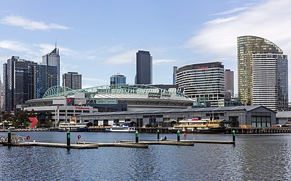
Directions to Yarra's Edge (Docklands) with public transport
The following transport lines have routes that pass near Yarra's Edge
Bus:
Train:
See Yarra's Edge, Docklands, on the map
How to get to Yarra's Edge by Bus?
Click on the Bus route to see step by step directions with maps, line arrival times and updated time schedules.
How to get to Yarra's Edge by Train?
Click on the Train route to see step by step directions with maps, line arrival times and updated time schedules.
Bus stations near Yarra's Edge in Docklands
- Hall St/Lorimer St (Port Melbourne),6 min walk,
Tram stations near Yarra's Edge in Docklands
- D3-Stadium Precinct - Bourke St/Harbour Esp (Docklands),28 min walk,
- D17-Merchant St/Collins St (Docklands),33 min walk,
- D10-New Quay Prom/Docklands Dr (Docklands),48 min walk,
Bus lines to Yarra's Edge in Docklands
- 237,City (Queen Victoria Market),
What are the nearest stations to Yarra's Edge?
The nearest stations to Yarra's Edge are:
- Hall St/Lorimer St (Port Melbourne) is 393 meters away, 6 min walk.
- D3-Stadium Precinct - Bourke St/Harbour Esp (Docklands) is 2083 meters away, 28 min walk.
- D17-Merchant St/Collins St (Docklands) is 2542 meters away, 33 min walk.
- D10-New Quay Prom/Docklands Dr (Docklands) is 3727 meters away, 48 min walk.
Which Bus lines stop near Yarra's Edge?
These Bus lines stop near Yarra's Edge: 232, 237
Which Train lines stop near Yarra's Edge?
These Train lines stop near Yarra's Edge: LILYDALE, PAKENHAM, SUNBURY, WERRIBEE
What’s the nearest tram station to Yarra's Edge in Docklands?
The nearest tram station to Yarra's Edge in Docklands is D3-Stadium Precinct - Bourke St/Harbour Esp (Docklands). It’s a 28 min walk away.
What’s the nearest bus stop to Yarra's Edge in Docklands?
The nearest bus stop to Yarra's Edge in Docklands is Hall St/Lorimer St (Port Melbourne). It’s a 6 min walk away.
What time is the first Tram to Yarra's Edge in Docklands?
The 70 is the first Tram that goes to Yarra's Edge in Docklands. It stops nearby at 05:33.
What time is the last Tram to Yarra's Edge in Docklands?
The 11 is the last Tram that goes to Yarra's Edge in Docklands. It stops nearby at 00:39.
What time is the first Bus to Yarra's Edge in Docklands?
The 237 is the first Bus that goes to Yarra's Edge in Docklands. It stops nearby at 05:55.
What time is the last Bus to Yarra's Edge in Docklands?
The 237 is the last Bus that goes to Yarra's Edge in Docklands. It stops nearby at 21:07.
How much is the Tram fare to Yarra's Edge?
The Tram fare to Yarra's Edge costs about $3.10 - $4.60.
How much is the Bus fare to Yarra's Edge?
The Bus fare to Yarra's Edge costs about $3.10 - $4.60.
See Yarra's Edge, Docklands, on the map

Public Transit to Yarra's Edge in Docklands
Wondering how to get to Yarra's Edge in Docklands, Australia? Moovit helps you find the best way to get to Yarra's Edge with step-by-step directions from the nearest public transit station.
Moovit provides free maps and live directions to help you navigate through your city. View schedules, routes, timetables, and find out how long does it take to get to Yarra's Edge in real time.
Looking for the nearest stop or station to Yarra's Edge? Check out this list of stops closest to your destination: Hall St/Lorimer St (Port Melbourne); D3-Stadium Precinct - Bourke St/Harbour Esp (Docklands); D17-Merchant St/Collins St (Docklands); D10-New Quay Prom/Docklands Dr (Docklands).
Bus:Train:
Want to see if there’s another route that gets you there at an earlier time? Moovit helps you find alternative routes or times. Get directions from and directions to Yarra's Edge easily from the Moovit App or Website.
We make riding to Yarra's Edge easy, which is why over 1.5 million users, including users in Docklands, trust Moovit as the best app for public transit. You don’t need to download an individual bus app or train app, Moovit is your all-in-one transit app that helps you find the best bus time or train time available.
For information on prices of Bus, Train and Tram, costs and ride fares to Yarra's Edge, please check the Moovit app.
Use the app to navigate to popular places including to the airport, hospital, stadium, grocery store, mall, coffee shop, school, college, and university.
Yarra's Edge Address: South Wharf Dr 103 Docklands, 3008 Melbourne street in Docklands

Attractions near Yarra's Edge
- Jumbo South Wharf Pt
- Chargefox
- 850 Lorimer Street
- Miiy Pty
- Novo Shoes Group
- Cotton On South Whar
- Cargo Homes Yarra's Edge
- ABB Australia
- Tangible Technology
- Lanier
- Dexion Citiport
- Hoffmann SPV
- Silk Contract Logistics
- Kalari-National Office
- GKN Aerospace Engineering
- ISUZU
- Linda & Dita
- Dreamwalk Interactive
- Wellcom Pty. LTD.
- Wellcom Worldwide
How to get to popular attractions in Docklands with public transportation
- Lorne, Lorne
- Glen Eira College, Caulfield East
- Carey Baptist Grammar School, Kew
- Waverly Shopping Centre, Mulgrave
- Doncaster Park & Ride, Doncaster
- Moonee Ponds, Moonee Ponds
- St Albans Station, St Albans
- Corio Central, Corio
- Hughesdale Station, Hughesdale
- Watsonia Station, Watsonia
- Craigieburn Station, Craigieburn
- Caroline Springs, Caroline Springs
- State Library Of Victoria, Melbourne
- MLC, Melbourne
- Box Hill Institute Of Tafe (Elgar Campus), Mont Albert
- National Gallery Of Victoria (Ngv International), Southbank
- Doncaster Park And Ride, Doncaster
- Coles Eden Rise, Berwick
- Qv, Melbourne
- Tram Stop 138 - Luna Park (3a / 16 / 96), St Kilda