Directions to Yishun (Northwest) with public transport
The following transport lines have routes that pass near Yishun
How to get to Yishun by bus?
Click on the bus route to see step by step directions with maps, line arrival times and updated time schedules.
How to get to Yishun by metro?
Click on the metro route to see step by step directions with maps, line arrival times and updated time schedules.
Bus stations near Yishun in Northwest
- Yishun Ring Rd - Aft Chong Pang Cc (59139), 6 min walk,
- Yishun Ave 5 - Blk 701 (59111), 8 min walk,
- Yishun Ave 5 - Opp Blk 701a (59119), 9 min walk,
- Yishun Ave 2 - Blk 220 (59099), 12 min walk,
- Yishun Ave 2 - Opp Darul Makmur Mque (59251), 12 min walk,
Metro stations near Yishun in Northwest
- Yishun (NS13), 11 min walk,
Bus lines to Yishun in Northwest
- 670, [AM]: Marina Blvd (Marina Bay Financial Ctr) [PM]: Yishun Ave 7 (Blk 289),
- 800, Yishun Int ↺ Sembawang Rd,
- 812, Yishun Int ↺ Yishun Ave 4 & 3,
- SSC SHUTTLE, Sembawang Shopping Ctr ↺ Sembawang/Yishun/Woodlands/Canberra,
- 171, Yishun Int ↺ Bukit Panjang MRT,
- 740, [AM]: Changi Sth Ave 4 (Bef Changi Sth St 1) [PM]: Sembawang Dr (Blk 478),
- 807, Yishun Int ↺ Yishun St 71,
- 856, Yishun Int ↔ Woodlands Int,
- 858, Woodlands Int ↺ Changi Airport,
- 859, Sembawang Int ↺ Yishun Int,
- 969, Woodlands Int ↔ Tampines Int,
- AC7, Yishun Int ↔ JB CIQ,
- 811, Yishun Int ↺ Yishun Ave 5 & 1,
- 811A, Yishun Int → Yishun Ave 5 (Blk 151),
- 858A, Woodlands Int → Yishun Ave 2 (Opp Yishun Stn),
- 883M, Sembawang Int ↺ Sembawang Rd,
- 811T, Yishun Ave 7 (Opp Blk 288) / Yishun Int → Yishun Ctrl (Opp Blk 201),
- 859T, Sembawang Int → Yishun Int,
- 117, Punggol Temp Int ↔ Sembawang Int,
- 169, Woodlands Int ↔ Ang Mo Kio Int,
What are the nearest stations to Yishun?
The nearest stations to Yishun are:
- Yishun Ring Rd - Aft Chong Pang Cc (59139) is 406 meters away, 6 min walk.
- Yishun Ave 5 - Blk 701 (59111) is 595 meters away, 8 min walk.
- Yishun Ave 5 - Opp Blk 701a (59119) is 658 meters away, 9 min walk.
- Yishun (NS13) is 816 meters away, 11 min walk.
- Yishun Ave 2 - Blk 220 (59099) is 888 meters away, 12 min walk.
- Yishun Ave 2 - Opp Darul Makmur Mque (59251) is 905 meters away, 12 min walk.
Which bus lines stop near Yishun?
These bus lines stop near Yishun: 171, 812, 969.
Which metro line stops near Yishun?
NORTH SOUTH LINE
What’s the nearest metro station to Yishun in Northwest?
The nearest metro station to Yishun in Northwest is Yishun (NS13). It’s a 11 min walk away.
What’s the nearest bus stop to Yishun in Northwest?
The nearest bus stop to Yishun in Northwest is Yishun Ring Rd - Aft Chong Pang Cc (59139). It’s a 6 min walk away.
What time is the first metro to Yishun in Northwest?
The NORTH SOUTH LINE is the first metro that goes to Yishun in Northwest. It stops nearby at 05:46.
What time is the last metro to Yishun in Northwest?
The NORTH SOUTH LINE is the last metro that goes to Yishun in Northwest. It stops nearby at 00:51.
What time is the first bus to Yishun in Northwest?
The 858 is the first bus that goes to Yishun in Northwest. It stops nearby at 05:25.
What time is the last bus to Yishun in Northwest?
The 812 is the last bus that goes to Yishun in Northwest. It stops nearby at 01:30.
See Yishun, Northwest, on the map
Public Transit to Yishun in Northwest
Wondering how to get to Yishun in Northwest, Singapore? Moovit helps you find the best way to get to Yishun with step-by-step directions from the nearest public transit station.
Moovit provides free maps and live directions to help you navigate through your city. View schedules, routes, timetables, and find out how long does it take to get to Yishun in real time.
Looking for the nearest stop or station to Yishun? Check out this list of stops closest to your destination: Yishun Ring Rd - Aft Chong Pang Cc (59139); Yishun Ave 5 - Blk 701 (59111); Yishun Ave 5 - Opp Blk 701a (59119); Yishun (NS13); Yishun Ave 2 - Blk 220 (59099); Yishun Ave 2 - Opp Darul Makmur Mque (59251).
Bus: 171, 812, 969, 670, 800, SSC SHUTTLE, 740, 807, 856, 858, 811, 811A, 858A, 883M, 811T, 117, 169, 804, 883, 965, 776, 883B.Metro: NORTH SOUTH LINE.
Want to see if there’s another route that gets you there at an earlier time? Moovit helps you find alternative routes or times. Get directions from and directions to Yishun easily from the Moovit App or Website.
We make riding to Yishun easy, which is why over 1.5 million users, including users in Northwest, trust Moovit as the best app for public transit. You don’t need to download an individual bus app or train app, Moovit is your all-in-one transit app that helps you find the best bus time or train time available.
For information on prices of bus and metro, costs and ride fares to Yishun, please check the Moovit app.
Use the app to navigate to popular places including to the airport, hospital, stadium, grocery store, mall, coffee shop, school, college, and university.
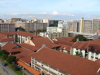
Location: Northwest, Singapore
Attractions near Yishun
Blk 173 Yishun Ave 7,132 Yishun Street 11,Blk 131 Yishun street 11,Blk 123 Yishun Coffee Shop,Blk 126 Yishun St11 Car Parkr,Candyland Blk 110 Yishun Ring Road,Block 137 BBQ Joint,Ah Tong Street Spccer Court,Blk 139 basketball court @ Yishun,Yishun Locksmith @ Yishun Bus Interchange,Huat Kee Kway Chap 發記馃汁·豬雜湯,Parkway health @ Yishun,Chong Pang View Yishun St 11,Lutheran Child Care Centre,Chew Shong Yuen,123,Epok Epok International,Tong Lam Photo Studio & Trading Centre,Huat Kee Kway Chap,Lu Jia Teochew KuehHow to get to popular attractions in Northwest with public transportation
Jotun (Singapore) Pte Ltd, Southwest,Punggol Park, Northeast,Sentosa Fire Station (Stn18), Southwest,Aspen Heights, Singapore,One Raffles Quay, Singapore,Modesto's, Northwest,4 Kian Teck Ave, Southwest,Jurong camp SOC ground, Southwest,Goodwood Park Hotel, Singapore,Tengah Airbase Malcolm Canteen, Southwest,善莲堂南海观音佛祖, Northwest,Jalan Besar Plaza, Singapore,The Pinnacle@Duxton, Singapore,Springdale Condominium, Northwest,Rang Mahal Pavilion, Southwest,Century Square, Northeast,Multi-Storey Carpark @ Sunshine Place, Southwest,Church Of the Nativity Of the Blessed Virgin Mary, Northeast,Bowen Secondary School, Northeast,Perennial Business City, SouthwestGet around Singapore by public transport!
Travelling around Singapore has never been so easy. See step by step directions as you travel to any attraction, street or major public transport station. View bus and train timetables, arrival times, service alerts and detailed routes on a map, so you know exactly how to get to anywhere in Singapore.
When travelling to any destination around Singapore use Moovit's Live Directions with Get Off Notifications to know exactly where and how far to walk, how long to wait for your line , and how many stops are left. Moovit will alert you when it’s time to get off — no need to constantly re-check whether yours is the next stop.
Wondering how to use public transport in Singapore or how to pay for public transport in Singapore? Moovit public transport app can help you navigate your way with public transport easily, and at minimum cost. It includes public transport fees, ticket prices, and costs. Looking for a map of Singapore public transport lines? Moovit public transport app shows all public transport maps in Singapore with all Bus, Train, Metro, MRT & LRT, Ferry and Cable Car routes and stops on an interactive map.
Singapore has 6 transport type(s), including: Bus, Train, Metro, MRT & LRT, Ferry and Cable Car, operated by several transport agencies, including SMRT, SBS Transit, MRT/LRT Replacement Services, Tower Transit, Go-Ahead Singapore, Premium Bus, City Direct Bus, Changi Airport, Sentosa Development Corporation, Cross Border Bus, Singapore Cable Car Network, NUS Shuttle (ComfortDelGro), NTU Shuttle (ComfortDelGro), JTC Corp, Shuttle Bus (Appx. Schedule)