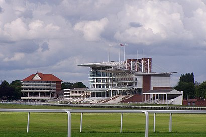
York Racecourse stop - Thursday schedule
| Line | Direction | Time |
|---|---|---|
| 26 | York | 07:39 |
| 26 | York | 08:39 |
| 26 | York | 09:39 |
| 26 | York | 10:39 |
| 21 | York | 10:46 |
| 26 | York | 11:39 |
| 26 | York | 12:39 |
| 21 | York | 12:46 |
| 26 | York | 13:39 |
| 26 | York | 14:39 |
| 21 | York | 14:46 |
| 26 | York | 15:39 |
| 26 | York | 16:39 |
| 21 | York | 16:46 |
| 26 | York | 17:43 |
| 26 | York | 18:47 |
| 11 | York | 18:55 |
| 11 | Bishopthorpe | 19:13 |
| 11 | York | 19:46 |
| 11 | Bishopthorpe | 20:21 |
| 11 | York | 20:45 |
| 11 | Bishopthorpe | 21:21 |
| 11 | York | 21:45 |
| 11 | Bishopthorpe | 22:21 |
| 11 | York | 22:46 |
See York Racecourse on the map
Directions to York Racecourse with public transportation
The following transport lines have routes that pass near York Racecourse
 Bus:
Bus: - Train:
How to get to York Racecourse by bus?
Click on the bus route to see step by step directions with maps, line arrival times and updated time schedules.
How to get to York Racecourse by train?
Click on the train route to see step by step directions with maps, line arrival times and updated time schedules.
Bus stations near York Racecourse
- York Racecourse,1 min walk,
- Nelson's Lane,4 min walk,
- Knavesmire Primary School,4 min walk,
- Pulleyn Drive,6 min walk,
Train stations near York Racecourse
- York,8 min walk,
Bus routes to York Racecourse
- CS,South Bank,
- 197,York,
- 4,York,
- Y12,Woodthorpe,
- 13,Copmanthorpe,
- 14,Haxby,
- 21,Bolton Percy,
- 840,Thornton-Le-Dale,
- 843,Peasholm Park,
- 875,Wigginton,
- 11,York,
- 26,South Bank,
- 37,Tadcaster,
What are the nearest stations to York Racecourse?
The nearest stations to York Racecourse are:
- York Racecourse is 34 meters away, 1 min walk.
- Nelson's Lane is 213 meters away, 4 min walk.
- Knavesmire Primary School is 240 meters away, 4 min walk.
- Pulleyn Drive is 410 meters away, 6 min walk.
- York is 577 meters away, 8 min walk.
Which bus lines stop near York Racecourse?
These bus lines stop near York Racecourse: 4, 843, CS.
Which train lines stop near York Racecourse?
These train lines stop near York Racecourse: CROSSCOUNTRY, NORTHERN.
What’s the nearest train station to York Racecourse?
The nearest train station to York Racecourse is York. It’s a 8 min walk away.
What’s the nearest bus stop to York Racecourse?
The nearest bus stop to York Racecourse is York Racecourse. It’s a 1 min walk away.
What time is the first train to York Racecourse?
The LONDON NORTH EASTERN RAILWAY is the first train that goes to York Racecourse. It stops nearby at 08:00.
What time is the last train to York Racecourse?
The TRANSPENNINE EXPRESS is the last train that goes to York Racecourse. It stops nearby at 04:46.
What time is the first bus to York Racecourse?
The 4 is the first bus that goes to York Racecourse. It stops nearby at 05:46.
What time is the last bus to York Racecourse?
The 4 is the last bus that goes to York Racecourse. It stops nearby at 23:16.
See York Racecourse on the map
Public transport to York Racecourse stop (ID: 32900361)
Looking for directions to York Racecourse in York, United Kingdom?
Download the Moovit App to find the current schedule and step-by-step directions for Bus or Train routes that pass through York Racecourse.
Looking for the nearest stops closest to York Racecourse ? Check out this list of closest stops to your destination: York Racecourse; Nelson's Lane; Knavesmire Primary School; Pulleyn Drive; York.
Bus:Train:
We make riding on public transit to York Racecourse easy, which is why over 1.5 million users, including users in York trust Moovit as the best app for public transit.
Use the app to navigate to popular places including to the airport, hospital, stadium, grocery store, mall, coffee shop, school, college, and university.
York Racecourse stop’s code is 32900361
The first line to this stop is 26, at 07:39, and the last line is 11 at 23:20.
This stop serves York Pullman, Coastliner and First York’s lines
Popular routes from York Racecourse
Train station near York Racecourse
YorkPopular public transport stations in York
Old Moor Lane,Brough Welton Road,Melton Monks Way,Rother Valley Way/Station Road,Rail Station (Stop Rj),Stonebow,Princess Avenue/Junction Road,Sprotbrough Road/Northfield Road,Strensall Camp,Falmouth Street,Hull Interchange,Doncaster Road/Mansfield Crescent,King Edward Road/Alexandra Street,Monks Cross Park And Ride,Full Sutton Moor Lane,Baysgarth School,Goole Centenary Road,Lady Lumley's School,Cleveland Street/St Sepulchre Gate West,Victor StreetGet around York by public transport!
Travelling around York has never been so easy. See step by step directions as you travel to any attraction, street or major public transport station. View bus and train timetables, arrival times, service alerts and detailed routes on a map, so you know exactly how to get to anywhere in York.
When travelling to any destination around York use Moovit's Live Directions with Get Off Notifications to know exactly where and how far to walk, how long to wait for your line , and how many stops are left. Moovit will alert you when it’s time to get off — no need to constantly re-check whether yours is the next stop.
Wondering how to use public transport in York or how to pay for public transport in York? Moovit public transport app can help you navigate your way with public transport easily, and at minimum cost. It includes public transport fees, ticket prices, and costs. Looking for a map of York public transport lines? Moovit public transport app shows all public transport maps in York with all bus or train routes and stops on an interactive map.
York has 2 transport type(s), including: bus or train, operated by several transport agencies, including First Leeds, First South Yorkshire, First York, Arriva Yorkshire, Stagecoach Yorkshire, National Rail, First Bradford, First Halifax, Calder Valley & Huddersfield, East Yorkshire, The Keighley Bus Company, South Yorkshire Future Tram, The Harrogate Bus Company, National Rail, TM Travel and Coastliner