Directions to Yowie Bay with public transportation
The following transport lines have routes that pass near Yowie Bay
 Bus:
Bus: - Train:
How to get to Yowie Bay by bus?
Click on the bus route to see step by step directions with maps, line arrival times and updated time schedules.
How to get to Yowie Bay by train?
Click on the train route to see step by step directions with maps, line arrival times and updated time schedules.
Bus stations near Yowie Bay
- Warrah Rd At Maroopna Rd,4 min walk,
Bus routes to Yowie Bay
- 973,Miranda Westfield,
What are the nearest stations to Yowie Bay?
The nearest stations to Yowie Bay are:
- Warrah Rd At Maroopna Rd is 240 meters away, 4 min walk.
Which bus lines stop near Yowie Bay?
These bus lines stop near Yowie Bay: 971, N11.
Which train line stops near Yowie Bay?
T4
What’s the nearest bus stop to Yowie Bay?
The nearest bus stop to Yowie Bay is Warrah Rd At Maroopna Rd. It’s a 4 min walk away.
See Yowie Bay on the map
Public Transportation to Yowie Bay
Wondering how to get to Yowie Bay, Australia? Moovit helps you find the best way to get to Yowie Bay with step-by-step directions from the nearest public transit station.
Moovit provides free maps and live directions to help you navigate through your city. View schedules, routes, timetables, and find out how long does it take to get to Yowie Bay in real time.
Looking for the nearest stop or station to Yowie Bay? Check out this list of stops closest to your destination: Warrah Rd At Maroopna Rd.
Bus:Train:
Want to see if there’s another route that gets you there at an earlier time? Moovit helps you find alternative routes or times. Get directions from and directions to Yowie Bay easily from the Moovit App or Website.
We make riding to Yowie Bay easy, which is why over 1.5 million users, including users in Yowie Bay, trust Moovit as the best app for public transit. You don’t need to download an individual bus app or train app, Moovit is your all-in-one transit app that helps you find the best bus time or train time available.
For information on prices of train and bus, costs and ride fares to Yowie Bay, please check the Moovit app.
Use the app to navigate to popular places including to the airport, hospital, stadium, grocery store, mall, coffee shop, school, college, and university.
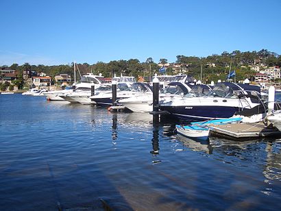
Location: Yowie Bay, Sydney
Attractions near Yowie Bay
42-64 Warrah Road,zaney's,Wonga Road Reserve,Zac's house of beer,19 Wyralla Road,Henry Turner Reserve,The Rose Glenn,Alkaringa Reserve,Gymea Bay Baths,Post Box Cafe,Lightning Point,Yowie Point,Miranda,Sugarfix,Calliope Road,Mimco Miranda,Belle Petite Cafe,Gymea Bay,Aqua Carwash,Hype DCHow to get to popular attractions in Yowie Bay with public transportation
Ms. G's, Potts Point,Macarthur Station, Campbelltown (NSW),Chatswood Station (Main Concourse), Chatswood,Epping Station (Concourse), Epping (NSW),Macquarie Centre Shopping Centre, Macquarie Park,Manly Wharf Bar,Revesby Station, Revesby,Holiday Inn, Potts Point,Coogee Pavilion, Coogee (NSW),Homebush Station, Homebush (NSW),Chat Thai, Haymarket,The Star Casino, Pyrmont,Forestway, Frenchs Forest,Central Station (Eddy Avenue Forecourt), Haymarket,Rose Of Australia Hotel, Erskineville,Darling Harbour,Single O, Surry Hills,Manly, Manly (NSW),Quakers Hill Station, Quakers Hill,Strathfield Station (Main Concourse), Strathfield (NSW)Get around Yowie Bay by public transport!
Travelling around Yowie Bay has never been so easy. See step by step directions as you travel to any attraction, street or major public transport station. View bus and train timetables, arrival times, service alerts and detailed routes on a map, so you know exactly how to get to anywhere in Yowie Bay.
When travelling to any destination around Yowie Bay use Moovit's Live Directions with Get Off Notifications to know exactly where and how far to walk, how long to wait for your line , and how many stops are left. Moovit will alert you when it’s time to get off — no need to constantly re-check whether yours is the next stop.
Wondering how to use public transport in Yowie Bay or how to pay for public transport in Yowie Bay? Moovit public transport app can help you navigate your way with public transport easily, and at minimum cost. It includes public transport fees, ticket prices, and costs. Looking for a map of Yowie Bay public transport lines? Moovit public transport app shows all public transport maps in Yowie Bay with all train or bus routes and stops on an interactive map.
Yowie Bay has 2 transport type(s), including: train or bus, operated by several transport agencies, including Sydney Metro, Sydney Trains, Sydney Light Rail, Sydney Ferries, Intercity Trains, Intercity Train, NSW TrainLink, CDC NSW R14, U-Go Mobility, Keolis Downer Northern Beaches, Manly Fast Ferry, Transdev John Holland Buses, Busways, Busways North West and Dysons Buslines