The Most Popular Urban Mobility App in Prague.
All local mobility options in one app
| Line | Direction | Time |
|---|---|---|
| 98 | Spojovací | 5:02 |
| 11 | Spojovací | 5:06 |
| 26 | Dědina | 5:08 |
| 7 | Lehovec | 5:10 |
| 97 | Vozovna Žižkov | 5:11 |
| 98 | Vozovna Žižkov | 5:14 |
| 10 | Sídliště Ďáblice | 5:19 |
| 11 | Spojovací | 5:26 |
| 26 | Dědina | 5:28 |
| 7 | Lehovec | 5:30 |
| 10 | Sídliště Ďáblice | 5:40 |
| 26 | Dědina | 5:46 |
| 11 | Spojovací | 5:47 |
| 7 | Lehovec | 5:51 |
| 10 | Sídliště Ďáblice | 5:59 |
| 26 | Dědina | 6:03 |
| 31 | Vysočanská | 6:06 |
| 11 | Spojovací | 6:08 |
| 7 | Lehovec | 6:11 |
| 10 | Sídliště Ďáblice | 6:16 |
| 26 | Dědina | 6:18 |
| 7 | Lehovec | 6:23 |
| 11 | Spojovací | 6:27 |
| 26 | Dědina | 6:28 |
| 7 | Lehovec | 6:28 |
The following transit lines have routes that pass near Želivského (O)
Click on the bus route to see step by step directions with maps, line arrival times and updated time schedules.
Click on the train route to see step by step directions with maps, line arrival times and updated time schedules.
Click on the subway route to see step by step directions with maps, line arrival times and updated time schedules.
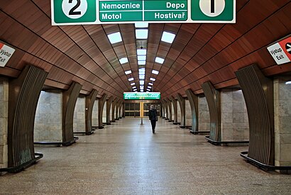
The closest stations to Želivského (O) are:
These bus lines stop near Želivského (O): 124, 133, 135, 146, 148, 150, 188, AE.
These train lines stop near Želivského (O): EX6, S4, S9.
A
10
The nearest light rail station to Želivského (O) in Prague is Želivského (A). It’s a 3 min walk away.
The nearest bus stops to Želivského (O) in Prague are Želivského (V) and Želivského (H). The closest one is a 3 min walk away.
The 34 is the first light rail that goes to Želivského (O) in Prague. It stops nearby at 4:23 AM.
The 91 is the last light rail that goes to Želivského (O) in Prague. It stops nearby at 3:54 AM.
The 136 is the first bus that goes to Želivského (O) in Prague. It stops nearby at 4:35 AM.
The 908 is the last bus that goes to Želivského (O) in Prague. It stops nearby at 3:35 AM.
Looking for directions to Želivského (O) in Prague, Czech Republic?
Download the Moovit App to find the current schedule and step-by-step directions for Bus, Subway, Train or Light Rail routes that pass through Želivského (O).
Looking for the nearest stops closest to Želivského (O) ? Check out this list of closest stops to your destination: Želivského (V); Želivského (H); Želivského (A); Mezi Hřbitovy (A); Želivského (D); Želivského (L); Basilejské Náměstí (A); Vlašimská (B).
Bus:Train:Subway:Light Rail:
We make riding on public transit to Želivského (O) easy, which is why over 1.5 million users, including users in Prague trust Moovit as the best app for public transit.
Use the app to navigate to popular places including to the airport, hospital, stadium, grocery store, mall, coffee shop, school, college, and university.
The first line to this station is 98, at 5:02, and the last line is 96 at 4:44.
This station serves DPP’s lines
Traveling around Prague has never been so easy. See step by step directions as you travel to any attraction, street or major public transit station. View bus and train schedules, arrival times, service alerts and detailed routes on a map, so you know exactly how to get to anywhere in Prague.
When traveling to any destination around Prague use Moovit's Live Directions with Get Off Notifications to know exactly where and how far to walk, how long to wait for your line, and how many stops are left. Moovit will alert you when it's time to get off — no need to constantly re-check whether yours is the next stop.
Wondering how to use public transit in Prague or how to pay for public transit in Prague? Moovit public transit app can help you navigate your way with public transit easily, and at minimum cost. It includes public transit fees, ticket prices, and costs. Looking for a map of Prague public transit lines? Moovit public transit app shows all public transit maps in Prague with all bus, subway, train or light rail routes and stops on an interactive map.
Prague has 4 transit type(s), including: bus, subway, train or light rail, operated by several transit agencies, including Dopravní podnik měst Liberce a Jablonce nad Nisou, a.s., Dopravní podnik měst Liberce a Jablonce nad Nisou, a.s., BusLine jižní Čechy s.r.o., Railway Capital a.s., Dopravní společnost Ústeckého kraje, příspěvková organizace, DPP, DPP, DPP, DPP, Dopravní podnik hl. m. Prahy, akciová společnost, České dráhy, a.s., KŽC Doprava,s.r.o., ARRIVA vlaky s.r.o., KAD BUS spol. s r.o. and ARRIVA PRAHA s.r.o