Directions to Переделкино (Ново-Переделкино) with public transportation
The following transit lines have routes that pass near Переделкино
Directions to Переделкино (Ново-Переделкино) with public transportation
The following transit lines have routes that pass near Переделкино
How to get to Переделкино by bus?
Click on the bus route to see step by step directions with maps, line arrival times and updated time schedules.
How to get to Переделкино by train?
Click on the train route to see step by step directions with maps, line arrival times and updated time schedules.
How to get to Переделкино by metro?
Click on the metro route to see step by step directions with maps, line arrival times and updated time schedules.
Bus lines to Переделкино in Ново-Переделкино
- 316,улица Горького - улица Федосьино,
- 497,метро Рассказовка - 3-я улица Лазенки,
- 550,метро Рассказовка - платформа Переделкино,
- 579М,Лётчика Гривцевца - Платформа Переделкино,
- 729,Чоботовская ал., 7,
- 812,Лукино,
What are the closest stations to Переделкино?
The closest stations to Переделкино are:
- платформа Переделкино is 122 meters away, 2 min walk.
- Платф. Переделкино is 127 meters away, 2 min walk.
- Новопеределкинская is 148 meters away, 2 min walk.
- Лукино is 1172 meters away, 16 min walk.
- Боровское Шоссе (Borovskoye Shosse) is 1793 meters away, 23 min walk.
Which bus lines stop near Переделкино?
These bus lines stop near Переделкино: 316, 550, 729, 767.
Which train line stops near Переделкино?
КИЕВСКОЕ НАПРАВЛЕНИЕ
Which metro line stops near Переделкино?
8А
What’s the nearest metro station to Переделкино in Ново-Переделкино?
The nearest metro station to Переделкино in Ново-Переделкино is Боровское Шоссе (Borovskoye Shosse). It’s a 23 min walk away.
What’s the nearest bus stop to Переделкино in Ново-Переделкино?
The nearest bus stops to Переделкино in Ново-Переделкино are платформа Переделкино and Платф. Переделкино. The closest one is a 2 min walk away.
What’s the nearest shuttle station to Переделкино in Ново-Переделкино?
The nearest shuttle station to Переделкино in Ново-Переделкино is Новопеределкинская. It’s a 2 min walk away.
What time is the first metro to Переделкино in Ново-Переделкино?
The 8А is the first metro that goes to Переделкино in Ново-Переделкино. It stops nearby at 6:00 AM.
What time is the last metro to Переделкино in Ново-Переделкино?
The 8А is the last metro that goes to Переделкино in Ново-Переделкино. It stops nearby at 1:22 AM.
What time is the first bus to Переделкино in Ново-Переделкино?
The 812 is the first bus that goes to Переделкино in Ново-Переделкино. It stops nearby at 5:45 AM.
What time is the last bus to Переделкино in Ново-Переделкино?
The 316 is the last bus that goes to Переделкино in Ново-Переделкино. It stops nearby at 12:38 AM.
What time is the first shuttle to Переделкино in Ново-Переделкино?
The 579М is the first shuttle that goes to Переделкино in Ново-Переделкино. It stops nearby at 5:05 AM.
What time is the last shuttle to Переделкино in Ново-Переделкино?
The 985 is the last shuttle that goes to Переделкино in Ново-Переделкино. It stops nearby at 12:39 AM.
See Переделкино, Ново-Переделкино, on the map
Public Transit to Переделкино in Ново-Переделкино
Wondering how to get to Переделкино in Ново-Переделкино, Russia? Moovit helps you find the best way to get to Переделкино with step-by-step directions from the nearest public transit station.
Moovit provides free maps and live directions to help you navigate through your city. View schedules, routes, timetables, and find out how long does it take to get to Переделкино in real time.
Looking for the nearest stop or station to Переделкино? Check out this list of stops closest to your destination: платформа Переделкино; Платф. Переделкино; Новопеределкинская; Лукино; Боровское Шоссе (Borovskoye Shosse).
Bus: 316, 550, 729, 767, 497, 579М, 812.Train: КИЕВСКОЕ НАПРАВЛЕНИЕ.Metro: 8А.Shuttle: 985.
Want to see if there’s another route that gets you there at an earlier time? Moovit helps you find alternative routes or times. Get directions from and directions to Переделкино easily from the Moovit App or Website.
We make riding to Переделкино easy, which is why over 1.5 million users, including users in Ново-Переделкино, trust Moovit as the best app for public transit. You don’t need to download an individual bus app or train app, Moovit is your all-in-one transit app that helps you find the best bus time or train time available.
For information on prices of bus, train and metro, costs and ride fares to Переделкино, please check the Moovit app.
Use the app to navigate to popular places including to the airport, hospital, stadium, grocery store, mall, coffee shop, school, college, and university.
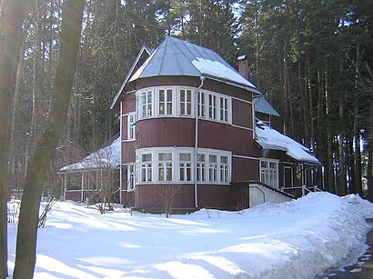
Переделкино Address: 1-я Чоботовская аллея street in Ново-Переделкино
Peredelkino (Russian: Переделкино, IPA: [pʲɪrʲɪˈdʲelkʲɪnə]) is a dacha complex situated just to the southwest of Moscow, Russia.Wiki
Attractions near Переделкино
Ж/д платформа Переделкино,Тпу Переделкино,Торговые Ряды,Остановка «Платформа Переделкино»,746й автобус (Переделкино),Станция-Переделкино,Цветы,Продуктовый Магазин,Мельница,Планета Секонд-Хенд,Переделкино,Переделкино,Яна Маркет 99,Советская аптека,Schponka,Клининговая Компания Домачисто - Цены на Услуги,Смешные Цены,Мастерская по ремонту одежды,Italclean,Хач Хач Хачапури ЛовкачHow to get to popular attractions in Ново-Переделкино with public transit
McDonald's, Ново-Переделкино,McDonald's, Одинцово,Рублёво,ММДЦ «Москва-Сити», Пресненский,Спортлэнд, Ясенево,M&G, Крылатское,Остановка «Метро Кунцевская», Фили-Давыдково,ТРЦ «Спектр», Ясенево,Aшан, Крылатское,Строгинский парк, Строгино,Троицк, Троицк,ТРК «Торговый квартал», Домодедово,Шоколадница, Внуково,ТРЦ «Иридиум», Силино,Аэроэкспресс Внуково — Москва, Внуково,Метро Бибирево, Бибирево,Бизнес-зал «Классик», Химки,РЭУ им. Г.В. Плеханова (Российский экономический университет имени Г.В. Плеханова), Очаково-Матвеевское,Duty Free Moscow, Внуково,Внуково-3 — Авиа Бизнес Терминал (VKO), ВнуковоGet around Moscow by public transit!
Traveling around Moscow has never been so easy. See step by step directions as you travel to any attraction, street or major public transit station. View bus and train schedules, arrival times, service alerts and detailed routes on a map, so you know exactly how to get to anywhere in Moscow.
When traveling to any destination around Moscow use Moovit's Live Directions with Get Off Notifications to know exactly where and how far to walk, how long to wait for your line, and how many stops are left. Moovit will alert you when it's time to get off — no need to constantly re-check whether yours is the next stop.
Wondering how to use public transit in Moscow or how to pay for public transit in Moscow? Moovit public transit app can help you navigate your way with public transit easily, and at minimum cost. It includes public transit fees, ticket prices, and costs. Looking for a map of Moscow public transit lines? Moovit public transit app shows all public transit maps in Moscow with all Bus, Train, Metro, Light Rail, Trolleybus, Shuttle and Gondola routes and stops on an interactive map.
Moscow has 7 transit type(s), including: Bus, Train, Metro, Light Rail, Trolleybus, Shuttle and Gondola, operated by several transit agencies, including ГУП «Мосметро», ГУП «Мосгортранс», Маршруты "Магистраль", Мосгортранс, ГУП Мосгортранс, ООО «Гепарт», Аэроэкспресс, Маршрутка, АО «Центральная ППК», МП «Химкиэлектротранс», МУП «Подольский троллейбус», МУП «Видновский троллейбусный парк», ООО «ТК «Велес», ООО «Стартранс», ГУП «Мострансавто»