See Северо-Западный тоннель, Строгино, on the map
Directions to Северо-Западный тоннель (Строгино) with public transportation
The following transit lines have routes that pass near Северо-Западный тоннель
 Bus:
Bus: - Metro:
How to get to Северо-Западный тоннель by bus?
Click on the bus route to see step by step directions with maps, line arrival times and updated time schedules.
How to get to Северо-Западный тоннель by metro?
Click on the metro route to see step by step directions with maps, line arrival times and updated time schedules.
Bus stations near Северо-Западный тоннель in Строгино
- Крылатская Ул.,9 min walk,
Bus lines to Северо-Западный тоннель in Строгино
- 129,Мякинино - Автобаза Ген. штаба,
- 251,Метро "Молодежная" - Автобаза Ген. штаба,
- М35,Центр досуга "Кунцево",
- 229,Дом быта,
- 829,Крылатский мост,
What are the closest stations to Северо-Западный тоннель?
The closest stations to Северо-Западный тоннель are:
- Крылатская Ул. is 635 meters away, 9 min walk.
Which bus lines stop near Северо-Западный тоннель?
These bus lines stop near Северо-Западный тоннель: 129, 251, 850, Т19.
Which metro line stops near Северо-Западный тоннель?
3
What’s the nearest bus stop to Северо-Западный тоннель in Строгино?
The nearest bus stop to Северо-Западный тоннель in Строгино is Крылатская Ул.. It’s a 9 min walk away.
See Северо-Западный тоннель, Строгино, on the map
Public Transit to Северо-Западный тоннель in Строгино
Wondering how to get to Северо-Западный тоннель in Строгино, Russia? Moovit helps you find the best way to get to Северо-Западный тоннель with step-by-step directions from the nearest public transit station.
Moovit provides free maps and live directions to help you navigate through your city. View schedules, routes, timetables, and find out how long does it take to get to Северо-Западный тоннель in real time.
Looking for the nearest stop or station to Северо-Западный тоннель? Check out this list of stops closest to your destination: Крылатская Ул..
Bus:Metro:
Want to see if there’s another route that gets you there at an earlier time? Moovit helps you find alternative routes or times. Get directions from and directions to Северо-Западный тоннель easily from the Moovit App or Website.
We make riding to Северо-Западный тоннель easy, which is why over 1.5 million users, including users in Строгино, trust Moovit as the best app for public transit. You don’t need to download an individual bus app or train app, Moovit is your all-in-one transit app that helps you find the best bus time or train time available.
For information on prices of bus, metro and Trolleybus, costs and ride fares to Северо-Западный тоннель, please check the Moovit app.
Use the app to navigate to popular places including to the airport, hospital, stadium, grocery store, mall, coffee shop, school, college, and university.
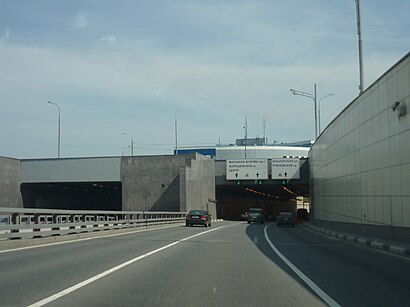
Северо-Западный тоннель Address: Москва, Северо-Западный тоннель street in Строгино
Attractions near Северо-Западный тоннель
проспект Маршала Жукова,Спорткомплекс" Рублево",Крылатская улица, 40,121609,Овраг Малая Гнилуша,храм в честь священномученика Ермогена,Тир Рублево.,Street Chef,"Дымов",Крылатская улица, 40с70,Остановка «Сосновка»,Серебряный Бор - 1,Крылатская улица, 45к1,Жилой Комплекс «Долина Грёз»,Адмирал,Крылатская ул., 45, корп. 3,Автомир,Осенняя улица/Крылатская улица,Бора-Бора,Крылатская улица 35, стр. 3How to get to popular attractions in Строгино with public transit
METRO Group HQ, Левобережный,Janinn Fitness, Красногорск,Ж/д станция Нара, Наро-Фоминск,НМИЦ сердечно-сосудистой хирургии имени А. Н. Бакулева,Рублёво,Ж/Д станция Царицыно, Царицыно,ТП «Отрада», Отрадное,ТЦ «Рублёвский», Крылатское,Зона выдачи багажа (D), Химки,Сходня, Химки,Зал вылета (D), Химки,Бизнес-зал «Аэросервис», Внуково,Метро Крылатское, Крылатское,Аэроэкспресс Внуково — Москва, Внуково,Долгопрудный, Долгопрудный,Бутовский лес, Северное Бутово,Станция Голицыно, Голицыно,Парк 30-летия Победы, Чертаново Центральное,McDonald's, Ново-Переделкино,Chalet, ХимкиGet around Строгино by public transit!
Traveling around Строгино has never been so easy. See step by step directions as you travel to any attraction, street or major public transit station. View bus and train schedules, arrival times, service alerts and detailed routes on a map, so you know exactly how to get to anywhere in Строгино.
When traveling to any destination around Строгино use Moovit's Live Directions with Get Off Notifications to know exactly where and how far to walk, how long to wait for your line, and how many stops are left. Moovit will alert you when it's time to get off — no need to constantly re-check whether yours is the next stop.
Wondering how to use public transit in Строгино or how to pay for public transit in Строгино? Moovit public transit app can help you navigate your way with public transit easily, and at minimum cost. It includes public transit fees, ticket prices, and costs. Looking for a map of Строгино public transit lines? Moovit public transit app shows all public transit maps in Строгино with all bus, metro or Trolleybus routes and stops on an interactive map.
Строгино has 3 transit type(s), including: bus, metro or Trolleybus, operated by several transit agencies, including ГУП «Мосметро», ГУП «Мосгортранс», Маршруты "Магистраль", Маршруты "Магистраль", Мосгортранс, ГУП Мосгортранс, ООО «Гепарт», Мосгортранс, Мосгортранс, ГУП Мосгортранс, Аэроэкспресс, Маршрутка, АО «Центральная ППК», ГУП «Мосгортранс» and МП «Химкиэлектротранс»