Directions to אמאוס-ניקופוליס (Israel) with public transportation
The following transit lines have routes that pass near אמאוס-ניקופוליס
How to get to אמאוס-ניקופוליס by bus?
Click on the bus route to see step by step directions with maps, line arrival times and updated time schedules.
Bus stops near אמאוס-ניקופוליס in Israel
- מחלף לטרון, 3 min walk,
- צומת חטיבה שבע, 26 min walk,
Bus lines to אמאוס-ניקופוליס in Israel
- 109, נוף איילון,
- 114, מודיעין-מכבים-רעות,
- 118, מודיעין-מכבים-רעות,
- 875, מודיעין עילית,
- 885, מודיעין עילית,
- 895, מודיעין עילית,
- 430, מטה יהודה,
- 433, ראשון לציון,
- 458, דימונה,
- 492, נתיבות,
- 494, אופקים,
- 495, בני נצרים,
- 496, נתיבות,
- 498, תפרח,
- 499, אופקים,
- 434, רחובות,
- 436, אשקלון,
- 437, אשקלון,
- 446 - ♿ ניתן להנגשה בהזמנה מראש, באר שבע,
- 448, אשדוד,
What are the closest stations to אמאוס-ניקופוליס?
The closest stations to אמאוס-ניקופוליס are:
- מחלף לטרון is 152 meters away, 3 min walk.
- צומת חטיבה שבע is 1912 meters away, 26 min walk.
Which bus lines stop near אמאוס-ניקופוליס?
These bus lines stop near אמאוס-ניקופוליס: 433, 885, 99.
What’s the nearest bus stop to אמאוס-ניקופוליס in Israel?
The nearest bus stop to אמאוס-ניקופוליס in Israel is מחלף לטרון. It’s a 3 min walk away.
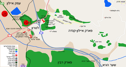
See אמאוס-ניקופוליס, Israel, on the map
Public Transit to אמאוס-ניקופוליס in Israel
Wondering how to get to אמאוס-ניקופוליס in Israel, Israel? Moovit helps you find the best way to get to אמאוס-ניקופוליס with step-by-step directions from the nearest public transit station.
Moovit provides free maps and live directions to help you navigate through your city. View schedules, routes, timetables, and find out how long does it take to get to אמאוס-ניקופוליס in real time.
Looking for the nearest stop or station to אמאוס-ניקופוליס? Check out this list of stops closest to your destination: מחלף לטרון; צומת חטיבה שבע.
Bus: 433, 885, 99, 109, 114, 118, 875, 430, 458, 492, 494, 434, 436, 437, 446 - ♿ ניתן להנגשה בהזמנה מראש, 448.
Want to see if there’s another route that gets you there at an earlier time? Moovit helps you find alternative routes or times. Get directions from and directions to אמאוס-ניקופוליס easily from the Moovit App or Website.
We make riding to אמאוס-ניקופוליס easy, which is why over 1.5 million users, including users in Israel, trust Moovit as the best app for public transit. You don’t need to download an individual bus app or train app, Moovit is your all-in-one transit app that helps you find the best bus time or train time available.
For information on prices of bus, costs and ride fares to אמאוס-ניקופוליס, please check the Moovit app.
Use the app to navigate to popular places including to the airport, hospital, stadium, grocery store, mall, coffee shop, school, college, and university.
אמאוס-ניקופוליס Address: HaNassi Blvd 126, Haifa, Israel street in Israel
Attractions near אמאוס-ניקופוליס
Emmaus,מחלף לטרון,אמאוס,לטרון אמפיתיאטרון,מחלף לטרון,Ayalon Forest And Picknick Area,פארק קנדה (Park Canada (פארק קנדה)),פארק איילון קנדה,Al Aţrūn,Al Laţrūn,Dayr al Laţrūn,Zatrun Monastery,Bīr al Ḩulw,Bīr el Hilū,Yad La-Shiryon,לטרון,חטיבה 7,יד לשריון,לטרון (לטרון [IDF Armored Corps Memorial Site And Museum]),מצד צלבניHow to get to popular attractions in Israel with public transit
קרית אונו, קריית אונו,דרך בן גוריון, רמת גן,מרכז ויצמן – איכילוב, תל אביב-יפו,בא""ח נח""ל קריות,בנייני האומה, ירושלים,קרית ביאליק, קריית ביאליק,בית כנסת עטרת אברהם, ירושלים,שער ירושלים מחנה צריפין,Yarkon Cemetery, פתח תקווה,סינמה סיטי גלילות, רמת השרון,רח׳ הסיבים, פתח תקווה,קרית עתידים, תל אביב-יפו,גני התערוכה, תל אביב-יפו,סינמה סיטי ראשל"צ, ראשון לציון,מחנה שדה תימן, מ.א. בני שמעון,בית חולים זיו, צפת,פיס ארנה ירושלים, ירושלים,בסיס זיקים, מ.א. חוף אשקלון,הגשר התלוי ירושלים, ירושלים,אוניברסיטת תל אביב, תל אביב-יפוGet around Israel by public transit!
Traveling around Israel has never been so easy. See step by step directions as you travel to any attraction, street or major public transit station. View bus and train schedules, arrival times, service alerts and detailed routes on a map, so you know exactly how to get to anywhere in Israel.
When traveling to any destination around Israel use Moovit's Live Directions with Get Off Notifications to know exactly where and how far to walk, how long to wait for your line, and how many stops are left. Moovit will alert you when it's time to get off — no need to constantly re-check whether yours is the next stop.
Wondering how to use public transit in Israel or how to pay for public transit in Israel? Moovit public transit app can help you navigate your way with public transit easily, and at minimum cost. It includes public transit fees, ticket prices, and costs. Looking for a map of Israel public transit lines? Moovit public transit app shows all public transit maps in Israel with all Bus, Israel Railways, Light Rail, Carmelit / Rachbalit and Shuttle routes and stops on an interactive map.
Israel has 5 transit type(s), including: Bus, Israel Railways, Light Rail, Carmelit / Rachbalit and Shuttle, operated by several transit agencies, including דן (Dan), הרכבת הקלה תל אביב - תבל - הקו האדום, רכבת ישראל (Israel Railways), אגד (Egged), מטרופולין (Metropoline), קווים (Kavim), אלקטרה אפיקים (Electra Afikim), נתיב אקספרס (Nateev Express), אקסטרה (Extra), אקסטרה ירושלים, הרכבת הקלה ירושלים - כפיר, דן בדרום (Dan Badarom), דן באר שבע (Dan Beer-Sheva), אלקטרה אפיקים תחבורה (Electra Afikim Tachbura), סופרבוס (Superbus)