See בית קברות נחלת יצחק, גבעתיים, on the map
Directions to בית קברות נחלת יצחק (גבעתיים) with public transportation
The following transit lines have routes that pass near בית קברות נחלת יצחק
 Bus:
Bus: - Israel Railways:
How to get to בית קברות נחלת יצחק by bus?
Click on the bus route to see step by step directions with maps, line arrival times and updated time schedules.
How to get to בית קברות נחלת יצחק by Israel Railways?
Click on the Israel Railways route to see step by step directions with maps, line arrival times and updated time schedules.
Bus stations near בית קברות נחלת יצחק in גבעתיים
- דרך השלום/חביבה רייק,9 min walk,
Bus lines to בית קברות נחלת יצחק in גבעתיים
- 43,בת ים,
- 64,פתח תקווה,
- 116,קריית אונו,
- 278,אלעד,
- 364,פתח תקווה,
- 463,גבעת שמואל,
- 473,ראש העין,
- 477,ראש העין,
- 478,ראש העין,
What are the closest stations to בית קברות נחלת יצחק?
The closest stations to בית קברות נחלת יצחק are:
- דרך השלום/חביבה רייק is 674 meters away, 9 min walk.
Which bus lines stop near בית קברות נחלת יצחק?
These bus lines stop near בית קברות נחלת יצחק: 43, 54, 63, 64.
Which Israel Railways line stops near בית קברות נחלת יצחק?
קו בנימינה - תל אביב מרכז
What’s the nearest bus stop to בית קברות נחלת יצחק in גבעתיים?
The nearest bus stop to בית קברות נחלת יצחק in גבעתיים is דרך השלום/חביבה רייק. It’s a 9 min walk away.
See בית קברות נחלת יצחק, גבעתיים, on the map
Public Transit to בית קברות נחלת יצחק in גבעתיים
Wondering how to get to בית קברות נחלת יצחק in גבעתיים, Israel? Moovit helps you find the best way to get to בית קברות נחלת יצחק with step-by-step directions from the nearest public transit station.
Moovit provides free maps and live directions to help you navigate through your city. View schedules, routes, timetables, and find out how long does it take to get to בית קברות נחלת יצחק in real time.
Looking for the nearest stop or station to בית קברות נחלת יצחק? Check out this list of stops closest to your destination: דרך השלום/חביבה רייק.
Bus:Israel Railways:
Want to see if there’s another route that gets you there at an earlier time? Moovit helps you find alternative routes or times. Get directions from and directions to בית קברות נחלת יצחק easily from the Moovit App or Website.
We make riding to בית קברות נחלת יצחק easy, which is why over 1.5 million users, including users in גבעתיים, trust Moovit as the best app for public transit. You don’t need to download an individual bus app or train app, Moovit is your all-in-one transit app that helps you find the best bus time or train time available.
For information on prices of bus, Israel Railways and shuttle, costs and ride fares to בית קברות נחלת יצחק, please check the Moovit app.
Use the app to navigate to popular places including to the airport, hospital, stadium, grocery store, mall, coffee shop, school, college, and university.
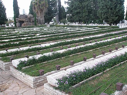
בית קברות נחלת יצחק Address: ישראל טייבר street in גבעתיים
Attractions near בית קברות נחלת יצחק
בית כנסת רמב’’ם,הפלמ"ח,דוד רמז 1,ח,קונסרבטוריון גבעתיים,אשרם בעיר,ה,גן הבנים,גן הבנים,גנסין & הצנחנים,5,דליה 15,רכבת ישראל,הנגבה,גן הבנים,רח` הל`ה 23,גנסין,הל"ה 20,קומה 1,כיכר רמב"םHow to get to popular attractions in גבעתיים with public transit
הגבעה הצרפתית, ירושלים,Hilton Tel Aviv, תל אביב-יפו,Leonardo Suite Hotel / מלון לאונרדו סוויט, בת ים,מגדלי לייף, בני ברק,שוק תלפיות, חיפה,בית כנסת שערי ציון, חולון,פארק וולפסון, תל אביב-יפו,Garage Gym (גראז' - חדר כושר), תל אביב-יפו,Dead Sea Kalia Beach,Hadera West Train Station, חדרה,הפקולטה למשפטים ע״ש בוכמן, תל אביב-יפו,ספרי אהרוני סניף צפת, צפת,נמל תעופה בן גוריון, נמל תעופה בן גוריון,חוף אשקלון, אשקלון,אברהם הוסטל, ירושלים,מינה טומיי, חיפה,מערת המכפלה, חברון,כיכר מגן דוד, תל אביב-יפו,מרכז ביג באר-שבע, באר שבע,The Ritz-Carlton, Herzliya, הרצלייהGet around גבעתיים by public transit!
Traveling around גבעתיים has never been so easy. See step by step directions as you travel to any attraction, street or major public transit station. View bus and train schedules, arrival times, service alerts and detailed routes on a map, so you know exactly how to get to anywhere in גבעתיים.
When traveling to any destination around גבעתיים use Moovit's Live Directions with Get Off Notifications to know exactly where and how far to walk, how long to wait for your line, and how many stops are left. Moovit will alert you when it's time to get off — no need to constantly re-check whether yours is the next stop.
Wondering how to use public transit in גבעתיים or how to pay for public transit in גבעתיים? Moovit public transit app can help you navigate your way with public transit easily, and at minimum cost. It includes public transit fees, ticket prices, and costs. Looking for a map of גבעתיים public transit lines? Moovit public transit app shows all public transit maps in גבעתיים with all bus, Israel Railways or shuttle routes and stops on an interactive map.
גבעתיים has 3 transit type(s), including: bus, Israel Railways or shuttle, operated by several transit agencies, including דן (Dan), הרכבת הקלה תל אביב - תבל - הקו האדום, רכבת ישראל (Israel Railways), אגד (Egged), מטרופולין (Metropoline), קווים (Kavim), אלקטרה אפיקים (Electra Afikim), נתיב אקספרס (Nateev Express), אקסטרה (Extra), אקסטרה ירושלים, הרכבת הקלה ירושלים - כפיר, דן בדרום (Dan Badarom), דן באר שבע (Dan Beer-Sheva), אלקטרה אפיקים תחבורה (Electra Afikim Tachbura) and סופרבוס (Superbus)