Directions to גבעת אסף with public transportation
The following transit lines have routes that pass near גבעת אסף
How to get to גבעת אסף by bus?
Click on the bus route to see step by step directions with maps, line arrival times and updated time schedules.
Bus stations near גבעת אסף
- צומת גבעת אסף/ כביש 60, 5 min walk,
- מועצה אזורית מטה בנימין, 80 min walk,
Bus lines to גבעת אסף
- 461, אריאל,
- 462, אריאל,
- 464, אריאל,
- 466, קדומים,
- 467, אלון מורה,
- 468, מודיעין-מכבים-רעות,
- 140, ירושלים,
- 141, ירושלים,
- 269, ירושלים,
- 148, ירושלים,
- 270, ירושלים,
What are the closest stations to גבעת אסף?
The closest stations to גבעת אסף are:
- צומת גבעת אסף/ כביש 60 is 277 meters away, 5 min walk.
- מועצה אזורית מטה בנימין is 6201 meters away, 80 min walk.
Which bus lines stop near גבעת אסף?
These bus lines stop near גבעת אסף: 140, 463.
What’s the nearest bus stop to גבעת אסף?
The nearest bus stop to גבעת אסף is צומת גבעת אסף/ כביש 60. It’s a 5 min walk away.
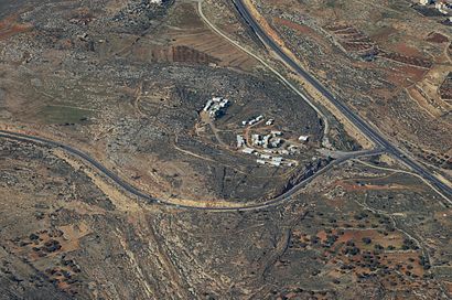
See גבעת אסף on the map
Public Transportation to גבעת אסף
Wondering how to get to גבעת אסף, Israel? Moovit helps you find the best way to get to גבעת אסף with step-by-step directions from the nearest public transit station.
Moovit provides free maps and live directions to help you navigate through your city. View schedules, routes, timetables, and find out how long does it take to get to גבעת אסף in real time.
Looking for the nearest stop or station to גבעת אסף? Check out this list of stops closest to your destination: צומת גבעת אסף/ כביש 60; מועצה אזורית מטה בנימין.
Bus: 140, 463, 461, 462, 464, 466, 467, 141, 269, 148, 270.
Want to see if there’s another route that gets you there at an earlier time? Moovit helps you find alternative routes or times. Get directions from and directions to גבעת אסף easily from the Moovit App or Website.
We make riding to גבעת אסף easy, which is why over 1.5 million users, including users in גבעת אסף, trust Moovit as the best app for public transit. You don’t need to download an individual bus app or train app, Moovit is your all-in-one transit app that helps you find the best bus time or train time available.
For information on prices of bus, costs and ride fares to גבעת אסף, please check the Moovit app.
Use the app to navigate to popular places including to the airport, hospital, stadium, grocery store, mall, coffee shop, school, college, and university.
גבעת אסף Address: כביש עפולה באר-שבע street in גבעת אסף
Attractions near גבעת אסף
בית מדרש גבעת אסף,דרך זו מובילה לשטח B הכניסה לישראלים מסוכנת,צומת עז ציון,עז ציון,דרך זו מובילה לשטח B הכניסה לישראלים מסוכנת,‘Ayn al ‘Ullayq,‘Ain el ‘Ulleiq,Wādī Muḩammad,Ash Shaykh Yūsuf,Ash Shaykh Shaybān,Sheikh Sheiban,Biteen Secondary Male School,Ash Shaykh ‘Ajamī,Khirbat at Tall,Bethaven,Ai,Et Tell,Ofra,Baladna,‘Ayn Wādī al JāyahHow to get to popular attractions in גבעת אסף with public transit
הדסה עין כרם, ירושלים,היכל הקרח Ice Peaks, חולון,פארק הירקון, תל אביב-יפו,גבעת מרדכי, ירושלים,לוינסקי, תל אביב-יפו,בסיס «תל נוף», מ.א. ברנר,הספארי - המרכז הזואולוגי תל אביב-רמת גן, רמת גן,בית חולים רוטשילד, חיפה,קרית אתא, חיפה,נווה שאנן, חיפה,בקו"ם,בית עלמין קרית אתא - ארץ החיים, קריית אתא,ירפ״א 112, רמת גן,הבימה, תל אביב-יפו,אצטדיון רמת גן, רמת גן,מגדלי בסר פתח תקווה, פתח תקווה,קינג ג'ורג', תל אביב-יפו,שוק הכרמל, תל אביב-יפו,עלי, עלי,שדה התעופה בן גוריון, נמל תעופה בן גוריוןGet around Israel by public transit!
Traveling around Israel has never been so easy. See step by step directions as you travel to any attraction, street or major public transit station. View bus and train schedules, arrival times, service alerts and detailed routes on a map, so you know exactly how to get to anywhere in Israel.
When traveling to any destination around Israel use Moovit's Live Directions with Get Off Notifications to know exactly where and how far to walk, how long to wait for your line, and how many stops are left. Moovit will alert you when it's time to get off — no need to constantly re-check whether yours is the next stop.
Wondering how to use public transit in Israel or how to pay for public transit in Israel? Moovit public transit app can help you navigate your way with public transit easily, and at minimum cost. It includes public transit fees, ticket prices, and costs. Looking for a map of Israel public transit lines? Moovit public transit app shows all public transit maps in Israel with all Bus, Israel Railways, Light Rail, Carmelit / Rachbalit and Shuttle routes and stops on an interactive map.
Israel has 5 transit type(s), including: Bus, Israel Railways, Light Rail, Carmelit / Rachbalit and Shuttle, operated by several transit agencies, including דן (Dan), הרכבת הקלה תל אביב - תבל - הקו האדום, רכבת ישראל (Israel Railways), אגד (Egged), מטרופולין (Metropoline), קווים (Kavim), אלקטרה אפיקים (Electra Afikim), נתיב אקספרס (Nateev Express), אקסטרה (Extra), אקסטרה ירושלים, הרכבת הקלה ירושלים - כפיר, דן בדרום (Dan Badarom), דן באר שבע (Dan Beer-Sheva), אלקטרה אפיקים תחבורה (Electra Afikim Tachbura), סופרבוס (Superbus)