Directions to כפר כנא with public transportation
The following transit lines have routes that pass near כפר כנא
How to get to כפר כנא by bus?
Click on the bus route to see step by step directions with maps, line arrival times and updated time schedules.
Bus stops near כפר כנא
- כפר כנא ו'/מעיין, 8 min walk,
- כפר כנא ג'/מעיין, 8 min walk,
- מרכז מחזור/כפר כנא, 11 min walk,
Bus lines to כפר כנא
- 20א, כפר כנא,
- 22, נצרת,
- 22, מרכז מסחרי,
- 24, נוף הגליל,
- 24, נצרת,
- 26, טורעאן,
- 26, נוף הגליל,
- 27, נוף הגליל,
- 27, נצרת,
- 28, סח'נין,
- 28, נצרת,
- 29, נצרת,
- 30, נצרת,
- 31, עמק הירדן,
- 33, עפולה,
- 38, מגדל העמק,
- 62, מגאר,
- 65, בנה ביתך 2,
- 70, איצטדיון כפר כנא,
- 180, סח'נין,
What are the closest stations to כפר כנא?
The closest stations to כפר כנא are:
- כפר כנא ו'/מעיין is 508 meters away, 8 min walk.
- כפר כנא ג'/מעיין is 510 meters away, 8 min walk.
- מרכז מחזור/כפר כנא is 804 meters away, 11 min walk.
Which bus lines stop near כפר כנא?
These bus lines stop near כפר כנא: 28, 30, 31, 352, 431.
What’s the nearest bus stop to כפר כנא?
The nearest bus stops to כפר כנא are כפר כנא ו'/מעיין and כפר כנא ג'/מעיין. The closest one is a 8 min walk away.
See כפר כנא on the map
Public Transportation to כפר כנא
Wondering how to get to כפר כנא, Israel? Moovit helps you find the best way to get to כפר כנא with step-by-step directions from the nearest public transit station.
Moovit provides free maps and live directions to help you navigate through your city. View schedules, routes, timetables, and find out how long does it take to get to כפר כנא in real time.
Looking for the nearest stop or station to כפר כנא? Check out this list of stops closest to your destination: כפר כנא ו'/מעיין; כפר כנא ג'/מעיין; מרכז מחזור/כפר כנא.
Bus: 28, 30, 31, 352, 431, 20א, 22, 22, 24, 24, 62, 334, 71.
Want to see if there’s another route that gets you there at an earlier time? Moovit helps you find alternative routes or times. Get directions from and directions to כפר כנא easily from the Moovit App or Website.
We make riding to כפר כנא easy, which is why over 1.5 million users, including users in כפר כנא, trust Moovit as the best app for public transit. You don’t need to download an individual bus app or train app, Moovit is your all-in-one transit app that helps you find the best bus time or train time available.
For information on prices of bus, costs and ride fares to כפר כנא, please check the Moovit app.
Use the app to navigate to popular places including to the airport, hospital, stadium, grocery store, mall, coffee shop, school, college, and university.
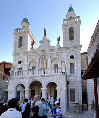
Location: כפר כנא, Israel
Attractions near כפר כנא
Kafr Kannā,Kafr Qanah,Kayra Kfar Kanna,אחמד אמרה,העיר העתיקה (אל בלד),אל מסאלה,الكنيسة اليونانية الكاثوليكية اليونانية,כפר כנא ג'/מעיין,البستان,مطعم أبو يوسف,Kaftage,احذية قانا,Canna Wedding Wine,Sondos,Monaliza,Topkapi,המעיין,M.Dental Clinic,מסעדת המעיין,عمارة ابناء صالح عبد القادرHow to get to popular attractions in כפר כנא with public transit
בא""ח נח""ל קריות,מרכז יצחק רבין, תל אביב-יפו,בית משפט השלום חיפה, חיפה,מחנה עמיעד, מ.א. הגליל העליון,מרפ"א ירושלים, ירושלים,גבעת מרדכי, ירושלים,אצטדיון רמת גן, רמת גן,אוניברסיטת בן גוריון, באר שבע,תל אביב יפו, תל אביב-יפו,Кирьят-Моцкин, קריית מוצקין,מחנה סיירים, מ.א. חבל אילות,צ'ק פוסט, חיפה,תל השומר שער צפוני, רמת גן,קרית השרון, נתניה,באח גולני, מ.א. מנשה,חוף ראשון לציון, ראשון לציון,ים, תל אביב-יפו,מחנה משגב, מ.א. משגב,מרכז רפואי בני ציון, חיפה,קניון רמת אביב, תל אביב-יפוGet around Israel by public transit!
Traveling around Israel has never been so easy. See step by step directions as you travel to any attraction, street or major public transit station. View bus and train schedules, arrival times, service alerts and detailed routes on a map, so you know exactly how to get to anywhere in Israel.
When traveling to any destination around Israel use Moovit's Live Directions with Get Off Notifications to know exactly where and how far to walk, how long to wait for your line, and how many stops are left. Moovit will alert you when it's time to get off — no need to constantly re-check whether yours is the next stop.
Wondering how to use public transit in Israel or how to pay for public transit in Israel? Moovit public transit app can help you navigate your way with public transit easily, and at minimum cost. It includes public transit fees, ticket prices, and costs. Looking for a map of Israel public transit lines? Moovit public transit app shows all public transit maps in Israel with all Bus, Israel Railways, Light Rail, Carmelit / Rachbalit and Shuttle routes and stops on an interactive map.
Israel has 5 transit type(s), including: Bus, Israel Railways, Light Rail, Carmelit / Rachbalit and Shuttle, operated by several transit agencies, including דן (Dan), הרכבת הקלה תל אביב - תבל - הקו האדום, רכבת ישראל (Israel Railways), אגד (Egged), מטרופולין (Metropoline), קווים (Kavim), אלקטרה אפיקים (Electra Afikim), נתיב אקספרס (Nateev Express), אקסטרה (Extra), אקסטרה ירושלים, הרכבת הקלה ירושלים - כפיר, דן בדרום (Dan Badarom), דן באר שבע (Dan Beer-Sheva), אלקטרה אפיקים תחבורה (Electra Afikim Tachbura), סופרבוס (Superbus)