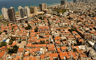
Directions to נווה צדק (תל אביב-יפו) with public transportation
The following transit lines have routes that pass near נווה צדק
How to get to נווה צדק by bus?
Click on the bus route to see step by step directions with maps, line arrival times and updated time schedules.
How to get to נווה צדק by Israel Railways?
Click on the Israel Railways route to see step by step directions with maps, line arrival times and updated time schedules.
Bus stations near נווה צדק in תל אביב-יפו
- אילת/שלוש, 4 min walk,
- מרכז הטקסטיל/המרד, 6 min walk,
- פרופ' קויפמן/שנקר, 9 min walk,
Bus lines to נווה צדק in תל אביב-יפו
- 40, בת ים,
- 425, ראשון לציון,
- 10, חולון,
- 18, בת ים,
- 73, חולון,
- 88, חולון,
- 119, ראשון לציון,
- 717, תל אביב-יפו,
- סבבוס אדום, רמת גן,
- 14, תל אביב-יפו,
- 54, תל אביב-יפו,
- 236, אור יהודה,
- 705, גבעתיים,
- 706, רמת השרון,
What are the closest stations to נווה צדק?
The closest stations to נווה צדק are:
- אילת/שלוש is 263 meters away, 4 min walk.
- מרכז הטקסטיל/המרד is 375 meters away, 6 min walk.
- פרופ' קויפמן/שנקר is 590 meters away, 9 min walk.
Which bus lines stop near נווה צדק?
These bus lines stop near נווה צדק: 240, 40, 41, 48.
Which Israel Railways line stops near נווה צדק?
קו באר שבע מרכז - תל אביב ההגנה
What’s the nearest bus stop to נווה צדק in תל אביב-יפו?
The nearest bus stop to נווה צדק in תל אביב-יפו is אילת/שלוש. It’s a 4 min walk away.
See נווה צדק, תל אביב-יפו, on the map
Public Transit to נווה צדק in תל אביב-יפו
Wondering how to get to נווה צדק in תל אביב-יפו, Israel? Moovit helps you find the best way to get to נווה צדק with step-by-step directions from the nearest public transit station.
Moovit provides free maps and live directions to help you navigate through your city. View schedules, routes, timetables, and find out how long does it take to get to נווה צדק in real time.
Looking for the nearest stop or station to נווה צדק? Check out this list of stops closest to your destination: אילת/שלוש; מרכז הטקסטיל/המרד; פרופ' קויפמן/שנקר.
Bus: 240, 40, 41, 48, 425, 10, 18, 73, 88, 119, סבבוס אדום, 14, 54, 236, 705.Israel Railways: קו באר שבע מרכז - תל אביב ההגנה.
Want to see if there’s another route that gets you there at an earlier time? Moovit helps you find alternative routes or times. Get directions from and directions to נווה צדק easily from the Moovit App or Website.
We make riding to נווה צדק easy, which is why over 1.5 million users, including users in תל אביב-יפו, trust Moovit as the best app for public transit. You don’t need to download an individual bus app or train app, Moovit is your all-in-one transit app that helps you find the best bus time or train time available.
For information on prices of bus and Israel Railways, costs and ride fares to נווה צדק, please check the Moovit app.
Use the app to navigate to popular places including to the airport, hospital, stadium, grocery store, mall, coffee shop, school, college, and university.
נווה צדק Address: נווה צדק, תל אביב יפו, ישראל street in תל אביב-יפו
Attractions near נווה צדק
כפר סבא 1,כפר סבא,Shir Gershovitz,אחווה 24,אחווה 103,אלון ליבנה,שמעון רוקח 21,נווה צדק 125,Agas and Tamar,אחווה,מוזיאון נחום גוטמן,אמזלג 20,יחיאלי & שלוש,שלוש & שמעון רוקח,אמזלג & נווה צדק,Edition by Sagit Goldin,שלוש & בוסתנאי,Dr. Ran Nagar OB/Gyn,קסם של גלידה,Little Tel AvivHow to get to popular attractions in תל אביב-יפו with public transit
Tel Aviv Hahagana Railway Station, תל אביב-יפו,בסיס תל השומר, רמת גן,ירפ״א 112, רמת גן,Кирьят-Ата, קריית אתא,חטמ״ר עציון,קניון מלחה ירושלים, ירושלים,נווה שאנן, חיפה,האוניברסיטה העברית - הר הצופים, ירושלים,Kever Rachel (Rachel's Tomb) קבר רחל, בית לחם,ישפרו סנטר, מודיעין-מכבים-רעות,הר חוצבים, ירושלים,מירון, מירון,קרית אונו, קריית אונו,נווה צדק, תל אביב-יפו,אזורי חן, תל אביב-יפו,גבעת רם, ירושלים,בסיס מז״י, קריית מלאכי,בגין 125, תל אביב-יפו,קבר הבבא סאלי, נתיבות,יס פלאנט, ראשון לציוןGet around Israel by public transit!
Traveling around Israel has never been so easy. See step by step directions as you travel to any attraction, street or major public transit station. View bus and train schedules, arrival times, service alerts and detailed routes on a map, so you know exactly how to get to anywhere in Israel.
When traveling to any destination around Israel use Moovit's Live Directions with Get Off Notifications to know exactly where and how far to walk, how long to wait for your line, and how many stops are left. Moovit will alert you when it's time to get off — no need to constantly re-check whether yours is the next stop.
Wondering how to use public transit in Israel or how to pay for public transit in Israel? Moovit public transit app can help you navigate your way with public transit easily, and at minimum cost. It includes public transit fees, ticket prices, and costs. Looking for a map of Israel public transit lines? Moovit public transit app shows all public transit maps in Israel with all Bus, Israel Railways, Light Rail, Carmelit / Rachbalit and Shuttle routes and stops on an interactive map.
Israel has 5 transit type(s), including: Bus, Israel Railways, Light Rail, Carmelit / Rachbalit and Shuttle, operated by several transit agencies, including דן (Dan), הרכבת הקלה תל אביב - תבל - הקו האדום, רכבת ישראל (Israel Railways), אגד (Egged), מטרופולין (Metropoline), קווים (Kavim), אלקטרה אפיקים (Electra Afikim), נתיב אקספרס (Nateev Express), אקסטרה (Extra), אקסטרה ירושלים, הרכבת הקלה ירושלים - כפיר, דן בדרום (Dan Badarom), דן באר שבע (Dan Beer-Sheva), אלקטרה אפיקים תחבורה (Electra Afikim Tachbura), סופרבוס (Superbus)