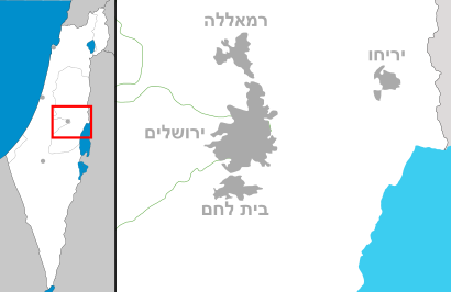
See נופי פרת, כפר אדומים, on the map
Directions to נופי פרת (כפר אדומים) with public transportation
The following transit lines have routes that pass near נופי פרת
 Bus:
Bus:
How to get to נופי פרת by bus?
Click on the bus route to see step by step directions with maps, line arrival times and updated time schedules.
Bus stations near נופי פרת in כפר אדומים
- צומת מישור אדומים,51 min walk,
- גבעת המייסדים,59 min walk,
Bus lines to נופי פרת in כפר אדומים
- 202,מצפה יריחו,
- 215,ירושלים,
- 216,ירושלים,
- 444 - בהזמנה מראש,ירושלים,
- 486,נווה זוהר,
- 487,עין גדי,
- 941,ירושלים,
- 943,ירושלים,
- 946,ירושלים,
- 961,ירושלים,
- 961 - ♿ ניתן להנגשה בהזמנה מראש,ירושלים,
- 966,ירושלים,
- 967,בית שאן,
- 22,ורד יריחו,
- 25,מעלה אדומים,
- 25א,עין הוד,
- 169,מעלה אדומים,
What are the closest stations to נופי פרת?
The closest stations to נופי פרת are:
- צומת מישור אדומים is 3946 meters away, 51 min walk.
- גבעת המייסדים is 4527 meters away, 59 min walk.
Which bus line stops near נופי פרת?
215
See נופי פרת, כפר אדומים, on the map
Public Transit to נופי פרת in כפר אדומים
Wondering how to get to נופי פרת in כפר אדומים, Israel? Moovit helps you find the best way to get to נופי פרת with step-by-step directions from the nearest public transit station.
Moovit provides free maps and live directions to help you navigate through your city. View schedules, routes, timetables, and find out how long does it take to get to נופי פרת in real time.
Looking for the nearest stop or station to נופי פרת? Check out this list of stops closest to your destination: צומת מישור אדומים; גבעת המייסדים.
Bus:
Want to see if there’s another route that gets you there at an earlier time? Moovit helps you find alternative routes or times. Get directions from and directions to נופי פרת easily from the Moovit App or Website.
We make riding to נופי פרת easy, which is why over 1.5 million users, including users in כפר אדומים, trust Moovit as the best app for public transit. You don’t need to download an individual bus app or train app, Moovit is your all-in-one transit app that helps you find the best bus time or train time available.
For information on prices of bus, costs and ride fares to נופי פרת, please check the Moovit app.
Use the app to navigate to popular places including to the airport, hospital, stadium, grocery store, mall, coffee shop, school, college, and university.
נופי פרת Address: נחל ערוגות street in כפר אדומים
Attractions near נופי פרת
Nofei Prat,דרך נחל קדם,9061800,נחל צאלים,דרך נחל פרת & דרך החיים,בית עלמין נופי פרת,נחל צפית 560,Kfar Adumim,Tall al Kābūs,מתק החרוב,Wādī al Ḩarīq,שבט יהודה - צופים,Kefar Adummim,כפר אדומים,משכנות הרועים,שמורת טבע עין פרת,Wadi Qelt,Kfar Adumim,דרך המדבר & עם אחד,בית ספר כפר אדומיםHow to get to popular attractions in כפר אדומים with public transit
דן אכדיה, הרצלייה,אוניברסיטת אריאל בשומרון, אריאל,Yoqneam Ilit / יוקנעם עלית, יקנעם עילית,Hotel Metropolitan מלון מטרופוליטן, תל אביב-יפו,בית קברות צבאי הר הרצל, ירושלים,Garage Gym (גראז' - חדר כושר), תל אביב-יפו,הרצליה הצעירה, הרצלייה,Mount of Beatitudes, מ.א. עמק הירדן,בנק אוצר החייל, מ.א. חוף השרון,Yad Vashem, ירושלים,רמת פולג, נתניה,תל השומר שער צפוני, רמת גן,רמות השבים, רמות השבים,אנדרטת חיל ההנדסה, מ.א. גזר,שוק תלפיות, חיפה,Frishman Beach, תל אביב-יפו,שכונת הדר יוסף, תל אביב-יפו,מנחת בילינסון, פתח תקווה,IDC - Interdisciplinary Center (המרכז הבינתחומי הרצליה), הרצלייה,טרקלין דן, נמל תעופה בן גוריוןGet around כפר אדומים by public transit!
Traveling around כפר אדומים has never been so easy. See step by step directions as you travel to any attraction, street or major public transit station. View bus and train schedules, arrival times, service alerts and detailed routes on a map, so you know exactly how to get to anywhere in כפר אדומים.
When traveling to any destination around כפר אדומים use Moovit's Live Directions with Get Off Notifications to know exactly where and how far to walk, how long to wait for your line, and how many stops are left. Moovit will alert you when it's time to get off — no need to constantly re-check whether yours is the next stop.
Wondering how to use public transit in כפר אדומים or how to pay for public transit in כפר אדומים? Moovit public transit app can help you navigate your way with public transit easily, and at minimum cost. It includes public transit fees, ticket prices, and costs. Looking for a map of כפר אדומים public transit lines? Moovit public transit app shows all public transit maps in כפר אדומים with all bus routes and stops on an interactive map.
כפר אדומים has 1 transit type(s), including: bus, operated by several transit agencies, including דן (Dan), הרכבת הקלה תל אביב - תבל - הקו האדום, רכבת ישראל (Israel Railways), אגד (Egged), מטרופולין (Metropoline), קווים (Kavim), אלקטרה אפיקים (Electra Afikim), נתיב אקספרס (Nateev Express), אקסטרה (Extra), אקסטרה ירושלים, הרכבת הקלה ירושלים - כפיר, דן בדרום (Dan Badarom), דן באר שבע (Dan Beer-Sheva), אלקטרה אפיקים תחבורה (Electra Afikim Tachbura) and סופרבוס (Superbus)