See סתריה, סתרייה, on the map
Directions to סתריה (סתרייה) with public transportation
The following transit lines have routes that pass near סתריה
 Bus:
Bus:
How to get to סתריה by bus?
Click on the bus route to see step by step directions with maps, line arrival times and updated time schedules.
Bus stations near סתריה in סתרייה
- צומת רחובות מזרח,13 min walk,
- צומת נען/כביש 4233,20 min walk,
- צומת נען,20 min walk,
- מגיני הגליל/אורי כהן,24 min walk,
- חיים לסקוב/אוריאל מנוחין,25 min walk,
Bus lines to סתריה in סתרייה
- 160,מודיעין-מכבים-רעות,
- 249,פתח תקווה,
- 323,רמלה,
- 439,ירושלים,
- 548,כפר חב''ד,
- 28,רמות מאיר,
- 249,רחובות,
- 276,גבעת ברנר,
- 5,ת.מרכזית עפולה/הורדה,
- 3,ת. מרכזית רחובות/רציפים,
- 13,ת. מרכזית רחובות/רציפים,
What are the closest stations to סתריה?
The closest stations to סתריה are:
- צומת רחובות מזרח is 983 meters away, 13 min walk.
- צומת נען/כביש 4233 is 1489 meters away, 20 min walk.
- צומת נען is 1517 meters away, 20 min walk.
- מגיני הגליל/אורי כהן is 1808 meters away, 24 min walk.
- חיים לסקוב/אוריאל מנוחין is 1855 meters away, 25 min walk.
Which bus line stops near סתריה?
249
What’s the nearest bus stop to סתריה in סתרייה?
The nearest bus stop to סתריה in סתרייה is צומת רחובות מזרח. It’s a 13 min walk away.
See סתריה, סתרייה, on the map
Public Transit to סתריה in סתרייה
Wondering how to get to סתריה in סתרייה, Israel? Moovit helps you find the best way to get to סתריה with step-by-step directions from the nearest public transit station.
Moovit provides free maps and live directions to help you navigate through your city. View schedules, routes, timetables, and find out how long does it take to get to סתריה in real time.
Looking for the nearest stop or station to סתריה? Check out this list of stops closest to your destination: צומת רחובות מזרח; צומת נען/כביש 4233; צומת נען; מגיני הגליל/אורי כהן; חיים לסקוב/אוריאל מנוחין.
Bus:
Want to see if there’s another route that gets you there at an earlier time? Moovit helps you find alternative routes or times. Get directions from and directions to סתריה easily from the Moovit App or Website.
We make riding to סתריה easy, which is why over 1.5 million users, including users in סתרייה, trust Moovit as the best app for public transit. You don’t need to download an individual bus app or train app, Moovit is your all-in-one transit app that helps you find the best bus time or train time available.
For information on prices of bus, costs and ride fares to סתריה, please check the Moovit app.
Use the app to navigate to popular places including to the airport, hospital, stadium, grocery store, mall, coffee shop, school, college, and university.
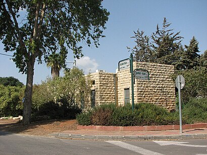
סתריה Address: הרימון street in סתרייה
Sitria (Hebrew: סִתְרִיָה) is a moshav in central Israel. Located in the Shfela near Rehovot, it falls under the jurisdiction of Gezer Regional Council. In 2017 it had a population of 1,099.Wiki
Attractions near סתריה
Sitriya,Satariyyah,Sitriyya,Sitaryah,שוהם 288,שוהם 444,שוהם 500,שוהם 298,שוהם,לופט חיק הטבע- צימר למסיבת רווקות עד 1000 שקל,צומת סתריה,משתלת סלונר,משתלת סלונר,התאנה,שוהם 182,הזית,מצפה ליאור, סתריה,40 & Derech Menachem Begin,ראובן- מספרה,צומת רחובות מזרחHow to get to popular attractions in סתרייה with public transit
רמת פולג, נתניה,גבעת שמואל, גבעת שמואל,תחנה מרכזית ראשון-לציון, ראשון לציון,Dead Sea Kalia Beach,בנק אוצר החייל, מ.א. חוף השרון,בית ליאו גולדברג, תל אביב-יפו,Central Bus Station Tel Aviv, תל אביב-יפו,בית קברות צבאי הר הרצל, ירושלים,גני יהושוע / פארק הירקון, תל אביב-יפו,רח' רוטשילד פתח תקווה, פתח תקווה,נמל תעופה בן גוריון, נמל תעופה בן גוריון,חניון רידינג, תל אביב-יפו,צומת כפר הירוק, רמת השרון,מינה טומיי, חיפה,Frishman Beach, תל אביב-יפו,מרכז ביג באר-שבע, באר שבע,הגבעה הצרפתית, ירושלים,אצטדיון כפר סבא, כפר סבא,The Ritz-Carlton, Herzliya, הרצלייה,אנדרטת חיל ההנדסה, מ.א. גזרGet around סתרייה by public transit!
Traveling around סתרייה has never been so easy. See step by step directions as you travel to any attraction, street or major public transit station. View bus and train schedules, arrival times, service alerts and detailed routes on a map, so you know exactly how to get to anywhere in סתרייה.
When traveling to any destination around סתרייה use Moovit's Live Directions with Get Off Notifications to know exactly where and how far to walk, how long to wait for your line, and how many stops are left. Moovit will alert you when it's time to get off — no need to constantly re-check whether yours is the next stop.
Wondering how to use public transit in סתרייה or how to pay for public transit in סתרייה? Moovit public transit app can help you navigate your way with public transit easily, and at minimum cost. It includes public transit fees, ticket prices, and costs. Looking for a map of סתרייה public transit lines? Moovit public transit app shows all public transit maps in סתרייה with all bus routes and stops on an interactive map.
סתרייה has 1 transit type(s), including: bus, operated by several transit agencies, including דן (Dan), הרכבת הקלה תל אביב - תבל - הקו האדום, רכבת ישראל (Israel Railways), אגד (Egged), מטרופולין (Metropoline), קווים (Kavim), אלקטרה אפיקים (Electra Afikim), נתיב אקספרס (Nateev Express), אקסטרה (Extra), אקסטרה ירושלים, הרכבת הקלה ירושלים - כפיר, דן בדרום (Dan Badarom), דן באר שבע (Dan Beer-Sheva), אלקטרה אפיקים תחבורה (Electra Afikim Tachbura) and סופרבוס (Superbus)