Directions to עבדת (מ.א. רמת נגב) with public transportation
The following transit lines have routes that pass near עבדת
How to get to עבדת by bus?
Click on the bus route to see step by step directions with maps, line arrival times and updated time schedules.
Bus stations near עבדת in מ.א. רמת נגב
- שבט עזזמה, 65 min walk,
- צומת ציפורים, 85 min walk,
Bus lines to עבדת in מ.א. רמת נגב
- 55, דימונה,
- 64, באר שבע,
- 65, באר שבע,
- 60, מצפה רמון,
- 160, מצפה רמון,
What are the closest stations to עבדת?
The closest stations to עבדת are:
- שבט עזזמה is 5076 meters away, 65 min walk.
- צומת ציפורים is 6670 meters away, 85 min walk.
Which bus line stops near עבדת?
64
See עבדת, מ.א. רמת נגב, on the map
Public Transit to עבדת in מ.א. רמת נגב
Wondering how to get to עבדת in מ.א. רמת נגב, Israel? Moovit helps you find the best way to get to עבדת with step-by-step directions from the nearest public transit station.
Moovit provides free maps and live directions to help you navigate through your city. View schedules, routes, timetables, and find out how long does it take to get to עבדת in real time.
Looking for the nearest stop or station to עבדת? Check out this list of stops closest to your destination: שבט עזזמה; צומת ציפורים.
Bus: 64, 55, 65, 60, 160.
Want to see if there’s another route that gets you there at an earlier time? Moovit helps you find alternative routes or times. Get directions from and directions to עבדת easily from the Moovit App or Website.
We make riding to עבדת easy, which is why over 1.5 million users, including users in מ.א. רמת נגב, trust Moovit as the best app for public transit. You don’t need to download an individual bus app or train app, Moovit is your all-in-one transit app that helps you find the best bus time or train time available.
For information on prices of bus, costs and ride fares to עבדת, please check the Moovit app.
Use the app to navigate to popular places including to the airport, hospital, stadium, grocery store, mall, coffee shop, school, college, and university.
Location: מ.א. רמת נגב, Israel
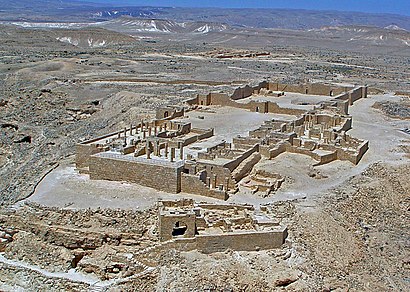
Attractions near עבדת
גן לאומי עבדת,Dwelling,אורוות,Nabatean Settlement,מגדל רומי,חדר מקושת,Eboda,‘Abdah,Roman Villa,מחנה רומי,ארומה,עבדת/עתיקות,נחל רחץ,‘Avdat,שטח נסיוני אוניברסיטת בן גוריון,בורות רמליה,בית ספר יסודי עבדא,`En Ma'arif,Har Arkov,כפר בדואי עבדאHow to get to popular attractions in מ.א. רמת נגב with public transit
ימית 2000, חולון,מחנה בקעות,TLV Fashion Mall, תל אביב-יפו,נמל התעופה ע"ש אילן ואסף רמון, אילת,שד הפלי"ם 15א, חיפה,איירפורט סיטי, קרית שדה התעופה,בא"פ דרום, מ.א. מרחבים,מונית שירות מתל-אביב לנתניה, הרצלייה,בא״פ אליקים, מ.א. מגידו,אבן גבירול 124, תל אביב-יפו,מסוף רידינג, תל אביב-יפו,מחנה אמיתי, מ.א. אשכול,سخنين-סכנין-Sakhnin, סח'נין,כפר המכביה, רמת גן,שוק מחנה יהודה ירושלים, ירושלים,מתחם התחנה, תל אביב-יפו,חוף הים, חיפה,סינמה סיטי באר שבע, באר שבע,נתב"ג, נמל תעופה בן גוריון,גרנד קניון חיפה, מ.א. חוף הכרמלGet around Israel by public transit!
Traveling around Israel has never been so easy. See step by step directions as you travel to any attraction, street or major public transit station. View bus and train schedules, arrival times, service alerts and detailed routes on a map, so you know exactly how to get to anywhere in Israel.
When traveling to any destination around Israel use Moovit's Live Directions with Get Off Notifications to know exactly where and how far to walk, how long to wait for your line, and how many stops are left. Moovit will alert you when it's time to get off — no need to constantly re-check whether yours is the next stop.
Wondering how to use public transit in Israel or how to pay for public transit in Israel? Moovit public transit app can help you navigate your way with public transit easily, and at minimum cost. It includes public transit fees, ticket prices, and costs. Looking for a map of Israel public transit lines? Moovit public transit app shows all public transit maps in Israel with all Bus, Israel Railways, Light Rail, Carmelit / Rachbalit and Shuttle routes and stops on an interactive map.
Israel has 5 transit type(s), including: Bus, Israel Railways, Light Rail, Carmelit / Rachbalit and Shuttle, operated by several transit agencies, including דן (Dan), הרכבת הקלה תל אביב - תבל - הקו האדום, רכבת ישראל (Israel Railways), אגד (Egged), מטרופולין (Metropoline), קווים (Kavim), אלקטרה אפיקים (Electra Afikim), נתיב אקספרס (Nateev Express), אקסטרה (Extra), אקסטרה ירושלים, הרכבת הקלה ירושלים - כפיר, דן בדרום (Dan Badarom), דן באר שבע (Dan Beer-Sheva), אלקטרה אפיקים תחבורה (Electra Afikim Tachbura), סופרבוס (Superbus)