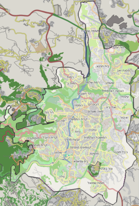
See עין חמד, עין נקובא, on the map

Directions to עין חמד (עין נקובא) with public transportation
The following transit lines have routes that pass near עין חמד
 Bus:
Bus:
How to get to עין חמד by bus?
Click on the bus route to see step by step directions with maps, line arrival times and updated time schedules.
Bus stations near עין חמד in עין נקובא
- צומת חמד,8 min walk,
- מחלף חמד,11 min walk,
Bus lines to עין חמד in עין נקובא
- 87,הר אדר,
- 185,נווה אילן,
- 187,הר אדר,
- 195,ירושלים,
- 54,שכונה י''א א,
- 56,מטה יהודה,
- 58,מטה יהודה,
- 59,מחלף חמד,
- 100,בית דגן,
- 104,מבשרת ציון,
- 109,נוף איילון,
- 114,מודיעין-מכבים-רעות,
- 115,בית שמש,
- 118,מודיעין-מכבים-רעות,
- 151,מבשרת ציון,
- 154,מבשרת ציון,
- 186,בית מאיר,
- 188,עין ראפה,
- 189,קריית יערים,
- 289,קריית יערים,
What are the closest stations to עין חמד?
The closest stations to עין חמד are:
- צומת חמד is 597 meters away, 8 min walk.
- מחלף חמד is 767 meters away, 11 min walk.
Which bus lines stop near עין חמד?
These bus lines stop near עין חמד: 188, 415, 433.
What’s the nearest bus stop to עין חמד in עין נקובא?
The nearest bus stop to עין חמד in עין נקובא is צומת חמד. It’s a 8 min walk away.
See עין חמד, עין נקובא, on the map
Public Transit to עין חמד in עין נקובא
Wondering how to get to עין חמד in עין נקובא, Israel? Moovit helps you find the best way to get to עין חמד with step-by-step directions from the nearest public transit station.
Moovit provides free maps and live directions to help you navigate through your city. View schedules, routes, timetables, and find out how long does it take to get to עין חמד in real time.
Looking for the nearest stop or station to עין חמד? Check out this list of stops closest to your destination: צומת חמד; מחלף חמד.
Bus:
Want to see if there’s another route that gets you there at an earlier time? Moovit helps you find alternative routes or times. Get directions from and directions to עין חמד easily from the Moovit App or Website.
We make riding to עין חמד easy, which is why over 1.5 million users, including users in עין נקובא, trust Moovit as the best app for public transit. You don’t need to download an individual bus app or train app, Moovit is your all-in-one transit app that helps you find the best bus time or train time available.
For information on prices of bus and light rail, costs and ride fares to עין חמד, please check the Moovit app.
Use the app to navigate to popular places including to the airport, hospital, stadium, grocery store, mall, coffee shop, school, college, and university.
Location: עין נקובא, Israel
Attractions near עין חמד
‘En H̱emed,שמורת עין חמד,Shemurat ‘En H̱emed,Gan Le’ummi ‘En H̱emed,`En Hemed,חניון לילה הקסטל - Al-Qastal Camping,Shemurat Aqwa Bella,שמורת אקוה בלה,مدرسة بركنو فايس,הואדי & הדקלים,3975,גן אירועים עין חמד,גן לאומי עין חמד,‘Ein Naqūbā,En Nakuba,מחלף עין חמד,מחלף חמד,Meẖlaf H̱emed,Zova,3975How to get to popular attractions in עין נקובא with public transit
חוף סירונית נתניה, נתניה,חוף הכרמל תחנה מרכזית, חיפה,מרכז ביג באר-שבע, באר שבע,קיבוץ גליל ים, גליל ים,מבשרת ציון, מבשרת ציון,Dead Sea Kalia Beach,Haifa (Haifa (חיפה)), חיפה,רמות השבים, רמות השבים,חניון רידינג, תל אביב-יפו,רמת פולג, נתניה,שכונת הדר יוסף, תל אביב-יפו,מסוף אורנית,Ir Yamim Mall קניון עיר ימים, נתניה,מחלף חמד, בית נקופה,Azrieli Sarona Tower, תל אביב-יפו,The Carlton Hotel Tel Aviv, תל אביב-יפו,Kiryat Moriah, ירושלים,חוף אשקלון, אשקלון,Frishman Beach, תל אביב-יפו,תחנה מרכזית באר שבע, באר שבעGet around עין נקובא by public transit!
Traveling around עין נקובא has never been so easy. See step by step directions as you travel to any attraction, street or major public transit station. View bus and train schedules, arrival times, service alerts and detailed routes on a map, so you know exactly how to get to anywhere in עין נקובא.
When traveling to any destination around עין נקובא use Moovit's Live Directions with Get Off Notifications to know exactly where and how far to walk, how long to wait for your line, and how many stops are left. Moovit will alert you when it's time to get off — no need to constantly re-check whether yours is the next stop.
Wondering how to use public transit in עין נקובא or how to pay for public transit in עין נקובא? Moovit public transit app can help you navigate your way with public transit easily, and at minimum cost. It includes public transit fees, ticket prices, and costs. Looking for a map of עין נקובא public transit lines? Moovit public transit app shows all public transit maps in עין נקובא with all bus or light rail routes and stops on an interactive map.
עין נקובא has 2 transit type(s), including: bus or light rail, operated by several transit agencies, including דן (Dan), הרכבת הקלה תל אביב - תבל - הקו האדום, רכבת ישראל (Israel Railways), אגד (Egged), מטרופולין (Metropoline), קווים (Kavim), אלקטרה אפיקים (Electra Afikim), נתיב אקספרס (Nateev Express), אקסטרה (Extra), אקסטרה ירושלים, הרכבת הקלה ירושלים - כפיר, דן בדרום (Dan Badarom), דן באר שבע (Dan Beer-Sheva), אלקטרה אפיקים תחבורה (Electra Afikim Tachbura) and סופרבוס (Superbus)