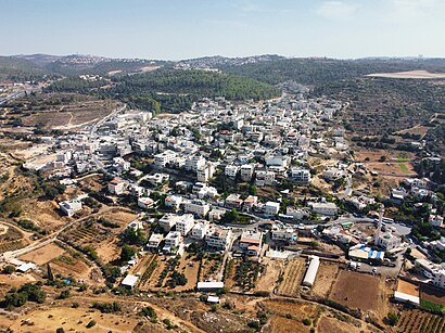
See עין נקופה, מ.א. מטה יהודה, on the map
Directions to עין נקופה (מ.א. מטה יהודה) with public transportation
The following transit lines have routes that pass near עין נקופה
 Bus:
Bus:
How to get to עין נקופה by bus?
Click on the bus route to see step by step directions with maps, line arrival times and updated time schedules.
Bus stations near עין נקופה in מ.א. מטה יהודה
- הדרור/חרמון,13 min walk,
- יצחק נסים/חרמון,17 min walk,
- יסמין,24 min walk,
Bus lines to עין נקופה in מ.א. מטה יהודה
- 56,הראל/יסמין,
- 104,ירושלים,
- 155,מבשרת ציון,
- 156,מבשרת ציון,
- 87,הר אדר,
- 54,שכונה י''א א,
- 153,מבשרת ציון,
- 154,ירושלים,
What are the closest stations to עין נקופה?
The closest stations to עין נקופה are:
- הדרור/חרמון is 1011 meters away, 13 min walk.
- יצחק נסים/חרמון is 1311 meters away, 17 min walk.
- יסמין is 1867 meters away, 24 min walk.
Which bus lines stop near עין נקופה?
These bus lines stop near עין נקופה: 118, 154, 155, 615.
What’s the nearest bus stop to עין נקופה in מ.א. מטה יהודה?
The nearest bus stop to עין נקופה in מ.א. מטה יהודה is הדרור/חרמון. It’s a 13 min walk away.
What time is the first bus to עין נקופה in מ.א. מטה יהודה?
The 104 is the first bus that goes to עין נקופה in מ.א. מטה יהודה. It stops nearby at 3:01 AM.
What time is the last bus to עין נקופה in מ.א. מטה יהודה?
The 155 is the last bus that goes to עין נקופה in מ.א. מטה יהודה. It stops nearby at 1:10 AM.
How much is the bus fare to עין נקופה?
The bus fare to עין נקופה costs about ₪5.50 - ₪12.00.
See עין נקופה, מ.א. מטה יהודה, on the map
Public Transit to עין נקופה in מ.א. מטה יהודה
Wondering how to get to עין נקופה in מ.א. מטה יהודה, Israel? Moovit helps you find the best way to get to עין נקופה with step-by-step directions from the nearest public transit station.
Moovit provides free maps and live directions to help you navigate through your city. View schedules, routes, timetables, and find out how long does it take to get to עין נקופה in real time.
Looking for the nearest stop or station to עין נקופה? Check out this list of stops closest to your destination: הדרור/חרמון; יצחק נסים/חרמון; יסמין.
Bus:
Want to see if there’s another route that gets you there at an earlier time? Moovit helps you find alternative routes or times. Get directions from and directions to עין נקופה easily from the Moovit App or Website.
We make riding to עין נקופה easy, which is why over 1.5 million users, including users in מ.א. מטה יהודה, trust Moovit as the best app for public transit. You don’t need to download an individual bus app or train app, Moovit is your all-in-one transit app that helps you find the best bus time or train time available.
For information on prices of bus, costs and ride fares to עין נקופה, please check the Moovit app.
Use the app to navigate to popular places including to the airport, hospital, stadium, grocery store, mall, coffee shop, school, college, and university.
עין נקופה Address: עין נקופה street in מ.א. מטה יהודה
Attractions near עין נקופה
קלפי 18.2 ביס ממלכתי הדרור-תלי מבשרת ציון,קלפי 18.3 ביס ממלכתי הדרור-תלי מבשרת ציון,קלפי 18.5 ביס ממלכתי הדרור-תלי מבשרת ציון,קלפי 18.1 ביס ממלכתי הדרור-תלי מבשרת ציון,קלפי 18.4 ביס ממלכתי הדרור-תלי מבשרת ציון,מספרת יואל צרפתי,ילושקה בגדי מעצבים - בוטיק ביתי ויחודי,מכולת הזמיר,3453 - הדרור הזמיר,מרגלית שחר - עיסוי הוליסטי מרפא,פארק הדרור,הזמיר,3451 - הדרור הזמיר,2934 - הדרור הזמיר,בית ספר הדרור,הדרור תל""י,הר שלומציון,בית כנסת חזון יחזקאל,3447 - הר מירון חרמון,יצחק נסים/חרמוןHow to get to popular attractions in מ.א. מטה יהודה with public transit
מנחת בילינסון, פתח תקווה,IDC - Interdisciplinary Center (המרכז הבינתחומי הרצליה), הרצלייה,Frishman Beach, תל אביב-יפו,מלון כפר המכביה, רמת גן,פארק וולפסון, תל אביב-יפו,Central Bus Station Tel Aviv, תל אביב-יפו,חוף הכרמל תחנה מרכזית, חיפה,זאפה, תל אביב-יפו,Central Bus Station Jerusalem, ירושלים,חוף אשקלון, אשקלון,Ir Yamim Mall קניון עיר ימים, נתניה,El Al Head Offices and Campus, נמל תעופה בן גוריון,Mount of Beatitudes, מ.א. עמק הירדן,דיזי פרישדון, תל אביב-יפו,WIX offices, תל אביב-יפו,קיבוץ גליל ים, גליל ים,Garage Gym (גראז' - חדר כושר), תל אביב-יפו,טיילת בת-ים, בת ים,תחנה מרכזית ראשון-לציון, ראשון לציון,תחנה מרכזית באר-שבע, באר שבעGet around מ.א. מטה יהודה by public transit!
Traveling around מ.א. מטה יהודה has never been so easy. See step by step directions as you travel to any attraction, street or major public transit station. View bus and train schedules, arrival times, service alerts and detailed routes on a map, so you know exactly how to get to anywhere in מ.א. מטה יהודה.
When traveling to any destination around מ.א. מטה יהודה use Moovit's Live Directions with Get Off Notifications to know exactly where and how far to walk, how long to wait for your line, and how many stops are left. Moovit will alert you when it's time to get off — no need to constantly re-check whether yours is the next stop.
Wondering how to use public transit in מ.א. מטה יהודה or how to pay for public transit in מ.א. מטה יהודה? Moovit public transit app can help you navigate your way with public transit easily, and at minimum cost. It includes public transit fees, ticket prices, and costs. Looking for a map of מ.א. מטה יהודה public transit lines? Moovit public transit app shows all public transit maps in מ.א. מטה יהודה with all bus routes and stops on an interactive map.
מ.א. מטה יהודה has 1 transit type(s), including: bus, operated by several transit agencies, including דן (Dan), הרכבת הקלה תל אביב - תבל - הקו האדום, רכבת ישראל (Israel Railways), אגד (Egged), מטרופולין (Metropoline), קווים (Kavim), אלקטרה אפיקים (Electra Afikim), נתיב אקספרס (Nateev Express), אקסטרה (Extra), אקסטרה ירושלים, הרכבת הקלה ירושלים - כפיר, דן בדרום (Dan Badarom), דן באר שבע (Dan Beer-Sheva), אלקטרה אפיקים תחבורה (Electra Afikim Tachbura) and סופרבוס (Superbus)