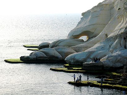
See ראש הניקרה, כפר ראש הנקרה, on the map
Directions to ראש הניקרה (כפר ראש הנקרה) with public transportation
The following transit lines have routes that pass near ראש הניקרה
Bus:
How to get to ראש הניקרה by Bus?
Click on the Bus route to see step by step directions with maps, line arrival times and updated time schedules.
Which Bus lines stop near ראש הניקרה?
These Bus lines stop near ראש הניקרה: 31
See ראש הניקרה, כפר ראש הנקרה, on the map

Public Transit to ראש הניקרה in כפר ראש הנקרה
Wondering how to get to ראש הניקרה in כפר ראש הנקרה, Israel? Moovit helps you find the best way to get to ראש הניקרה with step-by-step directions from the nearest public transit station.
Moovit provides free maps and live directions to help you navigate through your city. View schedules, routes, timetables, and find out how long does it take to get to ראש הניקרה in real time.
Bus:
Want to see if there’s another route that gets you there at an earlier time? Moovit helps you find alternative routes or times. Get directions from and directions to ראש הניקרה easily from the Moovit App or Website.
We make riding to ראש הניקרה easy, which is why over 1.5 million users, including users in כפר ראש הנקרה, trust Moovit as the best app for public transit. You don’t need to download an individual bus app or train app, Moovit is your all-in-one transit app that helps you find the best bus time or train time available.
For information on prices of Bus and Israel Railways, costs and ride fares to ראש הניקרה, please check the Moovit app.
Use the app to navigate to popular places including to the airport, hospital, stadium, grocery store, mall, coffee shop, school, college, and university.
Location: כפר ראש הנקרה, Israel

Attractions near ראש הניקרה
How to get to popular attractions in כפר ראש הנקרה with public transit
- מחלף חמד, בית נקופה
- טיב טעם, ראשון לציון
- Royal RAMADA Jerusalem, ירושלים
- Hilton Tel Aviv, תל אביב-יפו
- חוף סירונית נתניה, נתניה
- זאפה, תל אביב-יפו
- כיכר מגן דוד, תל אביב-יפו
- בנק אוצר החייל, מ.א. חוף השרון
- אצטדיון כפר סבא, כפר סבא
- בית כנסת שערי ציון, חולון
- חוף אשקלון, אשקלון
- Garage Gym (גראז' - חדר כושר), תל אביב-יפו
- קניון רוטשילד / Rothschild Mall Center, ראשון לציון
- Tel Aviv Hashalom Railway Station, תל אביב-יפו
- גני יהושוע / פארק הירקון, תל אביב-יפו
- תחנת רכבת הוד השרון סוקולוב, הוד השרון
- שכונת הדר יוסף, תל אביב-יפו
- חצי חינם, הוד השרון
- Netanya Railway Station, נתניה
- Yad Vashem, ירושלים