See برج خليفة/ دبي مول, Dubai, on the map
Directions to برج خليفة/ دبي مول (Dubai) with public transportation
The following transit lines have routes that pass near برج خليفة/ دبي مول
 Bus:
Bus: - Metro:
How to get to برج خليفة/ دبي مول by bus?
Click on the bus route to see step by step directions with maps, line arrival times and updated time schedules.
How to get to برج خليفة/ دبي مول by metro?
Click on the metro route to see step by step directions with maps, line arrival times and updated time schedules.
Bus stations near برج خليفة/ دبي مول in Dubai
- Dubai Mall Landside Metro Bus Stop - 02,3 min walk,
- Mazaya Center - 02,12 min walk,
- Mazaya Center - 01,13 min walk,
- Wasl, Etisalat - 01,20 min walk,
- Wasl, Terminus - 01,31 min walk,
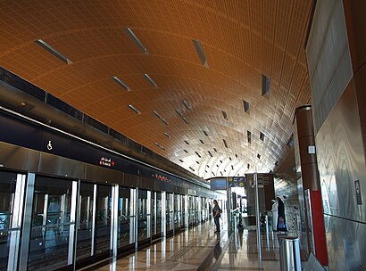
Metro stations near برج خليفة/ دبي مول in Dubai
- World Trade Centre Metro Station,22 min walk,
Bus lines to برج خليفة/ دبي مول in Dubai
- D03,Dubai Mall Landside Metro Bus Stop,
- F13,Dubai Mall Landside Metro Bus Stop,
- 98E,Satwa, Bus Station,
- 7,Al Quoz, J Mart Supermarket,
- 27,Gold Souq Bus Station,
- 29,Ghubaiba Bus Station,
- F11,Financial Center Seaside Metro Bus Stop,
What are the closest stations to برج خليفة/ دبي مول?
The closest stations to برج خليفة/ دبي مول are:
- Dubai Mall Landside Metro Bus Stop - 02 is 180 meters away, 3 min walk.
- Mazaya Center - 02 is 864 meters away, 12 min walk.
- Mazaya Center - 01 is 989 meters away, 13 min walk.
- Wasl, Etisalat - 01 is 1522 meters away, 20 min walk.
- World Trade Centre Metro Station is 1649 meters away, 22 min walk.
- Wasl, Terminus - 01 is 2409 meters away, 31 min walk.
Which bus line stops near برج خليفة/ دبي مول?
F13
Which metro line stops near برج خليفة/ دبي مول?
M1
What’s the nearest metro station to برج خليفة/ دبي مول in Dubai?
The nearest metro station to برج خليفة/ دبي مول in Dubai is World Trade Centre Metro Station. It’s a 22 min walk away.
What’s the nearest bus stop to برج خليفة/ دبي مول in Dubai?
The nearest bus stop to برج خليفة/ دبي مول in Dubai is Dubai Mall Landside Metro Bus Stop - 02. It’s a 3 min walk away.
What time is the first metro to برج خليفة/ دبي مول in Dubai?
The M1 is the first metro that goes to برج خليفة/ دبي مول in Dubai. It stops nearby at 5:51 AM.
What time is the last metro to برج خليفة/ دبي مول in Dubai?
The M1 is the last metro that goes to برج خليفة/ دبي مول in Dubai. It stops nearby at 12:29 AM.
What time is the first bus to برج خليفة/ دبي مول in Dubai?
The F11 is the first bus that goes to برج خليفة/ دبي مول in Dubai. It stops nearby at 5:48 AM.
What time is the last bus to برج خليفة/ دبي مول in Dubai?
The 27 is the last bus that goes to برج خليفة/ دبي مول in Dubai. It stops nearby at 12:53 AM.
See برج خليفة/ دبي مول, Dubai, on the map
Public Transit to برج خليفة/ دبي مول in Dubai
Wondering how to get to برج خليفة/ دبي مول in Dubai, United Arab Emirates? Moovit helps you find the best way to get to برج خليفة/ دبي مول with step-by-step directions from the nearest public transit station.
Moovit provides free maps and live directions to help you navigate through your city. View schedules, routes, timetables, and find out how long does it take to get to برج خليفة/ دبي مول in real time.
Looking for the nearest stop or station to برج خليفة/ دبي مول? Check out this list of stops closest to your destination: Dubai Mall Landside Metro Bus Stop - 02; Mazaya Center - 02; Mazaya Center - 01; Wasl; World Trade Centre Metro Station; Wasl.
Bus:Metro:
Want to see if there’s another route that gets you there at an earlier time? Moovit helps you find alternative routes or times. Get directions from and directions to برج خليفة/ دبي مول easily from the Moovit App or Website.
We make riding to برج خليفة/ دبي مول easy, which is why over 1.5 million users, including users in Dubai, trust Moovit as the best app for public transit. You don’t need to download an individual bus app or train app, Moovit is your all-in-one transit app that helps you find the best bus time or train time available.
For information on prices of bus and metro, costs and ride fares to برج خليفة/ دبي مول, please check the Moovit app.
Use the app to navigate to popular places including to the airport, hospital, stadium, grocery store, mall, coffee shop, school, college, and university.
برج خليفة/ دبي مول Address: برج خليفة, دبي street in Dubai
Attractions near برج خليفة/ دبي مول
Burj Khalifa Dubai Mall Dubai Metro,محطة برج خليفة / دبي مول,Burj Khalifa / Dubai Mall Metro Station محطة مترو برج خليفة / دبي مول ,Dubai Mall Metro Bus Stop,The Address - Sky View Tower 1,48 Burj Gate,Bait Al Mandi,Tesla Showroom,Barracuda Beach Resort,The Address - Sky View,Address Sky View Dubai,ملحمة قلعة بعلبك,Downtown Dubai,Ce la VI دبي,Damac Hills,وزارة الموارد البشرية والتوطين,Vida Downtown Dubai,Al Wasl Building,Inka,Sofitel Dubai DowntownHow to get to popular attractions in Dubai with public transit
Coya, Dubai,مزيد مول, Abu Dhabi,Abu Dhabi Golf Club, Abu Dhabi,ستاربكس, Abu Dhabi,القرية العالمية, Dubai,مطار أبو ظبي الدولي (AUH), Abu Dhabi,Towers Rotana Hotel, Dubai,IBIS Hotel, Dubai,General Directorate of Residence And Foreigners Affairs-Abu Dhabi, Abu Dhabi,The Town Center, Dubai,Mcdermott International, Dubai,Ibis One Central Hotel, Dubai,مركز ابن بطوطة, Dubai,Dubai Hospital Nurses Accommodation, Dubai,نار, Dubai,Abela أبيلا, Abu Dhabi,Al Ittihad Road, Sharjah,Khalifa University جامعة خليفة, Abu Dhabi,Ferrari World Abu Dhabi, Abu Dhabi,Abu Dhabi International Airport Transit Area, Abu DhabiGet around Dubai by public transit!
Traveling around Dubai has never been so easy. See step by step directions as you travel to any attraction, street or major public transit station. View bus and train schedules, arrival times, service alerts and detailed routes on a map, so you know exactly how to get to anywhere in Dubai.
When traveling to any destination around Dubai use Moovit's Live Directions with Get Off Notifications to know exactly where and how far to walk, how long to wait for your line, and how many stops are left. Moovit will alert you when it's time to get off — no need to constantly re-check whether yours is the next stop.
Wondering how to use public transit in Dubai or how to pay for public transit in Dubai? Moovit public transit app can help you navigate your way with public transit easily, and at minimum cost. It includes public transit fees, ticket prices, and costs. Looking for a map of Dubai public transit lines? Moovit public transit app shows all public transit maps in Dubai with all bus or metro routes and stops on an interactive map.
Dubai has 2 transit type(s), including: bus or metro, operated by several transit agencies, including RTA, RTA, Serco Group plc, RTA, DARB, Sharjah Road Transport Agency and DARB