
How to get to ถนน บำรุงเมือง in พระนคร by Bus, Ferry, Metro, SkyTrain or Train?

See ถนน บำรุงเมือง, พระนคร, on the map

Directions to ถนน บำรุงเมือง (พระนคร) with public transportation

The following transit lines have routes that pass near ถนน บำรุงเมือง

  • SkyTrainSkyTrain:
  • MetroMetro:
  • BusBus:
  • FerryFerry:
  • TrainTrain:

How to get to ถนน บำรุงเมือง by Bus?

Click on the Bus route to see step by step directions with maps, line arrival times and updated time schedules.

How to get to ถนน บำรุงเมือง by Train?

Click on the Train route to see step by step directions with maps, line arrival times and updated time schedules.

How to get to ถนน บำรุงเมือง by Metro?

Click on the Metro route to see step by step directions with maps, line arrival times and updated time schedules.

How to get to ถนน บำรุงเมือง by SkyTrain?

Click on the SkyTrain route to see step by step directions with maps, line arrival times and updated time schedules.

How to get to ถนน บำรุงเมือง by Ferry?

Click on the Ferry route to see step by step directions with maps, line arrival times and updated time schedules.

Bus stations near ถนน บำรุงเมือง in พระนคร

  • สน.สำราญราษฎร์;Samran Rat Police Station,3 min walk,
  • ตรงข้ามสถานีตำรวจนครบาลสำราญราษฎร์,4 min walk,
  • เสาชิงช้า;Sao Chingcha,5 min walk,
  • เสาชิงช้า Sao Chingcha,6 min walk,
  • ตรงข้ามวัดสุทัศน์ฯ;Wat Suthat Thepwararam (Opposite),6 min walk,
  • ตรงข้ามวัดสุทัศน์,ร้านวิจิตรพานิช,6 min walk,
  • ตรงข้ามศาลาว่าการกรุงเทพมหานคร,7 min walk,
  • สถานีตำรวจนครบาลสำราญราษฎร์;Police Station Samranrat,7 min walk,
  • สถานีตำรวจนครบาลสำราญราษฎร์,7 min walk,

Metro stations near ถนน บำรุงเมือง in พระนคร

  • Mrt สนามไชย;Mrt Sanam Chai,10 min walk,

Ferry stations near ถนน บำรุงเมือง in พระนคร

  • ท่าเรือผ่านฟ้าลีลาศ;Panfa Leelard Pier,10 min walk,
  • ท่าเรือท่าเตียน (ข้ามฟาก);Tha Tien Pier (Ferry),11 min walk,
  • ท่าเรือสะพานพุทธ;Memorial Bridge Pier,12 min walk,

Bus lines to ถนน บำรุงเมือง in พระนคร

  • 508,ปากน้ำ (ตลาดปากน้ำ);Paknam (Pak Nam Market),
  • 508 (ปอ.) (AC),อู่ฟาร์มจระเข้สมุทรปราการ,
  • 12,สนง.ที่ดินกรุงเทพฯ;Bangkok Metropolitan Land Office,
  • 35,สายใต้ใหม่ (ตลิ่งชัน);Southern Bus (Talingchan),
  • 42,เสาชิงช้า;Giant Swing,
  • 3-53,เสาชิงช้า;The Giant Swing,
  • 3-37 (12),ห้วยขวาง;Huai Kwang,
  • 4-10 (42),เสาชิงช้า;Sao Ching Cha,
  • 12,สถานีดับเพลิงห้วยขวาง,สาธารณสุข 52,
  • 12,ตรงข้ามตลาดสดห้วยขวาง,
  • 12 (ปอ.) (AC),โรงเรียนวัดราชบพิธ(ท่าปลายทางปากคลองตลาด),
  • 42,ตรงข้ามวัดสุทัศน์,ร้านวิจิตรพานิช,
  • 12,ห้วยขวาง;Huai Khwang,
  • 2-37,อู่หมอชิต 2;Mochit 2,
  • 3,อู่หมอชิต 2 Mochit 2 Bus Depot,
  • 3 (ปอ.) (AC),อู่หมอชิต 2 Mochit 2 Bus Depot,
  • 60,อู่สวนสยาม Siam Park Bus Depot,
  • 60 (ปอ.) (AC),อู่สวนสยาม Siam Park Bus Depot,
  • 1-63,สวนหลวงพระราม 8;Suan Luang Rama VIII,
  • 4-40 (56),บางลำพู;Banglamphu,
Questions & Answers
  • What are the closest stations to ถนน บำรุงเมือง?

    The closest stations to ถนน บำรุงเมือง are:

    • สน.สำราญราษฎร์;Samran Rat Police Station is 203 meters away, 3 min walk.
    • ตรงข้ามสถานีตำรวจนครบาลสำราญราษฎร์ is 288 meters away, 4 min walk.
    • เสาชิงช้า;Sao Chingcha is 320 meters away, 5 min walk.
    • เสาชิงช้า Sao Chingcha is 346 meters away, 6 min walk.
    • ตรงข้ามวัดสุทัศน์ฯ;Wat Suthat Thepwararam (Opposite) is 395 meters away, 6 min walk.
    • ตรงข้ามวัดสุทัศน์,ร้านวิจิตรพานิช is 395 meters away, 6 min walk.
    • ตรงข้ามศาลาว่าการกรุงเทพมหานคร is 436 meters away, 7 min walk.
    • สถานีตำรวจนครบาลสำราญราษฎร์;Police Station Samranrat is 489 meters away, 7 min walk.
    • สถานีตำรวจนครบาลสำราญราษฎร์ is 489 meters away, 7 min walk.
    • Mrt สนามไชย;Mrt Sanam Chai is 734 meters away, 10 min walk.
    • ท่าเรือผ่านฟ้าลีลาศ;Panfa Leelard Pier is 741 meters away, 10 min walk.
    • ท่าเรือท่าเตียน (ข้ามฟาก);Tha Tien Pier (Ferry) is 831 meters away, 11 min walk.
    • ท่าเรือสะพานพุทธ;Memorial Bridge Pier is 858 meters away, 12 min walk.
  • Which SkyTrain lines stop near ถนน บำรุงเมือง?

    These SkyTrain lines stop near ถนน บำรุงเมือง: SILOM

  • Which Metro lines stop near ถนน บำรุงเมือง?

    These Metro lines stop near ถนน บำรุงเมือง: BLUE

  • Which Bus lines stop near ถนน บำรุงเมือง?

    These Bus lines stop near ถนน บำรุงเมือง: 12 (ปอ.) (AC), 3-53, 35, 508

  • Which Ferry lines stop near ถนน บำรุงเมือง?

    These Ferry lines stop near ถนน บำรุงเมือง: เรือด่วนธงส้ม

  • Which Train lines stop near ถนน บำรุงเมือง?

    These Train lines stop near ถนน บำรุงเมือง: 262

  • What’s the nearest metro station to ถนน บำรุงเมือง in พระนคร?

    The nearest metro station to ถนน บำรุงเมือง in พระนคร is Mrt สนามไชย;Mrt Sanam Chai. It’s a 10 min walk away.

  • What’s the nearest bus stop to ถนน บำรุงเมือง in พระนคร?

    The nearest bus stop to ถนน บำรุงเมือง in พระนคร is สน.สำราญราษฎร์;Samran Rat Police Station. It’s a 3 min walk away.

  • What’s the nearest ferry station to ถนน บำรุงเมือง in พระนคร?

    The nearest ferry station to ถนน บำรุงเมือง in พระนคร is ท่าเรือผ่านฟ้าลีลาศ;Panfa Leelard Pier. It’s a 10 min walk away.

  • What time is the first Metro to ถนน บำรุงเมือง in พระนคร?

    The BLUE is the first Metro that goes to ถนน บำรุงเมือง in พระนคร. It stops nearby at 6:19 AM.

  • What time is the last Metro to ถนน บำรุงเมือง in พระนคร?

    The BLUE is the last Metro that goes to ถนน บำรุงเมือง in พระนคร. It stops nearby at 12:45 AM.

  • What time is the first Bus to ถนน บำรุงเมือง in พระนคร?

    The 60 is the first Bus that goes to ถนน บำรุงเมือง in พระนคร. It stops nearby at 3:02 AM.

  • What time is the last Bus to ถนน บำรุงเมือง in พระนคร?

    The 3 is the last Bus that goes to ถนน บำรุงเมือง in พระนคร. It stops nearby at 2:55 AM.

  • What time is the first Ferry to ถนน บำรุงเมือง in พระนคร?

    The เรือข้ามฟาก is the first Ferry that goes to ถนน บำรุงเมือง in พระนคร. It stops nearby at 5:00 AM.

  • What time is the last Ferry to ถนน บำรุงเมือง in พระนคร?

    The เรือคลองแสนแสบ is the last Ferry that goes to ถนน บำรุงเมือง in พระนคร. It stops nearby at 8:52 PM.

See ถนน บำรุงเมือง, พระนคร, on the map

The Most Popular Urban Mobility App in พระนคร.
All local mobility options in one app

Public Transit to ถนน บำรุงเมือง in พระนคร

Wondering how to get to ถนน บำรุงเมือง in พระนคร, Thailand? Moovit helps you find the best way to get to ถนน บำรุงเมือง with step-by-step directions from the nearest public transit station.

Moovit provides free maps and live directions to help you navigate through your city. View schedules, routes, timetables, and find out how long does it take to get to ถนน บำรุงเมือง in real time.

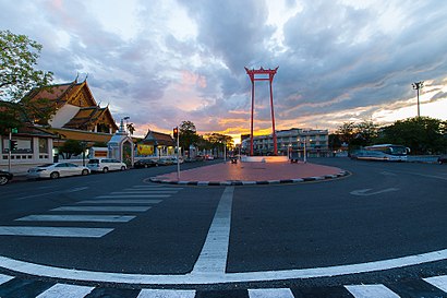
Looking for the nearest stop or station to ถนน บำรุงเมือง? Check out this list of stops closest to your destination: สน.สำราญราษฎร์;Samran Rat Police Station; ตรงข้ามสถานีตำรวจนครบาลสำราญราษฎร์; เสาชิงช้า;Sao Chingcha; เสาชิงช้า Sao Chingcha; ตรงข้ามวัดสุทัศน์ฯ;Wat Suthat Thepwararam (Opposite); ตรงข้ามวัดสุทัศน์,ร้านวิจิตรพานิช; ตรงข้ามศาลาว่าการกรุงเทพมหานคร; สถานีตำรวจนครบาลสำราญราษฎร์;Police Station Samranrat; สถานีตำรวจนครบาลสำราญราษฎร์; Mrt สนามไชย;Mrt Sanam Chai; ท่าเรือผ่านฟ้าลีลาศ;Panfa Leelard Pier; ท่าเรือท่าเตียน (ข้ามฟาก);Tha Tien Pier (Ferry); ท่าเรือสะพานพุทธ;Memorial Bridge Pier.

SkyTrain:Metro:Bus:Ferry:Train:

Want to see if there’s another route that gets you there at an earlier time? Moovit helps you find alternative routes or times. Get directions from and directions to ถนน บำรุงเมือง easily from the Moovit App or Website.

We make riding to ถนน บำรุงเมือง easy, which is why over 1.5 million users, including users in พระนคร, trust Moovit as the best app for public transit. You don’t need to download an individual bus app or train app, Moovit is your all-in-one transit app that helps you find the best bus time or train time available.

For information on prices of Bus, Ferry, Metro, SkyTrain and Train, costs and ride fares to ถนน บำรุงเมือง, please check the Moovit app.

Use the app to navigate to popular places including to the airport, hospital, stadium, grocery store, mall, coffee shop, school, college, and university.

ถนน บำรุงเมือง Address: ถนน บำรุงเมือง แขวง เสาชิงช้า Bangkok, กรุงเทพมหานคร 10200 ประเทศไทย street in พระนคร

ถนน บำรุงเมือง, พระนคร
ถนน บำรุงเมือง, พระนครBamrung Mueang Road (Thai: ถนนบำรุงเมือง, pronounced [tʰā.nǒn bām.rūŋ mɯ̄a̯ŋ]) is the second paved road in Bangkok. It was built in 1863 after Charoen Krung Road, in the reign of King Mongkut (Rama IV). It cut through the old fortified city of Rattanakosin Island from west to east, beginning near the Grand Palace, passing the Giant Swing and running eastward to Khlong Phadung Krung Kasem. It continues on as Rama I Road after crossing Kasat Suek Bridge. It was the main thoroughfare as the city expanded eastward and away from the Chao Phraya river in the early 20th century.Originally, it was called unofficially "Thanon Ree" (ถนนรี, "diagonal road") or "Thanon Sao Chingcha" (ถนนเสาชิงช้า, "giant swing road"). In the reign of King Chulalongkorn (Rama V), the road was made 9 meters (29.5 feet) wide as seen today. In the early Rattanakosin period (reigns of King Buddha Yodfa (Rama I) to King Nangklao (Rama III)), it was only an earthen path extending from the Grand Palace. The road's early segment is lined by historic shophouse buildings, originally built with connecting colonnades forming a five-foot way (a feature commonly found in Malaysia and Singapore), which, however, have since been walled up, and as such this segment of the road lacks pedestrian walkways.These shophouses owned by Thai Chinese people who do Buddhist monk's items business.
How to get to ถนน บำรุงเมือง with public transit - About the place

Public transit lines with stations closest to ถนน บำรุงเมือง in พระนคร

Metro lines with stations closest to ถนน บำรุงเมือง in พระนคร

Bus lines with stations closest to ถนน บำรุงเมือง in พระนคร

Ferry lines with stations closest to ถนน บำรุงเมือง in พระนคร

Easier to get to ถนน บำรุงเมือง in…