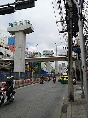
See ถนน ลาดพร้าว, Wang Thonglang, on the map
Directions to ถนน ลาดพร้าว (Wang Thonglang) with public transportation
The following transit lines have routes that pass near ถนน ลาดพร้าว
Metro:
Bus:
How to get to ถนน ลาดพร้าว by Bus?
Click on the Bus route to see step by step directions with maps, line arrival times and updated time schedules.
How to get to ถนน ลาดพร้าว by Metro?
Click on the Metro route to see step by step directions with maps, line arrival times and updated time schedules.
Bus stations near ถนน ลาดพร้าว in Wang Thonglang
- ตรงข้ามตลาดสะพาน 2 Lat Phrao Saphan 2,2 min walk,
Bus lines to ถนน ลาดพร้าว in Wang Thonglang
- 27,มีนบุรี - อนุสาวรีย์ชัยสมรภูมิ Minburi - Victory Monument,
- 73ก (ปอ.) (AC),อู่สวนสยาม - สะพานพุทธ Siam Park - Saphan Phut,
- 96,อู่มีนบุรี - อู่หมอชิต 2 Minburi - Mochit 2,
- 137 (ปอ.) (AC),รัชดาภิเษก - รามคำแหง Ratchadapisek - Ramkhamhaeng,
- 145,อู่แพรกษา-บ่อดิน - อู่หมอชิต 2 Praksa-Bodin - Mochit 2,
- 145,อู่เมกาบางนา - อู่หมอชิต2 Mega Bangna - Mochit 2,
- 145 (ปอ.) (AC),อู่แพรกษา-บ่อดิน - อู่หมอชิต 2 Praksa-Bodin - Mochit 2,
- 178,สวนสยาม - ตลาดสุคนธสวัสดิ์ siampark - Su Khontha Sawat Market,
- 191,กระทรวงพาณิชย์ - เคหะคลองจั่น Ministry of Commerce - Klongchan Housing,
- 502,อู่มีนบุรี - อนุสาวรีย์ชัยสมรภูมิ Minburi - Victory Monument,
- 502 (ปอ.) (AC),อู่มีนบุรี - อนุสาวรีย์ชัยสมรภูมิ Minburi - Victory Monument,
- 514 (ปอ.) (AC),อู่มีนบุรี - สีลม Minburi - Silom,
What are the closest stations to ถนน ลาดพร้าว?
The closest stations to ถนน ลาดพร้าว are:
- ตรงข้ามตลาดสะพาน 2 Lat Phrao Saphan 2 is 37 meters away, 2 min walk.
Which Metro lines stop near ถนน ลาดพร้าว?
These Metro lines stop near ถนน ลาดพร้าว: สายเฉลิมรัชมงคล MRT BLUE LINE
Which Bus lines stop near ถนน ลาดพร้าว?
These Bus lines stop near ถนน ลาดพร้าว: 126, 137 (ปอ.) (AC), 172 (ปอ.) (AC), 44, 545 (ปอ.) (AC), 73ก (ปอ.) (AC)
What’s the nearest bus stop to ถนน ลาดพร้าว in Wang Thonglang?
The nearest bus stop to ถนน ลาดพร้าว in Wang Thonglang is ตรงข้ามตลาดสะพาน 2 Lat Phrao Saphan 2. It’s a 2 min walk away.
See ถนน ลาดพร้าว, Wang Thonglang, on the map

Public Transit to ถนน ลาดพร้าว in Wang Thonglang
Wondering how to get to ถนน ลาดพร้าว in Wang Thonglang, Thailand? Moovit helps you find the best way to get to ถนน ลาดพร้าว with step-by-step directions from the nearest public transit station.
Moovit provides free maps and live directions to help you navigate through your city. View schedules, routes, timetables, and find out how long does it take to get to ถนน ลาดพร้าว in real time.
Looking for the nearest stop or station to ถนน ลาดพร้าว? Check out this list of stops closest to your destination: ตรงข้ามตลาดสะพาน 2 Lat Phrao Saphan 2.
Metro:Bus:
Want to see if there’s another route that gets you there at an earlier time? Moovit helps you find alternative routes or times. Get directions from and directions to ถนน ลาดพร้าว easily from the Moovit App or Website.
We make riding to ถนน ลาดพร้าว easy, which is why over 1.5 million users, including users in Wang Thonglang, trust Moovit as the best app for public transit. You don’t need to download an individual bus app or train app, Moovit is your all-in-one transit app that helps you find the best bus time or train time available.
For information on prices of Bus and Metro, costs and ride fares to ถนน ลาดพร้าว, please check the Moovit app.
Use the app to navigate to popular places including to the airport, hospital, stadium, grocery store, mall, coffee shop, school, college, and university.
ถนน ลาดพร้าว Address: ซอย ลาดพร้าว 47 ถนน ลาดพร้าว แขวง สะพานสอง เขต วังทองหลาง กรุงเทพมหานคร 10310 ไทย street in Wang Thonglang

Attractions near ถนน ลาดพร้าว
- ต๋อยแกงเลิศรส
- พลอยใสเภสัช
- ตลาดสะพาน 2
- Lat Phrao Saphan 2 Market
- อัน อัน มินิมาร์ท
- สินวัลลภเคหะและที่ดิน
- เทสโก้ โลตัส
- เค วี เอ็น อิมปอร์ต เอกซ์ปอร์ต 1991
- พลอยนรินทร์
- Hear Wirat Che Oai
- อาร์ทลิงค์
- สำนักงานบัญชี พี แอนด์ วาย คอนเซ้าท์ติ้ง กรุ๊ป
- เซ็นทริส คอร์ปอเรชั่น
- องค์การค้าของ สกสค.
- กาแฟสดโชว์ปัง
- พี เอส วี เคมีคอล
- ธัญรัต โปรดักชั่น
- ห้างทองหงษ์สุวรรณ
- สะพาน
- สะพานลอย
How to get to popular attractions in Wang Thonglang with public transit
- เยาวราช, สัมพันธวงศ์
- BMTA Bus Stop ท่าน้ำนนท์ (Thanam Nonthaburi), เมืองนนทบุรี
- หมู่บ้านสินทวี สวนธนฯ1, ทุ่งครุ
- โค้งโรงเจ, บางกรวย
- ห้างสรรพสินค้าเซ็นทรัล, บางบัวทอง
- ส้มตําคั่วแซ่บ, สายไหม
- สุดแซ่บ เมืองยศ, เมืองนนทบุรี
- เปี่ยมสุข รัตนาธิเบศร์ 17, เมืองนนทบุรี
- หมู่บ้านทิพย์พิมาน การ์เด้น, บางบัวทอง
- ธีรศักดิ์ เซรามิค&สกรีน, กระทุ่มแบน
- บางปะกง, ตลิ่งชัน
- CADET-TUTOR, ปากเกร็ด
- น้องบี ทะเลเผา, ดอนเมือง
- หมู่บ้านอมรชัย5, เมืองสมุทรสาคร
- เทสโก้ โลตัส เอ็กซ์เพรส, คลองหลวง
- หอพักเปี่ยมศิริ, บางกอกน้อย
- สนามหลวง, พระนคร
- พิศมัย สาย 2, บางแค
- แหนมเนือง "คุณน้อย" ปากเกร็ด, ปากเกร็ด
- บ้านสวนปาล์ม, คลองหลวง