See ถนน หลวง, ป้อมปราบศัตรูพ่าย, on the map
Directions to ถนน หลวง (ป้อมปราบศัตรูพ่าย) with public transportation
The following transit lines have routes that pass near ถนน หลวง
 Metro:
 - Bus:
- Ferry:
- Train:
How to get to ถนน หลวง by bus?
Click on the bus route to see step by step directions with maps, line arrival times and updated time schedules.
How to get to ถนน หลวง by train?
Click on the train route to see step by step directions with maps, line arrival times and updated time schedules.
How to get to ถนน หลวง by metro?
Click on the metro route to see step by step directions with maps, line arrival times and updated time schedules.
How to get to ถนน หลวง by ferry?
Click on the ferry route to see step by step directions with maps, line arrival times and updated time schedules.
Bus stations near ถนน หลวง in ป้อมปราบศัตรูพ่าย
- วัดดิสานุการาม;Wat Disanukaram,4 min walk,
- วัดพระพิเรนทร์;Wat Phra Phiren,4 min walk,
- ตลาดวรจักร Talat Wolachak,5 min walk,
- วรจักร Worachak,5 min walk,
- ตลาดวรจักร;Worachak Market,5 min walk,
- สถานีตำรวจนครบาลสำราญราษฎร์,6 min walk,
- โรงแรม Miramar Miramar Hotel,6 min walk,
- สถานีตำรวจนครบาลสำราญราษฎร์;Police Station Samranrat,6 min walk,
- บ้านบาตร;Baan Bat,6 min walk,
- บ้านบาตร Pai Ban Bat,6 min walk,
- แยกเอสเอบี;S. A. B. Intersection,7 min walk,
Metro stations near ถนน หลวง in ป้อมปราบศัตรูพ่าย
- Mrt วัดมังกร;Mrt WAT Mangkon,9 min walk,
Ferry stations near ถนน หลวง in ป้อมปราบศัตรูพ่าย
- ท่าเรือราชวงศ์;Rajchawongse Pier,11 min walk,
- ท่าเรือผ่านฟ้าลีลาศ;Panfa Leelard Pier,18 min walk,
- ท่าราชวงศ์ (ข้ามฟาก);Ratchawong Pier (Ferry),20 min walk,
Bus lines to ถนน หลวง in ป้อมปราบศัตรูพ่าย
- หมอชิต 2,สถานีขนส่่งผู้โดยสารกรุงเทพฯ (จตุจักร) - หัวลำโพง;Bangkok Apiwat - Hua LamphongBangkok Bus Terminal (Chatuchak) - Hua Lamphong,
- 8,แฮปปี้แลนด์ - สะพานพุทธ;Happyland - Saphan Phut,
- 37,แจงร้อน - มหานาค;Chaeng Ron - Mahanak,
- 2-38 (8)(TSB),แฮปปี้แลนด์ - ท่าเรือสะพานพุทธ;Happyland - Saphan Phut Pier,
- 2-43 (49),กรุงเทพอภิวัฒน์ - หัวลำโพง;Krung Thep Aphiwat - Hua Lamphong,
- 4-40 (56),วงกลมสะพานกรุงธน - บางลำพู;Krungthon - Banglamphu,
- 3-11 (48),วัดโพธิ์;Wat Pho,
- 15,โรงละครแห่งชาติ National Theater,
- 37 (ปอ.) (AC),ท่ามหานาค Tha Maha Nak,
- 49,สถานีรถไฟหัวลำโพง Hua Lamphong,
- 49 (ปอ.) (AC),อู่หมอชิต 2 Mochit 2 Bus Depot,
- 21,วัดคู่สร้าง(ถนนประชาอุทิศ) WAT Koosrang,
- 21 (ปอ.) (AC),วัดคู่สร้าง(ถนนประชาอุทิศ) WAT Koosrang,
- 15,BRT ราชพฤกษ์ - บางลำพู;BRT Ratchaphruek - Bang Lamphu,
- 47,ท่าเรือคลองเตย - สนง.ที่ดินกรุงเทพฯ;Khlong Toey - Bangkok Metropolitan Land Office,
- 4-8 (35),เคหะธนบุรี - บางลำพู;Thonburi Housing - Bang Lamphu,
- 56 (ปอ.) (AC),วัดรวกบางบำหรุ,บ้านบรรหารศิลปอาชา,
- 56 (ปอ.) (AC),วิทยาลัยเทคโนโลยีพณิชยการสยาม,
- 35,สายใต้ใหม่ (ตลิ่งชัน);Southern Bus (Talingchan),
- 1-63,สวนหลวงพระราม 8;Suan Luang Rama VIII,
What are the closest stations to ถนน หลวง?
The closest stations to ถนน หลวง are:
- วัดดิสานุการาม;Wat Disanukaram is 277 meters away, 4 min walk.
- วัดพระพิเรนทร์;Wat Phra Phiren is 289 meters away, 4 min walk.
- ตลาดวรจักร Talat Wolachak is 315 meters away, 5 min walk.
- วรจักร Worachak is 322 meters away, 5 min walk.
- ตลาดวรจักร;Worachak Market is 332 meters away, 5 min walk.
- สถานีตำรวจนครบาลสำราญราษฎร์ is 401 meters away, 6 min walk.
- โรงแรม Miramar Miramar Hotel is 402 meters away, 6 min walk.
- สถานีตำรวจนครบาลสำราญราษฎร์;Police Station Samranrat is 423 meters away, 6 min walk.
- บ้านบาตร;Baan Bat is 440 meters away, 6 min walk.
- บ้านบาตร Pai Ban Bat is 440 meters away, 6 min walk.
- แยกเอสเอบี;S. A. B. Intersection is 490 meters away, 7 min walk.
- Mrt วัดมังกร;Mrt WAT Mangkon is 674 meters away, 9 min walk.
- ท่าเรือราชวงศ์;Rajchawongse Pier is 783 meters away, 11 min walk.
- ท่าเรือผ่านฟ้าลีลาศ;Panfa Leelard Pier is 1369 meters away, 18 min walk.
- ท่าราชวงศ์ (ข้ามฟาก);Ratchawong Pier (Ferry) is 1511 meters away, 20 min walk.
Which metro line stops near ถนน หลวง?
BLUE
Which bus lines stop near ถนน หลวง?
These bus lines stop near ถนน หลวง: 1-63, 37, 37 (ปอ.) (AC), 4-40 (56), 49 (ปอ.) (AC).
Which ferry lines stop near ถนน หลวง?
These ferry lines stop near ถนน หลวง: เรือด่วนธงเขียวเหลือง, เรือด่วนธงส้ม, เรือประจำทาง (ไม่มีธง).
Which train line stops near ถนน หลวง?
262
What’s the nearest metro station to ถนน หลวง in ป้อมปราบศัตรูพ่าย?
The nearest metro station to ถนน หลวง in ป้อมปราบศัตรูพ่าย is Mrt วัดมังกร;Mrt WAT Mangkon. It’s a 9 min walk away.
What’s the nearest bus stop to ถนน หลวง in ป้อมปราบศัตรูพ่าย?
The nearest bus stops to ถนน หลวง in ป้อมปราบศัตรูพ่าย are วัดดิสานุการาม;Wat Disanukaram and วัดพระพิเรนทร์;Wat Phra Phiren. The closest one is a 4 min walk away.
What’s the nearest ferry station to ถนน หลวง in ป้อมปราบศัตรูพ่าย?
The nearest ferry station to ถนน หลวง in ป้อมปราบศัตรูพ่าย is ท่าเรือราชวงศ์;Rajchawongse Pier. It’s a 11 min walk away.
What time is the first metro to ถนน หลวง in ป้อมปราบศัตรูพ่าย?
The BLUE is the first metro that goes to ถนน หลวง in ป้อมปราบศัตรูพ่าย. It stops nearby at 6:21 AM.
What time is the last metro to ถนน หลวง in ป้อมปราบศัตรูพ่าย?
The BLUE is the last metro that goes to ถนน หลวง in ป้อมปราบศัตรูพ่าย. It stops nearby at 12:31 AM.
What time is the first bus to ถนน หลวง in ป้อมปราบศัตรูพ่าย?
The 508 (ปอ.) (AC) is the first bus that goes to ถนน หลวง in ป้อมปราบศัตรูพ่าย. It stops nearby at 4:02 AM.
What time is the last bus to ถนน หลวง in ป้อมปราบศัตรูพ่าย?
The 4-36 (7) is the last bus that goes to ถนน หลวง in ป้อมปราบศัตรูพ่าย. It stops nearby at 12:04 AM.
What time is the first ferry to ถนน หลวง in ป้อมปราบศัตรูพ่าย?
The เรือคลองแสนแสบ is the first ferry that goes to ถนน หลวง in ป้อมปราบศัตรูพ่าย. It stops nearby at 5:30 AM.
What time is the last ferry to ถนน หลวง in ป้อมปราบศัตรูพ่าย?
The เรือด่วนธงส้ม is the last ferry that goes to ถนน หลวง in ป้อมปราบศัตรูพ่าย. It stops nearby at 9:14 PM.
See ถนน หลวง, ป้อมปราบศัตรูพ่าย, on the map
Public Transit to ถนน หลวง in ป้อมปราบศัตรูพ่าย
Wondering how to get to ถนน หลวง in ป้อมปราบศัตรูพ่าย, Thailand? Moovit helps you find the best way to get to ถนน หลวง with step-by-step directions from the nearest public transit station.
Moovit provides free maps and live directions to help you navigate through your city. View schedules, routes, timetables, and find out how long does it take to get to ถนน หลวง in real time.
Looking for the nearest stop or station to ถนน หลวง? Check out this list of stops closest to your destination: วัดดิสานุการาม;Wat Disanukaram; วัดพระพิเรนทร์;Wat Phra Phiren; ตลาดวรจักร Talat Wolachak; วรจักร Worachak; ตลาดวรจักร;Worachak Market; สถานีตำรวจนครบาลสำราญราษฎร์; โรงแรม Miramar Miramar Hotel; สถานีตำรวจนครบาลสำราญราษฎร์;Police Station Samranrat; บ้านบาตร;Baan Bat; บ้านบาตร Pai Ban Bat; แยกเอสเอบี;S. A. B. Intersection; Mrt วัดมังกร;Mrt WAT Mangkon; ท่าเรือราชวงศ์;Rajchawongse Pier; ท่าเรือผ่านฟ้าลีลาศ;Panfa Leelard Pier; ท่าราชวงศ์ (ข้ามฟาก);Ratchawong Pier (Ferry).
Metro:Bus:Ferry:Train:
Want to see if there’s another route that gets you there at an earlier time? Moovit helps you find alternative routes or times. Get directions from and directions to ถนน หลวง easily from the Moovit App or Website.
We make riding to ถนน หลวง easy, which is why over 1.5 million users, including users in ป้อมปราบศัตรูพ่าย, trust Moovit as the best app for public transit. You don’t need to download an individual bus app or train app, Moovit is your all-in-one transit app that helps you find the best bus time or train time available.
For information on prices of bus, ferry, metro and train, costs and ride fares to ถนน หลวง, please check the Moovit app.
Use the app to navigate to popular places including to the airport, hospital, stadium, grocery store, mall, coffee shop, school, college, and university.
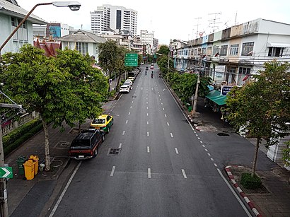
ถนน หลวง Address: 27/20 ถนน หลวง แขวง บ้านบาตร เขต ป้อมปราบศัตรูพ่าย กรุงเทพมหานคร 10100 ประเทศไทย street in ป้อมปราบศัตรูพ่าย
Attractions near ถนน หลวง
วรรธนามอเตอร์เวอร์ค,บ้านบัวลอย เผ่งอัง,วังบ้านดอกไม้ (Ban Dokmai Palace) Prince of Kamphaengphet Palace,เฮียบชุน ประดับยนต์ วรจักร,นครไทยอะไหล่,สำนักงานคณะกรรมการอ้อยและน้ำตาลทราย,Postcode 10100 2/11,เลี้ยงยานยนต์,ส. ธนะชัยกลการ,ป. รุ่งโรจน์อะไหล่ยนต์,ก.รุ่งโรจน์ออโต้พาร์ท,ส.มิตรอะไหล่ฟอร์ด (So Mit Ford Spare Parts),น.เจริญกลการ (เน้า),ร้านรุ่งศิริยนต์ วรจักร ศูนย์จำหน่ายอะไหล่แท้มาสด้าและฟอร์ด,น.เจริญกลการ(เน้า)@คลองถม,สยามชัยกลการ (Siamchai Machinery),ซอยจุรินทร์,ศาลเจ้าทีกงและปึงเถ่ากงวรจักร,รักษ์อะไหล่ยนต์,Ruxalaiyont Auto Parts (รักษ์อะไหล่ยนต์)How to get to popular attractions in ป้อมปราบศัตรูพ่าย with public transit
ห้างหุ้นส่วนจำกัด จัตวาพิมพ์รีด ซัพพลาย, เมืองสมุทรปราการ,มหาวิทยาลัยสวนดุสิต, ดุสิต,สะพานกลับรถหน้าฐานทัพอากาศ, ดอนเมือง,เยาวราช, สัมพันธวงศ์,หมู่บ้านอมรชัย5, เมืองสมุทรสาคร,เทสโก้ โลตัส เอ็กซ์เพรส, บางกอกน้อย,ถนนวงแหวนรอบนอก เอกชัย-บางบอน, บางบอน,พรปิยะแมนชั่น, บางซื่อ,Tostem Thai Co.,Ltd., คลองหลวง,ฝ่ายปฏิบัติการภาคกลาง (อปก.) EGAT, บางกรวย,ดอนเมือง, ดอนเมือง,บ้านสวนปาล์ม, คลองหลวง,วราภรณ์ ซาลาเปา, ตลิ่งชัน,BMTA Bus Stop ห้าแยกปากเกร็ด (Pak Kret Intersection), ปากเกร็ด,หมู่บ้านทองพัฒนา, ภาษีเจริญ,ร้านแกงไทย - บางนา, บางพลี,ร้านสหกรณ์มหาวิทยาลัยกรุงเทพ จำกัด, คลองหลวง,Hoya รังสิต, คลองหลวง,Wall8 futsal, เมืองนนทบุรี,ครัวยายเปล่ง, ทวีวัฒนาGet around ป้อมปราบศัตรูพ่าย by public transit!
Traveling around ป้อมปราบศัตรูพ่าย has never been so easy. See step by step directions as you travel to any attraction, street or major public transit station. View bus and train schedules, arrival times, service alerts and detailed routes on a map, so you know exactly how to get to anywhere in ป้อมปราบศัตรูพ่าย.
When traveling to any destination around ป้อมปราบศัตรูพ่าย use Moovit's Live Directions with Get Off Notifications to know exactly where and how far to walk, how long to wait for your line, and how many stops are left. Moovit will alert you when it's time to get off — no need to constantly re-check whether yours is the next stop.
Wondering how to use public transit in ป้อมปราบศัตรูพ่าย or how to pay for public transit in ป้อมปราบศัตรูพ่าย? Moovit public transit app can help you navigate your way with public transit easily, and at minimum cost. It includes public transit fees, ticket prices, and costs. Looking for a map of ป้อมปราบศัตรูพ่าย public transit lines? Moovit public transit app shows all public transit maps in ป้อมปราบศัตรูพ่าย with all bus, ferry, metro or train routes and stops on an interactive map.
ป้อมปราบศัตรูพ่าย has 4 transit type(s), including: bus, ferry, metro or train, operated by several transit agencies, including บีทีเอส BTS, MRT, ขสมก. BMTA, รถไฟฟ้ารฟท. SRTET, รถไฟฟ้ารฟท. SRTET, รถประจำทาง Transport Bus, บีอาร์ที BRT, เรือคลองโดยสาร Canal Ferry, เรือข้ามฟาก River Ferry, รถสองแถว Songthaew, จุฬาป๊อบบัส Chula Pop Bus, ขสมก BMTA, ขสมก. (BMTA), รถมินิบัส Minibus and รฟท. SRT